Index and method for ecological water demand zoning and classification
A classification method and ecological technology, applied in instruments, data processing applications, calculations, etc., can solve problems such as ecological water demand calculation, and achieve the effect of easy access and reliable partition classification results.
- Summary
- Abstract
- Description
- Claims
- Application Information
AI Technical Summary
Problems solved by technology
Method used
Image
Examples
Embodiment Construction
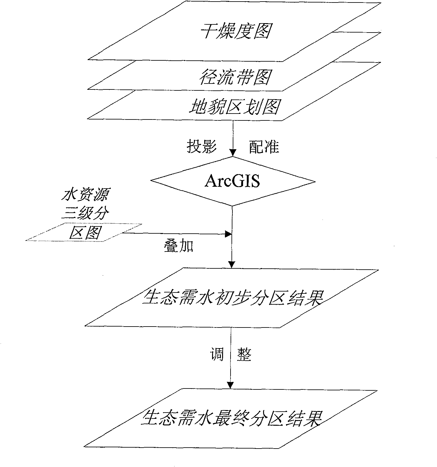
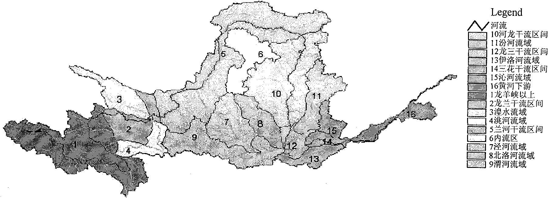
[0019] Taking the Yellow River Basin as an example, combined with the attached figure 1 And attached figure 2 The present invention is described in further detail.
[0020] 1) As attached figure 1 As shown, using the spatial analysis function of the geographic information system (GIS), select the software environment for spatial analysis (such as ARCGIS, etc.), and perform projection conversion (Projection) on the watershed dryness map, runoff zone map, and landform zoning map, and integrate them with the watershed Water resource zoning map for registration.
[0021] 2) Overlay the three-level zoning map of water resources in the basin with the aridity map, the runoff zone map, and the geomorphic zoning map of the basin in order to obtain the preliminary ecological water demand zoning results.
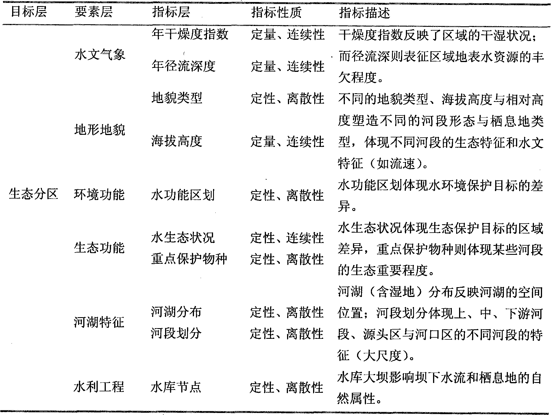
[0022] 3) Qualitative analysis is carried out using altitude, water function zoning, water ecological status and key protected species, distribution of rivers and lakes and charact...
PUM
 Abstract
Description
Claims
Application Information
 - R&D
- Intellectual Property
- Life Sciences
- Materials
- Tech Scout
- Unparalleled Data Quality
- Higher Quality Content
- 60% Fewer Hallucinations
Browse by: Latest US Patents, China's latest patents, Technical Efficacy Thesaurus, Application Domain, Technology Topic, Popular Technical Reports.
© 2025 PatSnap. All rights reserved.Legal|Privacy policy|Modern Slavery Act Transparency Statement|Sitemap|About US| Contact US: help@patsnap.com


