
Satellite image compression method and device for realizing satellite image compression

A satellite image and compression method technology, applied in image communication, television, electrical components, etc., can solve the problems of high bit error rate and slow processing speed of encoded data transmission

Active Publication Date: 2010-07-07
HUAZHONG UNIV OF SCI & TECH
View PDF0 Cites 33 Cited by
  • Summary
  • Abstract
  • Description
  • Claims
  • Application Information

AI Technical Summary

Problems solved by technology

[0009] The present invention provides a satellite image compression method and its implementation device, which solves the problems of high bit error rate and slow processing speed for the transmission of coded data in the existing image compression method; Under this condition, the real-time downloading of satellite image raw data information without distortion is realized, and the bit error tolerance of the algorithm is enhanced to maximize the image compression rate

Method used


Image

  • Satellite image compression method and device for realizing satellite image compression
  • Satellite image compression method and device for realizing satellite image compression
  • Satellite image compression method and device for realizing satellite image compression

Examples


Embodiment Construction

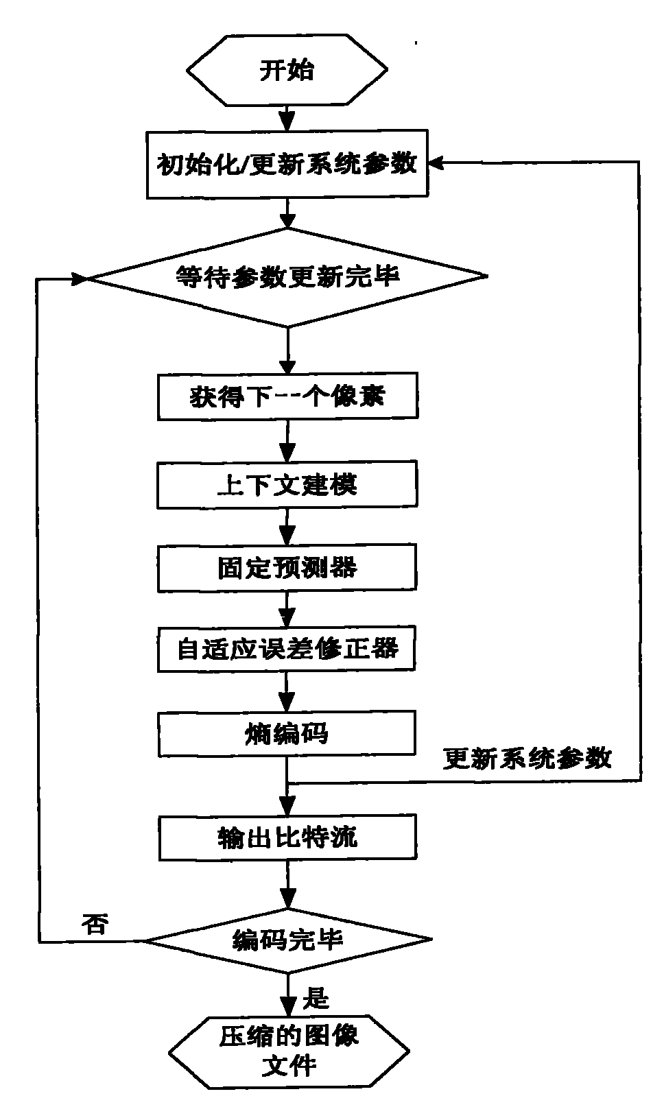
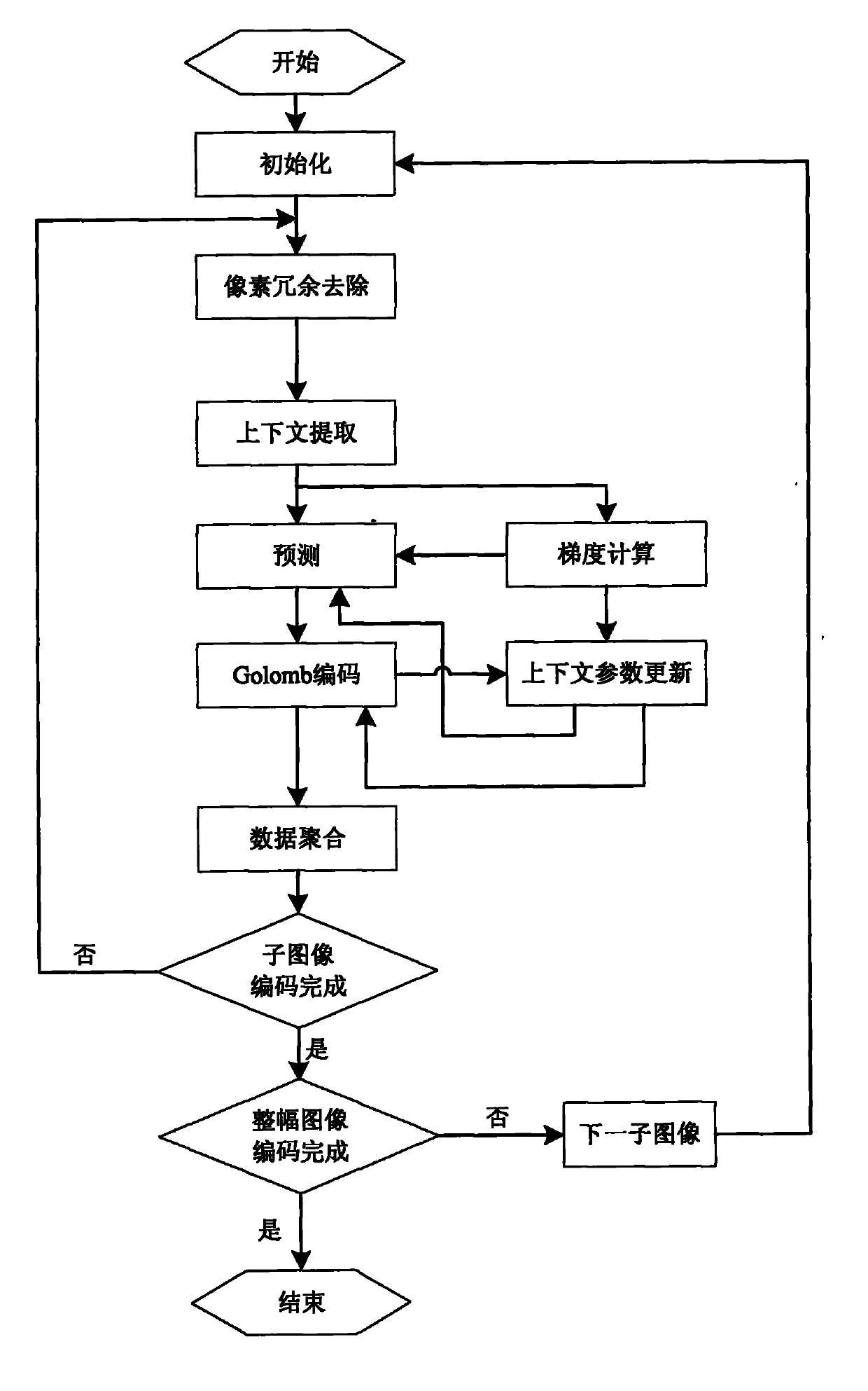
[0181] Such as figure 2 As shown, the present invention uses block encoding to process images, including initialization steps, pixel redundancy removal steps, context extraction steps, gradient calculation steps, prediction steps, Golomb encoding steps, data aggregation steps, and context environment parameter update steps .

[0182] Such as image 3 As shown, the present invention can be implemented inside the FPGA, including a coordinate calculation module, an initialization module, a pixel redundancy removal module, a context extraction module, a prediction module, a Golomb encoding module, a data aggregation module, a gradient calculation module and a context environment parameter update module.

[0183] Figure 4 For the satellite image to be encoded, the entire image is divided into 160 sub-images, each sub-image includes m rows and n columns, and the bit width of the image pixel gray value after removing redundancy is 8 bits, so M=255.

[0184] The initialization mo...


PUM


Abstract

The invention discloses a satellite image compression method and a device for realizing satellite image compression, belonging to the remote sensing and digital image processing field and solving the problems of high demand for encoded data transmission error rate and low processing speed in the existing image compression method. The method of the invention includes the steps of dividing a whole image into sub-images, independently encoding the sub-images, sequential initialization, removal of pixel redundancy, context extraction, preestimate, Golomb encoding and data polymerization; the steps of sequential gradient calculation and context environment parameters upgrade are finished simultaneously with the steps of preestimate and Golomb encoding. The invention improves image compression rate, realizes good error tolerance and good real-time performance and greatly improves the whole encoding efficiency, meeting the demand for wide satellite image data real-time nondestructive compression.

Description

technical field [0001] The invention belongs to the field of remote sensing and digital image processing, in particular to a satellite image compression method and its realization device. Background technique [0002] The cost of acquiring images from remote sensing satellites is high. For ground data analysis and processing, it is very important to obtain accurate, reliable and distortion-free data. Spaceborne cameras obtain a large amount of raw data, which is precious raw information, and is often required to be transmitted in real time without loss. The amount of data exceeds the capacity of my country's existing data transmission facilities, and real-time lossless compression transmission must be performed about twice. On-board data compression generally adopts the intra-frame compression method of single-frame images, and seldom uses the inter-frame compression method of multi-frame images. Transform coding and predictive coding are the mainstream methods of on-board ...

Claims


Application Information

Patent Timeline
IPC IPC(8): H04N7/26H04N7/32H04N7/66H04N7/20H04N19/176H04N19/423H04N19/50H04N19/60H04N19/85H04N19/89
Inventor 张天序颜露新钟胜龚程王泽李柯郭畅孙建华胡静
Owner HUAZHONG UNIV OF SCI & TECH
Learn More