

Underwater three dimensional terrain reconstruction method based on multi-beam sonar data
A three-dimensional terrain and multi-beam technology, which is applied in the direction of sound wave re-radiation, water resource assessment, radio wave measurement system, etc., can solve the problem that there are no set constraints, the underwater three-dimensional terrain cannot be judged whether it is close to the real terrain, and it is difficult to obtain Micro-geomorphological results and other issues, to achieve high precision and improve the effect of spatial resolution
- Summary
- Abstract
- Description
- Claims
- Application Information
AI Technical Summary
Problems solved by technology
Method used
Image

Examples
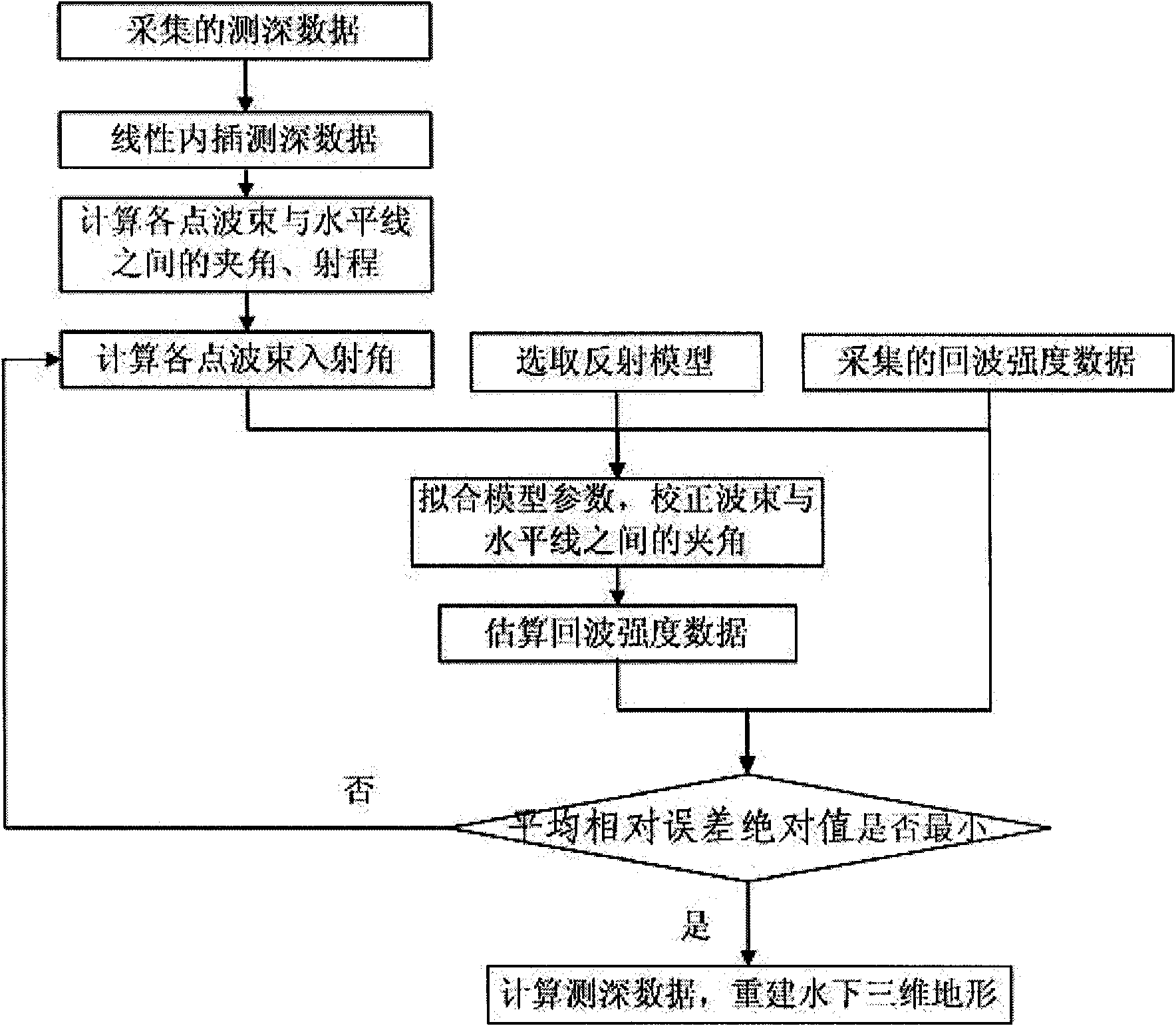
Embodiment
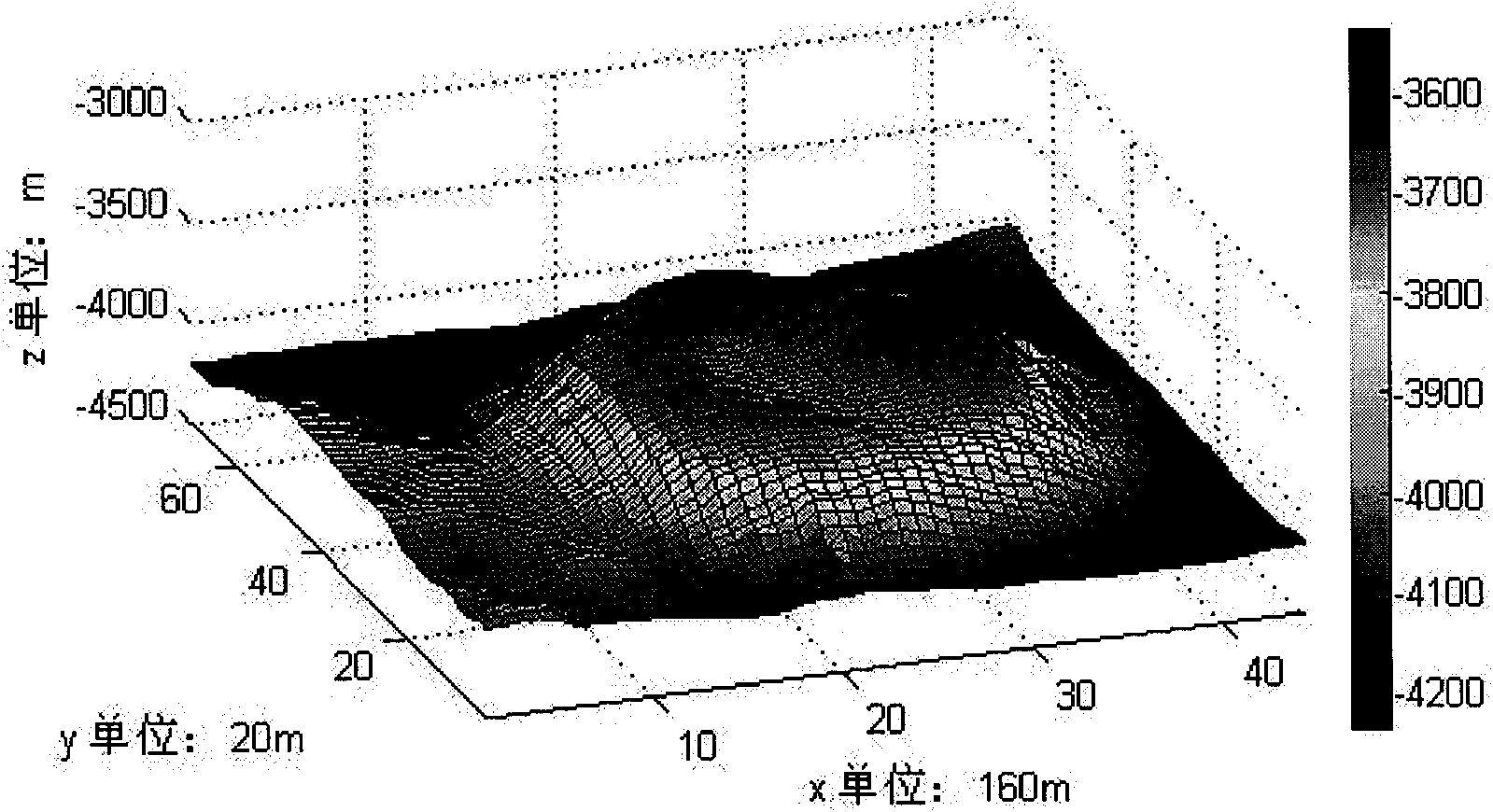
[0084] Embodiment: the value (%) of the average relative error absolute value χ (ρ) of the echo strength data estimated in this experiment and the collected echo strength data in the iterative process is respectively: 0.125, 0.079, 0.069, 0.062, 0.070, 0.067 ..., it can be seen that the echo intensity data estimated by this algorithm approaches the real value and gradually stabilizes. This shows that the overall error of the data obtained by this algorithm is small. In order to further analyze the details, three bathymetry data points with large fluctuations are selected and listed separately: (40, 10), (80, 20), (150, 30). The errors (m) during linear interpolation are 5.9, 7.6, and 5.6 respectively, and the errors (m) after the terrain is reconstructed by the present invention are 0.7, 7.1, and 1.8 respectively. It can be seen that this algorithm also has smaller error than the linear interpolation algorithm in the calculation of different data points, and the effect is bet...
PUM
 Abstract
Description
Claims
Application Information