

Simplifying method of electronic chart vector graph
A technology of vector graphics and electronic charts, applied in the field of geographic information system spatial data analysis and processing, can solve problems such as self-intersection without considering the defects of the Douglas-Peucker algorithm, so as to avoid self-intersection, solve self-intersection, and improve The effect of shape retention
- Summary
- Abstract
- Description
- Claims
- Application Information
AI Technical Summary
Problems solved by technology
Method used
Image

Examples
Embodiment Construction
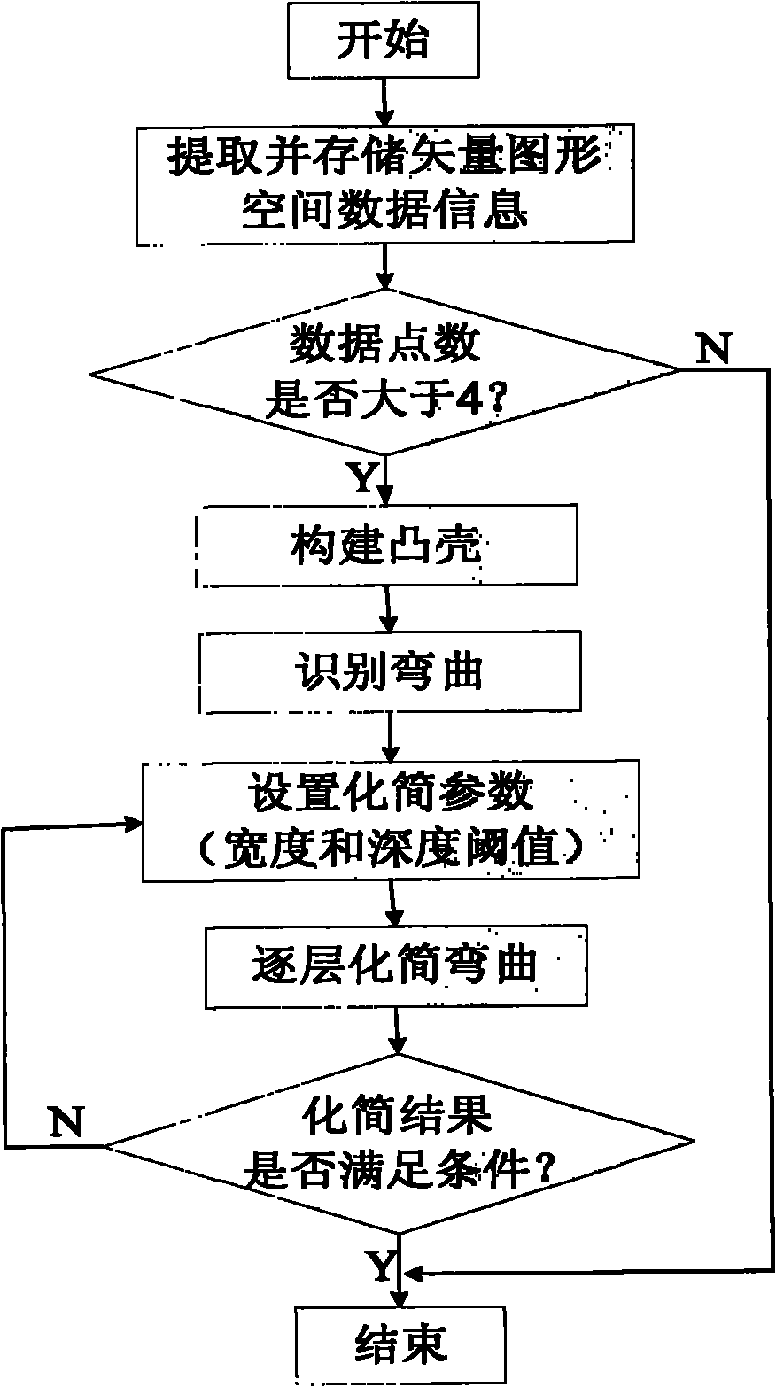
[0026] The present invention is described in more detail below in conjunction with accompanying drawing example:
[0027] The invention discloses a method for simplifying vector graphics of electronic charts. The specific implementation content of the method includes constructing a convex hull, identifying bending based on the orbiting direction of a straight line segment, and applying the improved Douglas-Peucker algorithm proposed to simplify the vector graphics layer by layer. and other key content. The following will describe in detail the specific implementation of the technical solution proposed by the present invention according to the simplification process, the simplification process is as follows figure 1 shown. This implementation mainly includes the following key steps:
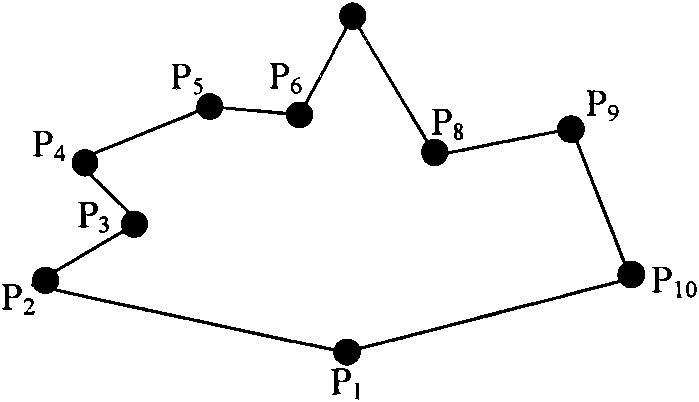
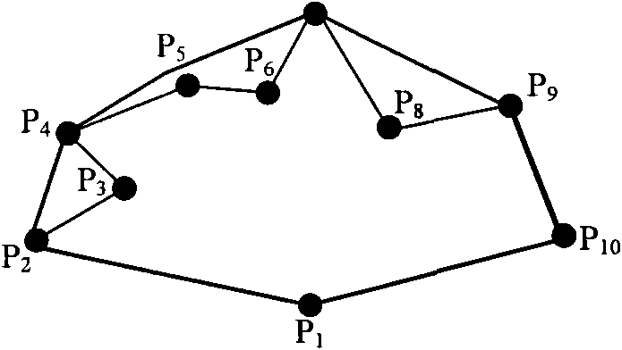
[0028] 1. Build a convex hull
[0029] The convex hull is the natural limit boundary of the data point set. It is the smallest convex polygon containing all the data points. The line segment co...
PUM
 Abstract
Description
Claims
Application Information