
Reconnaissance method, device and network optimization equipment

A network optimization and equipment technology, applied in the field of communications, can solve problems such as low efficiency and large manpower requirements, and achieve the effect of improving survey efficiency and saving labor costs

Inactive Publication Date: 2011-09-14
吴长松
View PDF4 Cites 14 Cited by
  • Summary
  • Abstract
  • Description
  • Claims
  • Application Information

AI Technical Summary

Problems solved by technology

GPS: collect the longitude, latitude and altitude information of the site; compass: determine the azimuth angle of the equipment room and antenna, and the azimuth information of each service sector; range finder: measure the distance or height of the coverage area or obstacles; steel tape: used for necessary Measurement; digital camera: photograph the geographical environment around the base station of the center. The current operation mode is manual measurement and drawing. The site is usually a group of several people, digital camera, compass, laptop, tape measure, and a GPS for base station survey work. It can be seen that the existing indoor space survey technology requires a large amount of manpower and is very inefficient

Method used


Image

  • Reconnaissance method, device and network optimization equipment
  • Reconnaissance method, device and network optimization equipment
  • Reconnaissance method, device and network optimization equipment

Examples


Embodiment 1

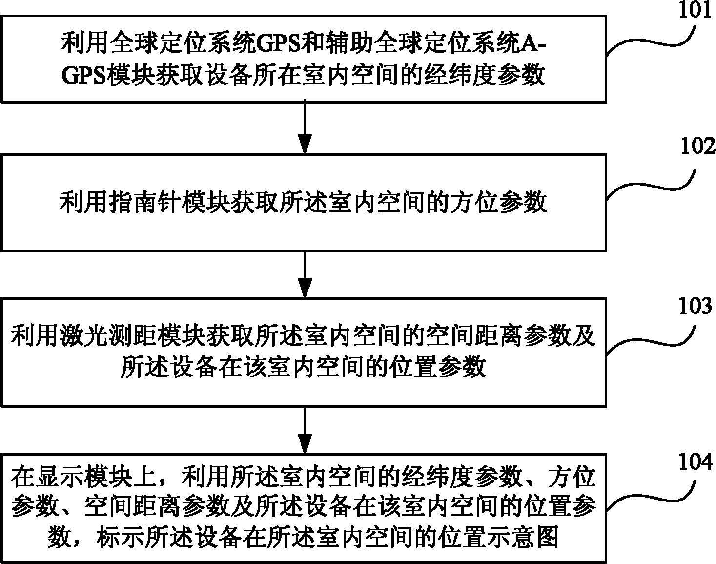
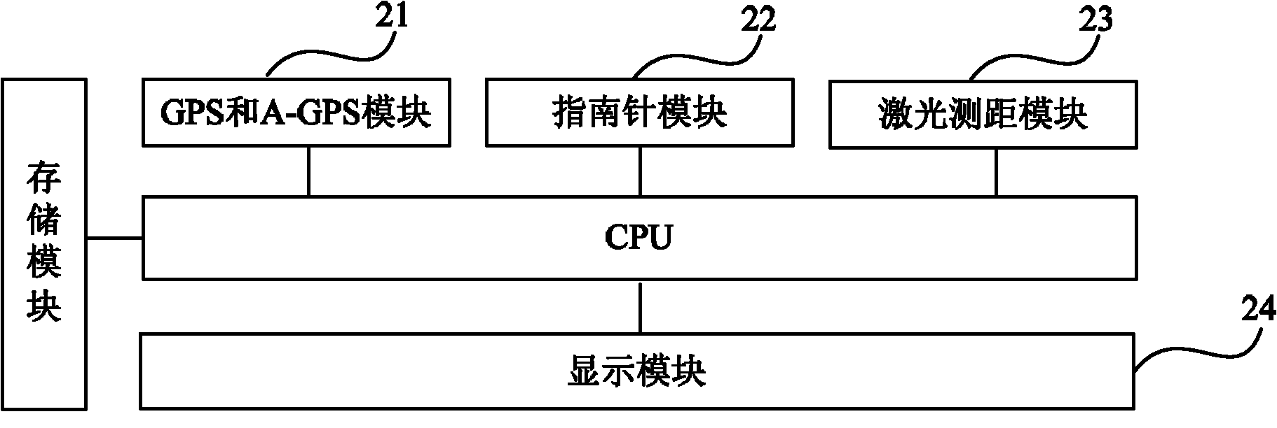
[0021] Such as figure 1 As shown, it is a flow chart of a survey method according to an embodiment of the present invention, and the method includes:

[0022] 101. Obtain the latitude and longitude parameters of the indoor space where the device is located by using the Global Positioning System GPS and the Assisted Global Positioning System A-GPS module;

[0023] 102. Obtain the orientation parameters of the indoor space by using the compass module;

[0024] 103. Using a laser ranging module to obtain a spatial distance parameter of the indoor space and a position parameter of the device in the indoor space;

[0025] 104. On the display module, use the latitude and longitude parameters, orientation parameters, and spatial distance parameters of the indoor space and the location parameters of the equipment in the indoor space to mark a schematic diagram of the location of the equipment in the indoor space.

[0026] Optionally, the method may further include: using the GPS and...


PUM


Abstract

The embodiment of the invention provides a reconnaissance method, a reconnaissance device and network optimization equipment. The reconnaissance method comprises the following steps of: acquiring longitude and latitude parameters of an indoor space in which the equipment is by utilizing a global positioning system (GPS) and assisted global positioning system (A-GPS) module; acquiring directionality parameters of the indoor space by utilizing a compass module; acquiring a spatial distance parameter of the indoor space and a position parameter of the equipment in the indoor space by utilizing a laser ranging module; and marking a geographic sketch map of the equipment in the indoor space on a display module by utilizing the longitude and latitude parameters, directionality parameters and spatial distance parameter of the indoor space and the position parameter of the equipment in the indoor space. The embodiment of the invention can improve the reconnaissance efficiency and save the labor cost.

Description

technical field [0001] The present invention relates to the technical field of communications, in particular to a survey method, device and network optimization equipment. Background technique [0002] The mobile communication system is the infrastructure of my country's communication network and national economic informatization, and the mobile communication base station is an important part of the mobile communication system. With the gradual promotion of mobile 3G (3rd-generation, third-generation mobile communication technology) networks, the demand for construction and optimization of network base stations is gradually increasing, and corresponding requirements are also put forward for the intelligentization of base station survey work. The promotion of intelligent work equipment Behind it is a huge untapped market. [0003] Base station survey is one of the indispensable and important tasks in network planning. It is the concrete realization of the network pre-plannin...

Claims


Application Information

Patent Timeline
IPC IPC(8): H04W16/20H04W64/00
Inventor 吴长松
Owner 吴长松
Learn More