
Geo-synchronous orbit synthetic aperture radar (GEO SAR) frequency modulation changeable standard imaging method under curve track model

A curved trajectory and imaging method technology, applied in the field of communication, can solve the problems of long synthetic aperture time, large amount of calculation, and high height, and achieve the effects of wide imaging mapping bandwidth, improved imaging accuracy, and complete motion information

Inactive Publication Date: 2011-11-02
XIDIAN UNIV
View PDF2 Cites 20 Cited by
  • Summary
  • Abstract
  • Description
  • Claims
  • Application Information

AI Technical Summary

Problems solved by technology

Due to the high orbital height and long synthetic aperture time of GEO SAR, the influence of curved trajectory on imaging cannot be ignored, and high-precision imaging cannot be obtained, so the CS imaging algorithm is no longer applicable
[0004] Li Jun, Xing Mengdao, Li Yachao, Wang Wanlin, Tan Xiaomin proposed to use BP algorithm for imaging in the paper "Analysis of Geosynchronous Orbit SAR System Parameters and Research on Imaging Algorithm" "System Engineering and Electronic Technology" 2010, 32(5): 931-936 Although the BP algorithm has no approximation in theory, it can image signals under any trajectory without being limited by the scene. It is the optimal imaging algorithm in the time domain, but its computational complexity is relatively large, which is not suitable for engineering implementation
[0005] Li Caipin, Zhang Hongtai, and Tan Xiaomin proposed a CS algorithm for imaging after compensating the curved trajectory to a straight line in "An Improved CS Algorithm Applicable to Geosynchronous Orbit SAR" "Acta Astronautics" 2011, 32(1): 179-186 method, but because it is compensated according to the center point of the scene, the focus effect on the edge points of the scene is poor

Method used


Image

  • Geo-synchronous orbit synthetic aperture radar (GEO SAR) frequency modulation changeable standard imaging method under curve track model
  • Geo-synchronous orbit synthetic aperture radar (GEO SAR) frequency modulation changeable standard imaging method under curve track model
  • Geo-synchronous orbit synthetic aperture radar (GEO SAR) frequency modulation changeable standard imaging method under curve track model

Examples


Embodiment Construction

[0034] The present invention will be further described below in conjunction with the accompanying drawings.

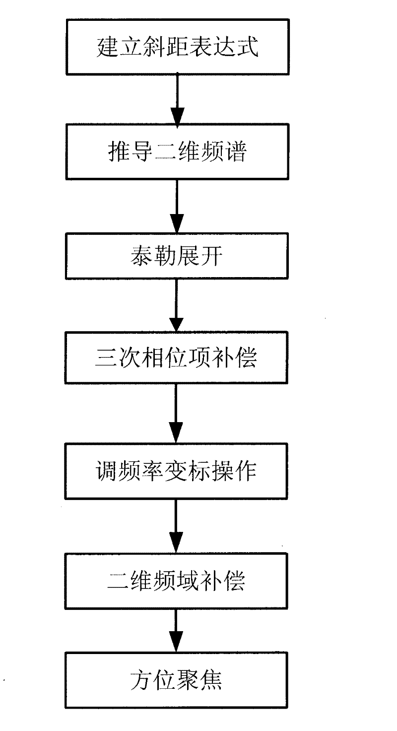
[0035] refer to figure 1 , the specific implementation steps of the present invention are as follows:

[0036] Step 1. Establish the slope distance expression.

[0037] The orbital equation of a geosynchronous orbit satellite is as follows:

[0038] x s y s z s = R cos L 0 [ 1 + ( cos ...


PUM


Abstract

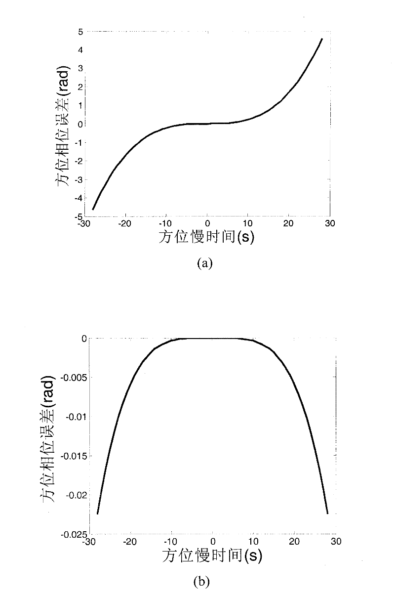
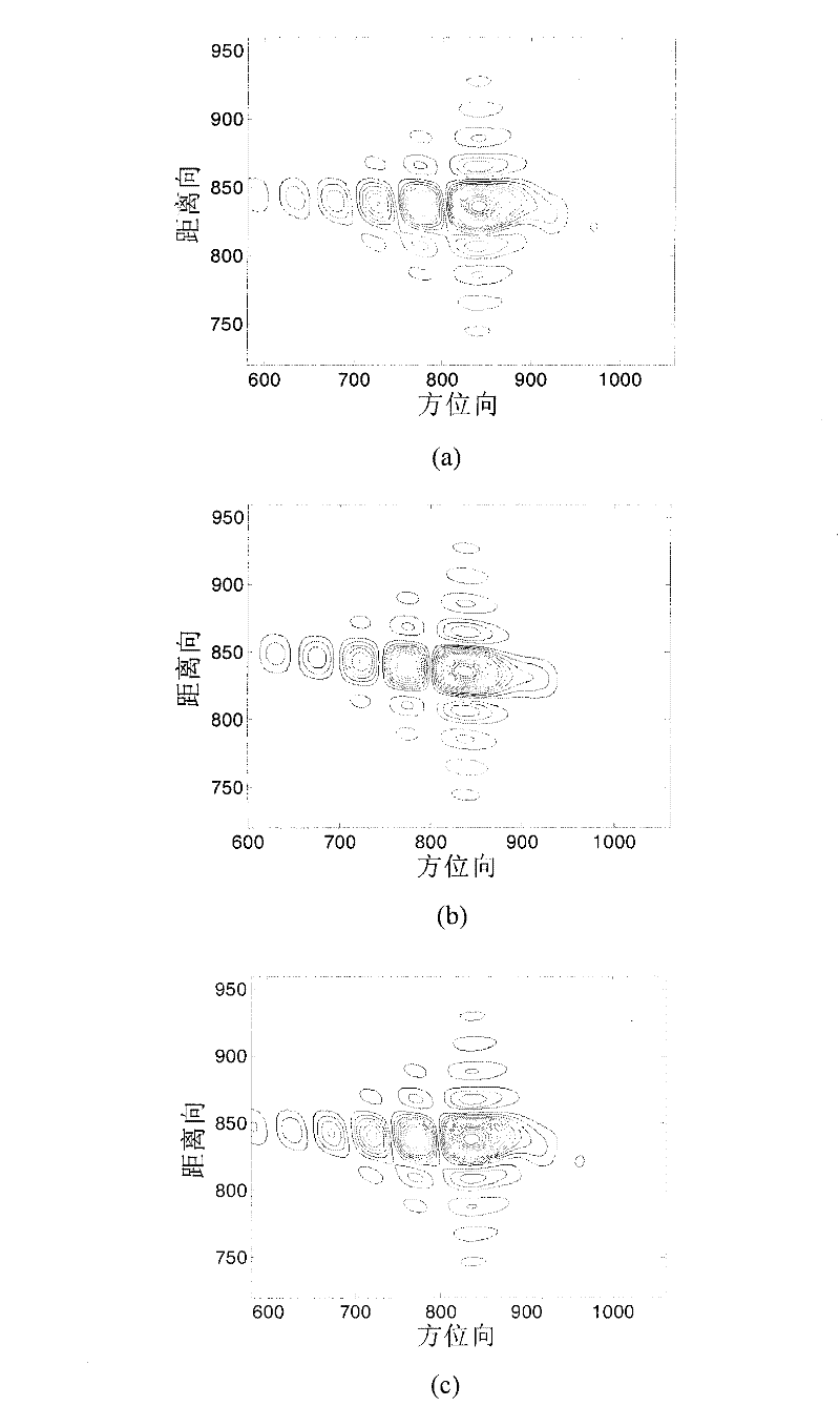
The invention discloses a geo-synchronous orbit synthetic aperture radar (GEO SAR) frequency modulation changeable standard (CS) imaging method under a curve track model. The method comprises the following steps of: establishing an oblique-distance and high-order expression under the GEO SAR curve track model; deducing a two-dimensional spectrum expression of an echo signal; performing triple Taylor expansion of a distance frequency on the two-dimensional spectrum expression; compensating a triple phase item of the distance frequency in a two-dimensional frequency domain; calculating a distance migration curve in a distance-Doppler domain and multiplying the distance migration curve by a constructed CS phase function; deducing a distance compensation function to finish distance focusing and distance migration correction; and performing direction compression and direction residual phase correction to finish direction focusing. By the method, the spatial-variant properties of the distance migration can be compensated, a wider imaging plotting bandwidth can be obtained and full-aperture high-resolution imaging can be realized. All types of operation in the method are finished throughfast Fourier transform and phase dot product; furthermore, the efficiency is higher and the method is suitable for engineering implementation.

Description

technical field [0001] The invention belongs to the technical field of communication, and further relates to a frequency modulation scaling (CS) imaging method used for wide-area observation of ground targets by a Geosynchronous Orbit Synthetic Aperture Radar (GEO SAR) in the field of spaceborne radar technology. Background technique [0002] The orbital altitude of geosynchronous orbit satellites is high, and GEO SAR has strong anti-strike and destruction capabilities, and has strong battlefield survivability. And GEO SAR can cover a large area with a small beam angle, obtain large-scale and continuous earth observation capabilities, and has potential advantages in earthquake and volcano forecasting, marine application research, etc., and because of its ultra-long synthetic aperture It has the potential of continuous tracking and high-resolution imaging of moving targets, and can realize large-scale strategic surveillance, early warning and battlefield reconnaissance. [0...

Claims


Application Information

Patent Timeline
Patent Type & Authority Applications(China)
IPC IPC(8): G01S13/90G01S7/02
Inventor 包敏李亚超邢孟道庄孟王万林
Owner XIDIAN UNIV
Learn More