Land leveling method, land leveling control device and land leveling device
A technology of land leveling and control devices, which is applied in the fields of land leveling, land leveling devices, and land leveling control devices, and can solve problems such as unsuitability for large-scale land leveling operations and limited range of laser leveling operations
- Summary
- Abstract
- Description
- Claims
- Application Information
AI Technical Summary
Problems solved by technology
Method used
Image
Examples
Embodiment 1
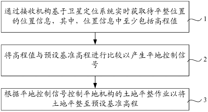
[0035] figure 1 The flow chart of the land leveling method provided by Embodiment 1 of the present invention, such as figure 1 As shown, the land leveling method includes:
[0036] Step 1. Obtain the location information of the location to be leveled in real time through the receiving mechanism based on the satellite positioning system, wherein the location information includes at least an elevation value.
[0037] Step 2. Comparing the elevation value with the preset reference elevation to generate a leveling control signal.
[0038] Step 3. Control the land leveling operation of the leveling mechanism according to the leveling control signal, so as to level the land to a preset reference elevation.
[0039] The receiving mechanism based on the satellite positioning system mainly includes a receiving antenna and a processing terminal, through which the satellite signal is received by the receiving antenna and transmitted to the processing terminal, and the processing termin...
Embodiment 2
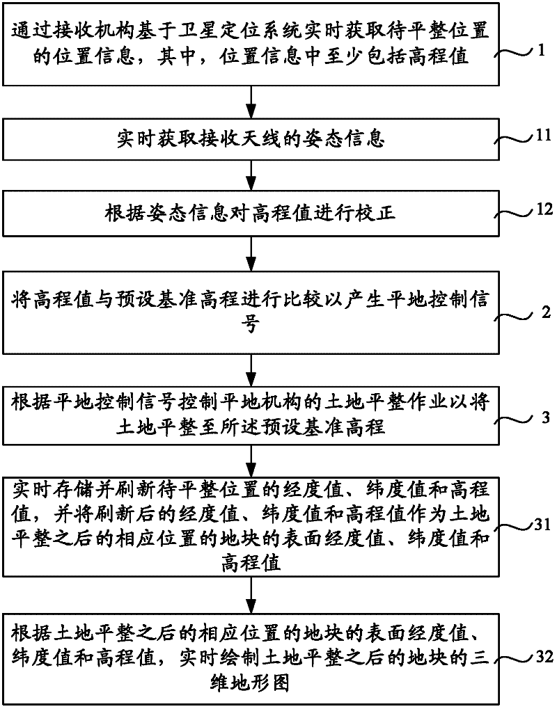
[0052] figure 2 It is a flow chart of the land leveling method provided by Embodiment 2 of the present invention. On the basis of Embodiment 1 above, the receiving mechanism includes at least a receiving antenna, such as figure 2 Shown, this land leveling method also comprises after above-mentioned step 1:
[0053] Step 11, obtaining the attitude information of the receiving antenna in real time;
[0054] Step 12. Correct the elevation according to the attitude information, and then perform step 2.
[0055] Usually the receiving mechanism includes a receiving antenna for receiving satellite signals, which is usually placed on the leveling mechanism and carried by the leveling mechanism. However, due to the complex terrain of the land to be leveled, the leveling mechanism will vibrate during travel, which will also cause The shaking of the receiving antenna makes the elevation value obtained through the position calculation of the receiving antenna have a large error, which...
Embodiment 3
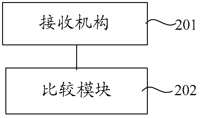
[0068] The embodiment of the present invention also provides a land leveling control device, which can implement the land leveling method provided by the embodiment of the present invention, image 3 It is a schematic structural diagram of the land leveling control device provided by Embodiment 3 of the present invention, as image 3 As shown, the land leveling control device includes a receiving mechanism 201 and a comparison module 202 .
[0069] The receiving mechanism 201 is used for acquiring the location information of the location to be leveled in real time based on the satellite positioning system, wherein the location information includes at least an elevation value.
[0070] The comparison module 202 is used to compare the elevation value with the preset reference elevation to generate a leveling control signal to the leveling mechanism to control the land leveling operation of the leveling mechanism so as to level the land to the preset reference elevation.
[0071...
PUM
 Abstract
Description
Claims
Application Information
 - R&D
- Intellectual Property
- Life Sciences
- Materials
- Tech Scout
- Unparalleled Data Quality
- Higher Quality Content
- 60% Fewer Hallucinations
Browse by: Latest US Patents, China's latest patents, Technical Efficacy Thesaurus, Application Domain, Technology Topic, Popular Technical Reports.
© 2025 PatSnap. All rights reserved.Legal|Privacy policy|Modern Slavery Act Transparency Statement|Sitemap|About US| Contact US: help@patsnap.com


