A Positioning Method of Ground Mobile Communication Network Corrected by Map Elevation

A technology of a mobile communication network and a positioning method, which is applied in the field of radio positioning, can solve the problems of large influence of positioning accuracy, and achieve the effect of improving positioning accuracy and the method being simple and easy to implement.

Inactive Publication Date: 2011-12-28
NAT ASTRONOMICAL OBSERVATORIES CHINESE ACAD OF SCI
View PDF8 Cites 15 Cited by
  • Summary
  • Abstract
  • Description
  • Claims
  • Application Information

AI Technical Summary

Problems solved by technology

This additional delay has a grea

Method used


Image

  • A Positioning Method of Ground Mobile Communication Network Corrected by Map Elevation
  • A Positioning Method of Ground Mobile Communication Network Corrected by Map Elevation
  • A Positioning Method of Ground Mobile Communication Network Corrected by Map Elevation

Examples


Embodiment Construction

[0057] The positioning method of the ground mobile communication network corrected by map elevation of the present invention can correctly distinguish, estimate and eliminate the influence of non-line-of-sight (NLOS) propagation errors, and further improve the positioning accuracy of mobile phones.

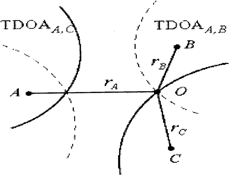
[0058] The positioning method of the ground mobile communication network with the map elevation correction of the present invention proposes the judgment criterion of non-line-of-sight error (NLOS) influence:

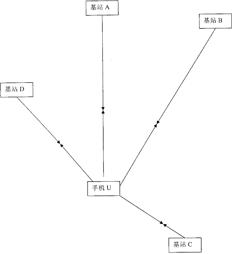
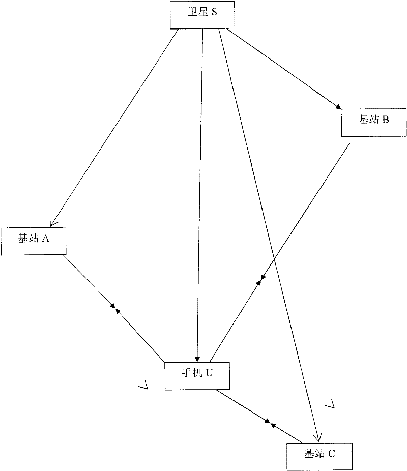
[0059] If there are four base stations, and the phase centers of the transmitting antennas of the four base stations are known, A(x a ,y a ,z a ), B(x b ,y b ,z b ), C(x c ,y c ,z c ) and D(x d ,y d ,z d ), when the mobile phone is between at least three base stations, the time of arrival (TOA, Time of Arrival) positioning method is used to measure the propagation time of the positioning signal sent by the mobile station to reach multiple base stations to determin...


PUM


Abstract

The invention relates to a positioning method for correcting and revising a ground mobile communication network by using a map elevation, which relates to positioning technology, and uses an electronic map marked with horizon and building elevation as the elevation constraint, and the high precision of the electronic map is decimeter or centimeter level. When using the ground mobile communication network or broadcasting network to measure the pseudo-range positioning, due to the non-line-of-sight error in the pseudo-range measurement, the current positioning accuracy is low. To improve the positioning accuracy of terrestrial mobile networks and broadcasting networks, the influence of non-line-of-sight errors must be corrected. This method utilizes the initial positioning solution and the elevation constraint to verify the accuracy of the pseudo-range measurement, judges whether the measured pseudo-range has non-line-of-sight transmission error, and corrects the pseudo-range error to improve the positioning accuracy of the mobile station. The method of the invention is simple and easy, can distinguish, estimate and eliminate non-line-of-sight propagation errors, and improves the positioning accuracy of the mobile phone to the order of meters, which has practical significance. It is suitable for radiolocation of terrestrial mobile communication network, radiolocation of terrestrial broadcasting network and radiolocation of satellite transmission network.

Description

technical field [0001] The invention relates to the field of positioning technology, in particular to the radio positioning technology of the ground mobile communication wireless network. Background technique [0002] The radio positioning of the terrestrial mobile communication network refers to estimating the distance or direction of the mobile station by detecting the characteristic parameters of the radio wave signal propagated between the base station and the mobile station at known positions. The positioning methods that have been applied now are: cell of origin (COO) positioning; angle of arrival (AOA) positioning; time of arrival (TOA) positioning; time difference of arrival (TDOA) positioning; enhanced observation time difference (E-OTD) positioning and A-GPS position. [0003] Among them, the cell-of-origin (COO) positioning technology, that is, the positioning technology based on Cell-ID, is the technology adopted in the first phase of the E911 wireless positioni...

Claims


Application Information

Patent Timeline
IPC IPC(8): H04W64/00
Inventor 施浒立朱海龙吕子平邓中亮王兆瑞
Owner NAT ASTRONOMICAL OBSERVATORIES CHINESE ACAD OF SCI
Why Eureka
Try Eureka