Omnidirectional search mechanism variogram based optimal remote sensing scale selection method

A variogram and scale selection technology, applied in image data processing, image data processing, instruments, etc., can solve the problems of complex calculation process, not considering the spatial correlation of distance between objects, and the optimal scale is not very accurate. The effect of improving accuracy

Active Publication Date: 2012-02-15
WUHAN UNIV OF TECH
View PDF2 Cites 7 Cited by
  • Summary
  • Abstract
  • Description
  • Claims
  • Application Information

AI Technical Summary

Problems solved by technology

[0004] At present, according to literature statistics, although many scholars at home and abroad have applied variograms to the selection of the optimal spatial scale of remote sensing images, due to the lack of improvement of these traditional general variogram algorithms, these algorithms have ...

Method used


Image

  • Omnidirectional search mechanism variogram based optimal remote sensing scale selection method
  • Omnidirectional search mechanism variogram based optimal remote sensing scale selection method
  • Omnidirectional search mechanism variogram based optimal remote sensing scale selection method

Examples


Embodiment

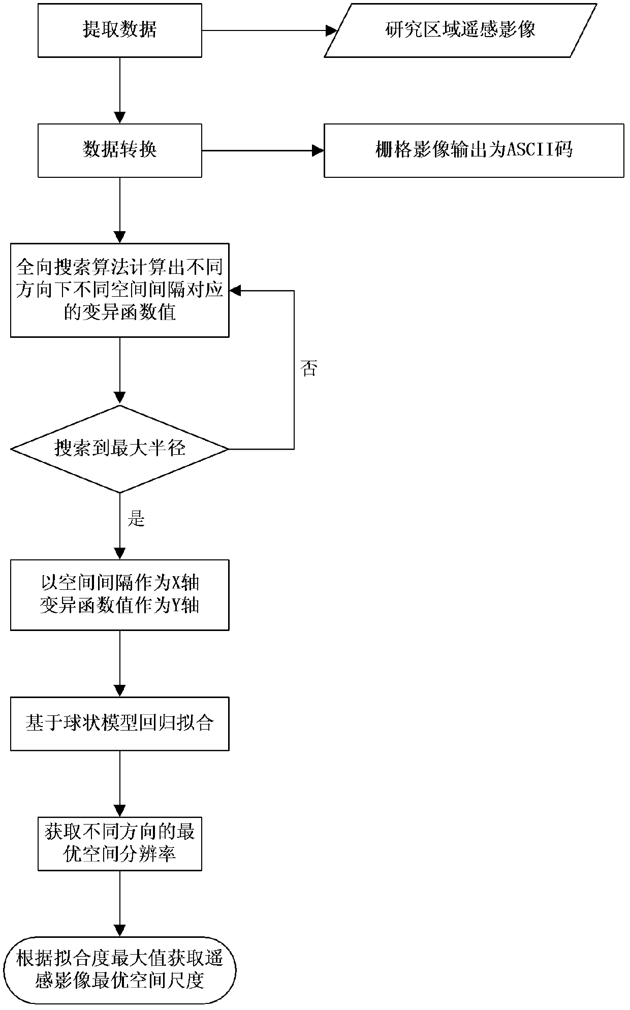
[0127] 1. Taking the Quickbird remote sensing image data of Wuhan in 2002 as the basic data, the third band is selected as the basic data of the case study.

[0128] 2. Obtain the gray value information of the remote sensing image pixel in the required research area through image cropping, data format conversion and other operations. The specific operation steps are: first use the AOI file to use DataPrep / Subset in the icon panel tool bar of Erdas software to crop the acquired remote sensing image; then import the cropped remote sensing image into ArcGIS, use ArcToolbox / Conversion Tools / From Raster / Raster to ASCII, complete the data conversion from raster data to ASCII code file, open the converted notepad file, remove the header file inside, and then get the grayscale information matrix of the remote sensing image of the research area.

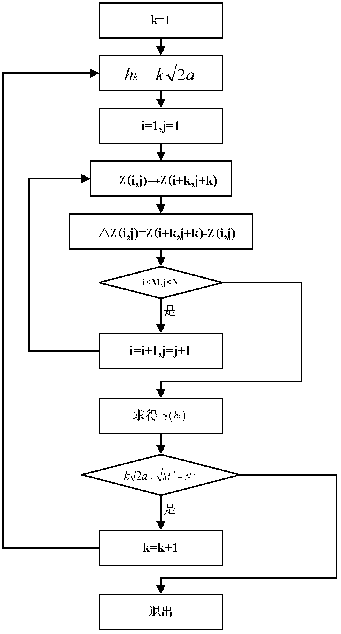
[0129] 3. The grayscale information matrix of the remote sensing images of the entire research area is imported into the matlab software, an...


PUM


Abstract

The invention relates to an omnidirectional search mechanism variogram based optimal remote sensing scale selection method, which comprises the following steps of: firstly, selecting a research area by using an obtained remote sensing image; then, calculating corresponding variogram values of the remote sensing image at different space intervals in each direction by using an omnidirectional search algorithm; on this basis, establishing a curvilinear relation between the space intervals and the variogram values of the space intervals, and then solving a corresponding local optimal space scale of the remote sensing image in each direction based on the spherical model regression fitting in a variogram model; and finally, taking the local optimal space scale corresponding to the direction with the maximum degree of fitting as the optimal space scale of the remote sensing image. By using the method disclosed by the invention, the problem of 'false' local optimal scales caused by that when a traditional variogram algorithm is used, in the process of selecting the optimal space scale of a remote sensing image, only an isotropic factor is taken into consideration is solved, thereby improving the accuracy of optimal scale selection.

Description

technical field [0001] The invention belongs to the technical field of land utilization, in particular to an optimal remote sensing scale selection method based on variation function of omnidirectional search mechanism. Background technique [0002] Land use change is an important field and hot issue in global change research in recent years. Land use change is regional and hierarchical. The spatial distribution and structural characteristics of land use change will be different in different research areas and observation scales. Therefore, it is very necessary to select remote sensing images with the optimal spatial scale to study land use change in a specific research area. [0003] In terms of optimal scale selection, many scholars have done a lot of work and achieved certain results. Judging from the current optimal scale selection methods of remote sensing images at home and abroad, they mainly focus on the average local variance method (Local Variance) and variation ...

Claims


Application Information

Patent Timeline
IPC IPC(8): G06T1/00
Inventor 吴浩迟旭周璐李辉李岩严冬
Owner WUHAN UNIV OF TECH
Why Eureka
Try Eureka