

Method for coding earth surface image through dividing
A technology of earth images and images, applied in image coding, image data processing, instruments, etc., can solve problems such as inability to retrieve each other, and achieve the effect of improving application convenience and retrieval efficiency
Inactive Publication Date: 2012-02-15
NANJING FORESTRY UNIV
View PDF1 Cites 5 Cited by
- Summary
- Abstract
- Description
- Claims
- Application Information
AI Technical Summary
Problems solved by technology
From the perspective of this document, the focus is on "a fast indexing mechanism" for the block image, and the block image is retrieved through "metadata", and the specific image is divided into blocks according to the predetermined pixel size. The index mechanisms established by different image blocks are independent of each other and cannot be retrieved from each other
Method used
View moreImage
Smart ImageViewing Examples

Examples
Embodiment Construction
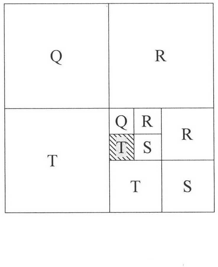
[0024] As shown in the attached figure, if "Q, R, S, T" is used to represent the upper left corner, upper right corner, lower right corner, and lower left corner image, the string formed by these 4 characters represents each image after framing , where the shaded image is coded as TSQT.
Login to View More PUM
 Abstract
The invention discloses a method for coding an earth surface image through dividing, comprising the following steps of: dividing an entire earth image (not containing high-latitude regions over southern and northern latitude of about 85) subjected to Mercator projection, respectively forming four images with peaks of four corners of the image by taking the center of the image as a peak, and then respectively dividing the four divided images in the same way until the divided earth surface images meet the required requirement; and coding each divided image, wherein each image has a special territorial scope and a code. By using the coding way for describing two-dimensional region information by using one-dimensional variable quantity, the retrieval efficiency of the image is greatly increased; and the original earth surface image data obtained through a satellite remote sensing technology can be used for creating an image database after projection transformation and coding through dividing.
Description
technical field [0001] The invention belongs to the field of surface image management in geographic information systems. Background technique [0002] The acquisition of massive satellite image data requires effective means to strengthen management in order to improve the utilization value of these image data. How to efficiently access and manage massive remote sensing image data is an urgent technical problem that needs to be solved. Many scholars have carried out extensive research and discussion on this problem. The database product relies on its image data processing function to build an image database, which solves the problem of multi-source image data storage management, uses the form of metadata to associate with images, and establishes indexes; from the perspective of literature, the constructed Most of the databases are limited to a specific scope of use, and cannot provide open image data sharing services. Among them, Wang Huabin et al [Wang Huabin, Tang Xinming...
Claims
Login to View More Application Information
Patent Timeline
 IPC IPC(8): G06T9/00
Inventor吕志英温小荣林国忠佘光辉
OwnerNANJING FORESTRY UNIV