
Earth gravitational field recovery method based on distance-among-star error model

An inter-satellite distance and error model technology, which is applied in the field of Earth's gravity field recovery based on the inter-satellite distance error model, can solve problems such as high requirements for satellite velocity measurement accuracy, high complexity of the solution process, and large computational load of observation data. Achieve the effect of low computer performance requirements, clear physical meaning and high recovery accuracy

Inactive Publication Date: 2013-04-24
INST OF GEODESY & GEOPHYSICS CHINESE ACADEMY OF SCI
View PDF0 Cites 6 Cited by
  • Summary
  • Abstract
  • Description
  • Claims
  • Application Information

AI Technical Summary

Problems solved by technology

The advantage of the dynamics method is that the solution accuracy is high; the disadvantage is that the observation data has a large amount of computation, the solution process is more complicated, and high-performance parallel computer support is required for the inversion of higher-order gravity fields (L>100 order); the energy The advantage of the conservation method is that the physical meaning of the observation equation is clear and it is easy to analyze the sensitivity of the earth's gravity field. The amount of calculation is greatly reduced under the premise of ensuring the accuracy of the solution. Usually, a PC computer can be used to complete the fast solution of the high-order earth's gravity field; the disadvantage is that the The measurement accuracy of satellite speed is high

Method used


Image

  • Earth gravitational field recovery method based on distance-among-star error model
  • Earth gravitational field recovery method based on distance-among-star error model
  • Earth gravitational field recovery method based on distance-among-star error model

Examples


Embodiment Construction

[0023] The specific implementation manners of the present invention will be further described below in conjunction with the accompanying drawings.

[0024] The earth's gravity field recovery method based on the intersatellite distance error model includes the following specific steps:

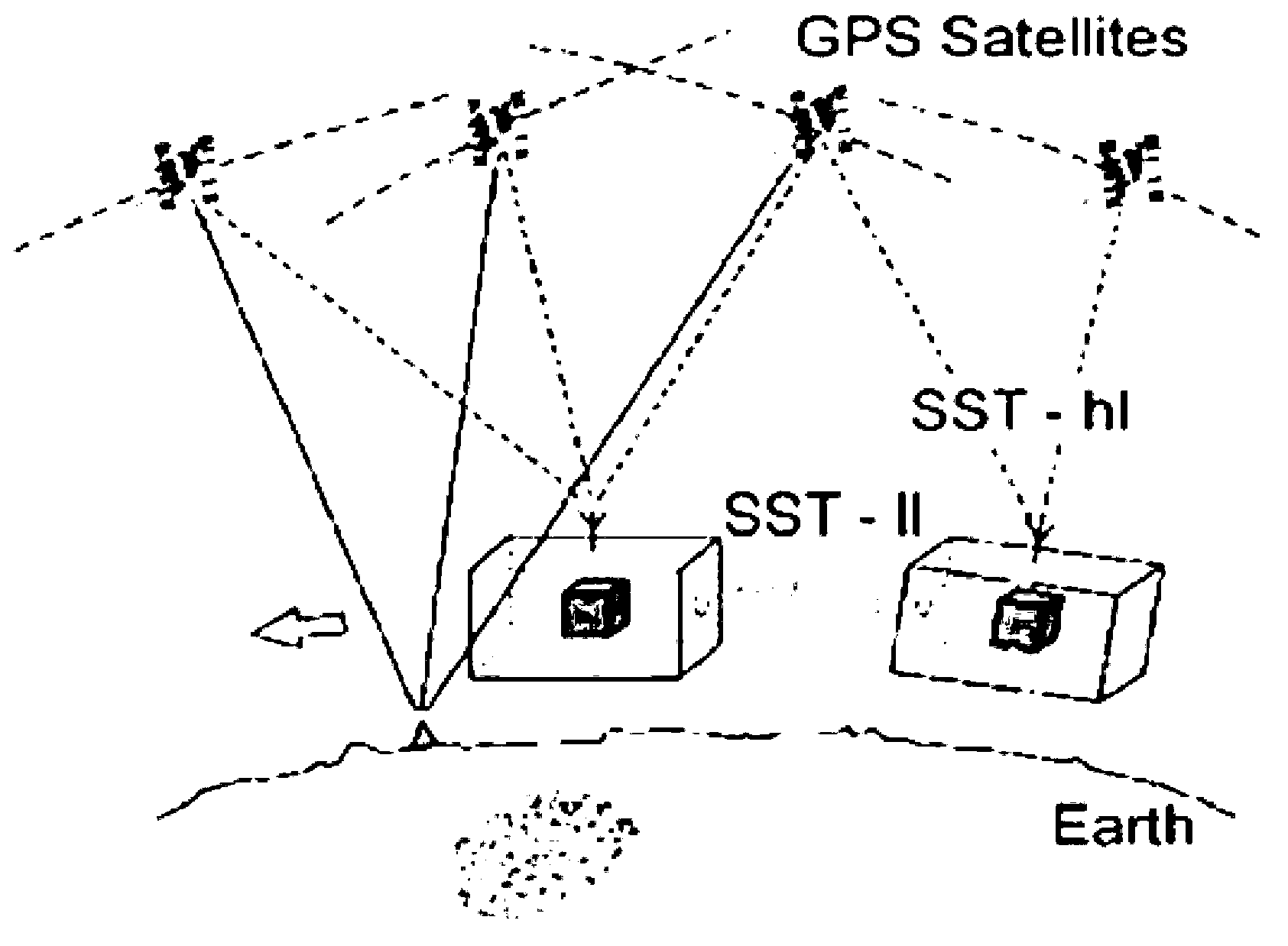
[0025] Step 1: Satellite key payload data collection

[0026] (1) Obtain the inter-satellite distance error data δρ through the space-borne rangefinder 12 ; For the GRACE satellite, the spaceborne K-band rangefinder is used to obtain the inter-satellite distance error data δρ 12 , for the GRACE-II satellite, the spaceborne laser interferometer is used to obtain the inter-satellite distance error data δρ 12 .

[0027] (2) Obtain the orbital position data r through the satellite-borne GPS receiver.

[0028] Step 2: Establishment of inter-satellite distance error model

[0029] The earth disturbance potential T(r, φ, λ) is expanded according to the spherical harmonic function and expressed as...


PUM


Abstract

The invention relates to a precision measurement method of an earth gravitational field, in particular to an earth gravitational field recovery method based on a distance-among-star error model. The method is based on the influence of the distance-among-star error model, accumulates the relation of geoidal surface precision, and establishes a distance-among-star error model, and further precisely and fast recovers a current GRACE earth gravitational field and a next generation GRACE-II earth gravitational field based on the distance-among-star error model. The method is high in recovery precision to the earth gravitational field, greatly improves resolving speed, and is prone to carrying out high order gravitational field error analysis, physical meanings of satellite observation equation are clear, and the requirement of computer performance is low. Therefore, the method of the distance-among-star error model is an effective method for recovering the high precision and high spatial resolution earth gravitational field.

Description

technical field [0001] The present invention relates to interdisciplinary technical fields such as satellite gravity, geodesy, and space science, and in particular to a method for establishing laser interferometric ranging based on the relationship between the intersatellite distance error of a spaceborne laser interferometric rangefinder and the cumulative geoid accuracy The intersatellite distance error model, and then use this intersatellite distance error model to accurately and quickly restore the current GRACE and the next generation GRACE-II method of the Earth's gravity field. Background technique [0002] The earth's gravitational field and its time variation reflect the spatial distribution, movement and change of the earth's surface and interior materials, and at the same time determine the fluctuation and change of the geoid. Therefore, determining the fine structure of the Earth's gravitational field and its time variation is not only a requirement for geodesy, ...

Claims


Application Information

Patent Timeline
IPC IPC(8): G01V7/02
Inventor 不公告发明人
Owner INST OF GEODESY & GEOPHYSICS CHINESE ACADEMY OF SCI
Learn More