Water conservation map data model-based flood risk map drawing method and system thereof
A flood risk map and map data technology, applied in the field of water conservancy GIS mapping, can solve the problems of inability to preprocess data files, lack of instructions for the design and implementation of water conservancy map making tools, and achieve the effect of improving automation
- Summary
- Abstract
- Description
- Claims
- Application Information
AI Technical Summary
Problems solved by technology
Method used
Image

Examples
Embodiment Construction
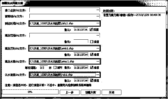
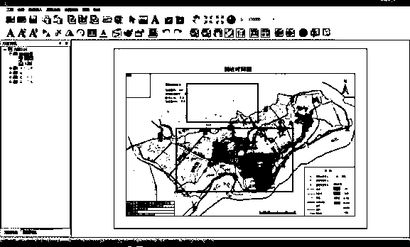
[0038]The present invention will be further described below in conjunction with accompanying drawing of specification sheet and specific embodiment:
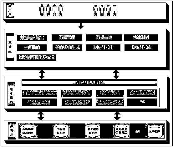
[0039] See attached figure 1 , in the first embodiment of the present invention, a flood risk map drawing system is firstly provided. The system includes the following layers, from bottom to top are data layer, application support layer, business layer.
[0040] Among them, the data layer is used to store the data of the risk map drawing system, which requires basic geographic data, hydraulic engineering data, risk analysis data, etc. In a preferred real-time manner, the involved data can be stored and managed using the ArcGIS File Geodatabase.
[0041] The application support layer is used to provide the underlying functional components necessary for the flood risk mapping system.
[0042] The business layer is used to encapsulate the functions provided by the application support layer, so that the functions conform to the u...
PUM
 Abstract
Description
Claims
Application Information
 - Generate Ideas
- Intellectual Property
- Life Sciences
- Materials
- Tech Scout
- Unparalleled Data Quality
- Higher Quality Content
- 60% Fewer Hallucinations
Browse by: Latest US Patents, China's latest patents, Technical Efficacy Thesaurus, Application Domain, Technology Topic, Popular Technical Reports.
© 2025 PatSnap. All rights reserved.Legal|Privacy policy|Modern Slavery Act Transparency Statement|Sitemap|About US| Contact US: help@patsnap.com