Checking method of aerophotography flight quality
A technology of aerial photography and flight quality, applied in the field of aerial photography, can solve problems such as imprecise theory, time-consuming and labor-consuming, and inconsistency of overlapping standards, and achieve the effect of high calculation efficiency and improved inspection efficiency
- Summary
- Abstract
- Description
- Claims
- Application Information
AI Technical Summary
Problems solved by technology
Method used
Image

Examples
Embodiment Construction
[0027] Preferred embodiments of the present invention will be specifically described below in conjunction with the accompanying drawings, wherein the accompanying drawings constitute a part of the application and are used together with the embodiments of the present invention to explain the principles of the present invention. For the sake of clarity and simplicity, detailed descriptions of known functions and constructions in the devices described herein will be omitted when it may obscure the subject matter of the present invention.
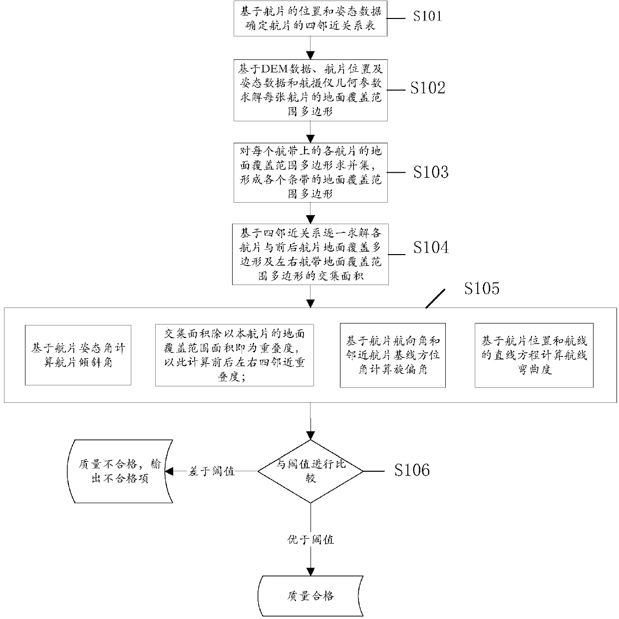
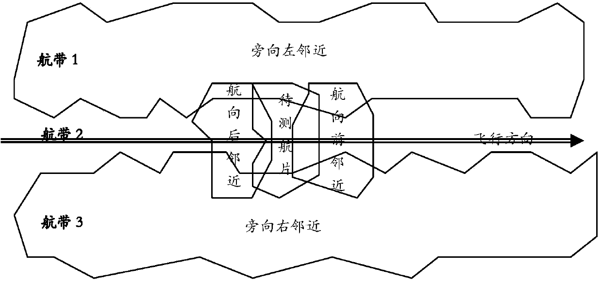
[0028] The embodiment of the present invention provides a method for inspecting the flight quality of aerial photography. Based on the position data, attitude data, geometric parameters of the aerial camera and digital elevation model (DEM) data of the aerial photograph, the collinear equation mathematical model is used to solve the problem of the aerial photograph. Ground coverage, based on the area intersection of the ground coverage, calculat...
PUM
 Abstract
Description
Claims
Application Information
 - Generate Ideas
- Intellectual Property
- Life Sciences
- Materials
- Tech Scout
- Unparalleled Data Quality
- Higher Quality Content
- 60% Fewer Hallucinations
Browse by: Latest US Patents, China's latest patents, Technical Efficacy Thesaurus, Application Domain, Technology Topic, Popular Technical Reports.
© 2025 PatSnap. All rights reserved.Legal|Privacy policy|Modern Slavery Act Transparency Statement|Sitemap|About US| Contact US: help@patsnap.com