Method and device for monitoring water environment in sunk ponding region
A technology for subsidence water accumulation and environmental monitoring, applied in the measurement of scattering characteristics, etc., can solve the problems of high cost, limited sampling quantity and scale, etc.
- Summary
- Abstract
- Description
- Claims
- Application Information
AI Technical Summary
Problems solved by technology
Method used
Image
Examples
Embodiment Construction
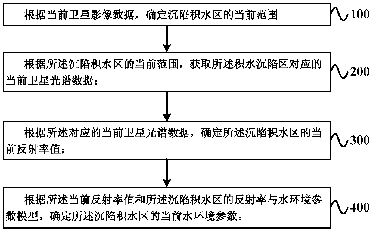
[0023] figure 1 A schematic flow chart of a water environment monitoring method for a subsidence water accumulation area provided by an embodiment of the present invention, as shown in figure 1 As shown, the method includes:
[0024] Step 100: Determine the current scope of the subsidence water accumulation area according to the current satellite image data.
[0025] Optionally, the current satellite image data is currently obtained from environmental remote sensing monitoring satellites. For example, environmental remote sensing monitoring satellites can be my country's Environment-1 satellite, the US Land Resources Satellite, etc. The satellite image data mentioned above should be subject to easy subsequent land type classification, which can be obtained from the green (hereinafter referred to as B2 spectrum), red (hereinafter referred to as B3 spectrum) and infrared (hereinafter referred to as B4 spectrum) of environmental remote sensing monitoring satellites. ) to obtai...
PUM
 Abstract
Description
Claims
Application Information
 - R&D
- Intellectual Property
- Life Sciences
- Materials
- Tech Scout
- Unparalleled Data Quality
- Higher Quality Content
- 60% Fewer Hallucinations
Browse by: Latest US Patents, China's latest patents, Technical Efficacy Thesaurus, Application Domain, Technology Topic, Popular Technical Reports.
© 2025 PatSnap. All rights reserved.Legal|Privacy policy|Modern Slavery Act Transparency Statement|Sitemap|About US| Contact US: help@patsnap.com


