Video geographic information system and method for urban areas

A video geographic information and geographic information technology, which is applied in the field of geographic information systems and intelligent video geographic information (GIS) systems, can solve problems such as large data barriers, poor video positioning and viewing effects, and inconsistent viewing angles

Inactive Publication Date: 2014-02-19
深圳市千方航实科技有限公司
View PDF8 Cites 29 Cited by
  • Summary
  • Abstract
  • Description
  • Claims
  • Application Information

AI Technical Summary

Problems solved by technology

[0005] The technology of the invention solves the problem: In order to overcome the shortcomings of the traditional video surveillance system, such as large data barriers, serious video surveillance fragmentation, poor integration of video surveillance and geographic information systems, poor video positioning and viewing effects for designated locations, and inconsistent viewing angles, the present invention The invention adopts the method of image projection transformation and map information matching, connects surveillance cameras of different systems, and accurately projects its video images on the corresponding position and angle of view of the map, thus providing a simple deployment, high reliability, and angle of view Real-time processing of a large amount of camera data and integration into a map with a coordinate system, a dynamic video geographic information system displayed in real time

Method used


Image

  • Video geographic information system and method for urban areas
  • Video geographic information system and method for urban areas
  • Video geographic information system and method for urban areas

Examples


Embodiment Construction

[0061] The specific embodiment of the present invention will be further described below in conjunction with accompanying drawing:

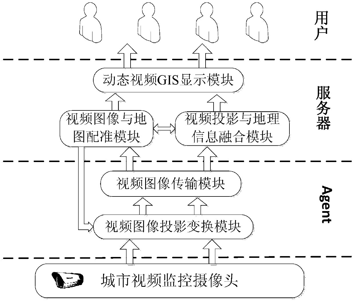
[0062] Such as figure 1 As shown, the metropolitan-oriented video geographic information system of the present invention is composed of a video projection transformation module, a video image transmission module, a video image and map registration module, a video projection and geographic information fusion module, and a dynamic video GIS display module.

[0063] The whole implementation process is as follows:

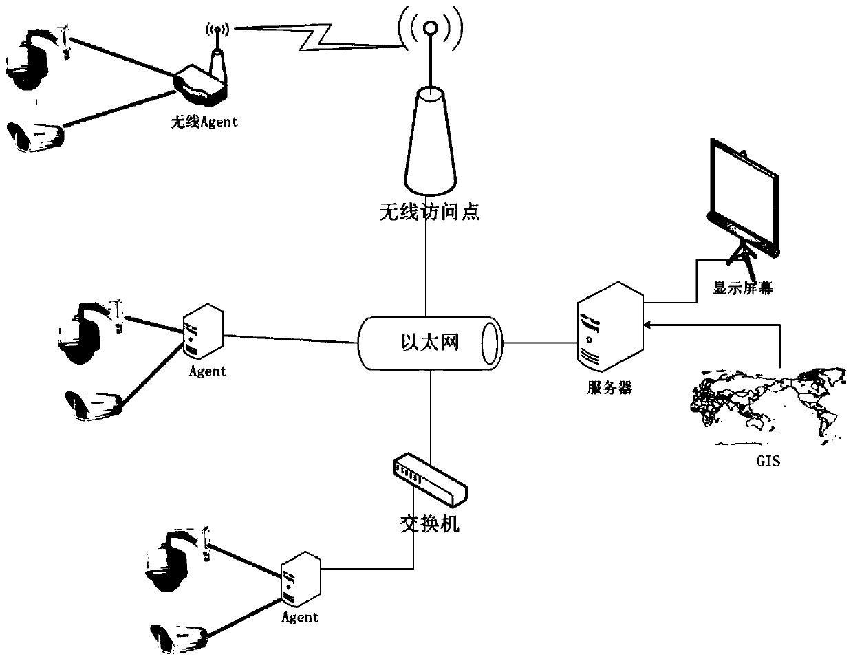
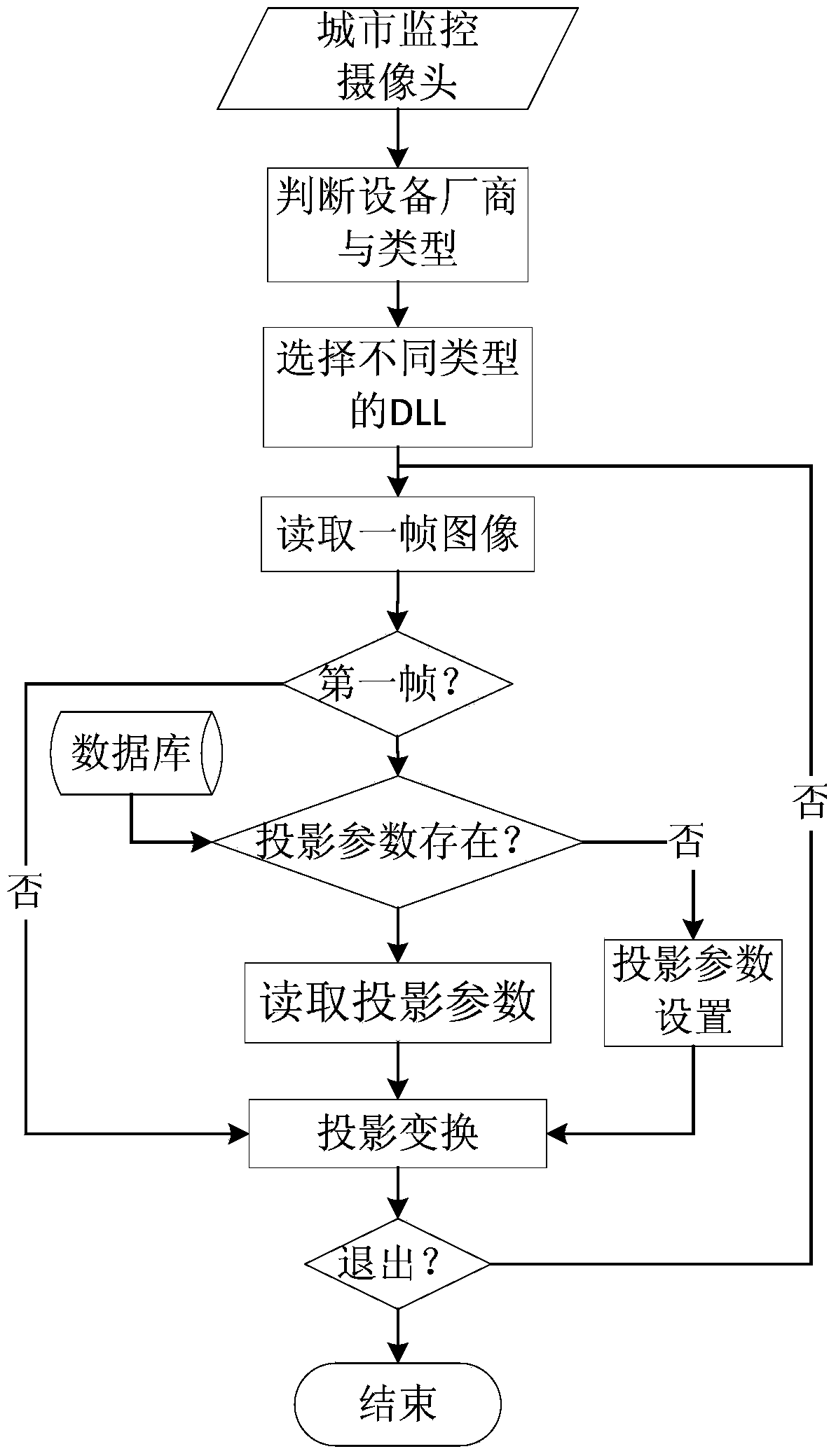
[0064] (1) For urban video surveillance cameras, judge the communication protocol and communication method used by the camera through the camera hardware information, and set the module to use the interaction parameters related to the manufacturer, so as to obtain the real-time video image of the camera; if the connected video surveillance If the camera has no projection parameters in the system, the acquired original video is directly ha...


PUM


Abstract

The invention discloses a video geographic information system and method for urban areas. The system comprises a video acquisition Agent, a video server and a geographic information system (GIS) positioned in the server, wherein the Agent is composed of a video transmission module and a video image projection transformation module; and the video server is composed of a video image and map registering module, a video projection and geographic information integrating module and a dynamic video GIS display module. The system of the invention is independent, data of the system comes from video monitoring cameras in the urban area, the instantaneity is high, lots of cameras can be simultaneously connected to the system, a lot of continuous monitoring data can be simultaneously read from one map, and visual whole-city running states and a target continuously searching and tracking service are provided for the city managers and decision makers.

Description

technical field [0001] The present invention relates to a video surveillance system and a geographic information system and method, in particular to an intelligent video geographic information that integrates metropolitan-oriented video surveillance and a GIS system for real-time monitoring of a large area under the same coordinate system and the same viewing angle (GIS) system, which belongs to the field of computer vision. Background technique [0002] With the development of the world economy and the popularization of video surveillance, the demand for computer vision in various applications is also increasing, and computer vision has received more attention. Computer intelligent video surveillance is an emerging application direction and a frontier subject that has attracted much attention in the field of computer vision. At the same time, geospatial expression is also an important content in the field of geographic information science, and it is also a major challenge ...

Claims


Application Information

Patent Timeline
Patent Type & Authority Applications(China)
IPC IPC(8): H04N7/18H04L29/06
Inventor 盛浩刘书凯李超汪林翰熊璋
Owner 深圳市千方航实科技有限公司
Why Eureka
Try Eureka