A spatial domain-based adaptive mtfc remote sensing image restoration method
A remote sensing image and adaptive technology, applied in the field of image processing, can solve problems such as image quality degradation, and achieve the effect of avoiding excessive amplification of high-frequency noise
- Summary
- Abstract
- Description
- Claims
- Application Information
AI Technical Summary
Problems solved by technology
Method used
Image
Examples
Embodiment Construction
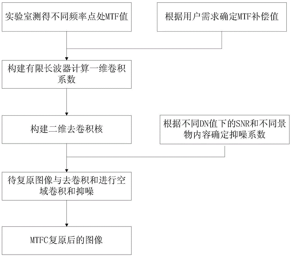
[0022] Such as figure 1 Shown, be the flowchart of the inventive method, main steps are as follows:
[0023] (1) Accurately calculate the one-dimensional convolution coefficient according to the MTF values at different frequencies of the remote sensor system measured in the laboratory;
[0024] (11) Obtain the MTF value of the remote sensor system from zero frequency to Nyquist frequency through laboratory measurement;
[0025] (12) Use the results of step (11) and combine the user demand value to determine the ideal MTF curve after restoration, and compare the two to obtain the compensation value of MTF at different frequencies in the remote sensor system from zero frequency to Nyquist frequency (The number of compensated frequency points is limited by the processing speed and resources. The more frequency points compensated, the larger the processing space and the slower the speed will be);
[0026] (13) Construct a finite-length digital filter according to the MTF compe...
PUM
 Abstract
Description
Claims
Application Information
 - R&D
- Intellectual Property
- Life Sciences
- Materials
- Tech Scout
- Unparalleled Data Quality
- Higher Quality Content
- 60% Fewer Hallucinations
Browse by: Latest US Patents, China's latest patents, Technical Efficacy Thesaurus, Application Domain, Technology Topic, Popular Technical Reports.
© 2025 PatSnap. All rights reserved.Legal|Privacy policy|Modern Slavery Act Transparency Statement|Sitemap|About US| Contact US: help@patsnap.com


