

Semi-supervised classification and regional distance measurement based SAR (Synthetic Aperture Radar) image identification method
A technology of regional distance and image recognition, applied in the field of image processing, can solve the problems that similarity matching technology does not consider the characteristics of SAR images, cannot fully verify the validity, and the difference of data distribution is large, so as to increase the reliability and reduce the impact. , the effect of accurate similarity matching results
- Summary
- Abstract
- Description
- Claims
- Application Information
AI Technical Summary
Problems solved by technology
Method used
Image



Examples
Embodiment Construction
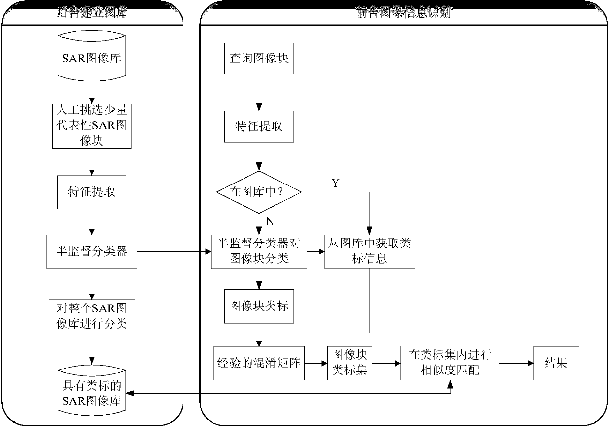
[0028] refer to figure 1 , the specific implementation steps of the present invention are as follows:
[0029] Step 1, build the SAR image database {p 1 ,p 2 ,...,p N}, and select SAR image blocks according to the principle of single target.
[0030] The specific implementation of this step is as follows:
[0031] 1a) Two large-scale SAR images with pixel sizes of 19035×7330 and 7082×7327 are selected as the original SAR images for building the library, respectively as follows figure 2 (a), figure 2 as shown in (b);
[0032] 1b) Segment the two selected original SAR images without overlapping, and obtain 2828 SAR image blocks with a size of 256×256 after segmentation, and use this to build a SAR image library{p 1 ,p 2 ,...,p N}, where N=2828;
[0033] 1c) Select SAR image blocks in the image library according to the principle of single target {p 1 ,p 2 ,...,p l}, where l<
PUM
 Abstract
Description
Claims
Application Information