Physical method for computing atmospheric path radiance of satellite remote sensing images through picture elements one by one
A technology of satellite remote sensing image and atmospheric path radiation, which is applied in the direction of utilizing re-radiation, electromagnetic wave re-radiation, measuring device, etc.
- Summary
- Abstract
- Description
- Claims
- Application Information
AI Technical Summary
Problems solved by technology
Method used
Image
Examples
Embodiment Construction
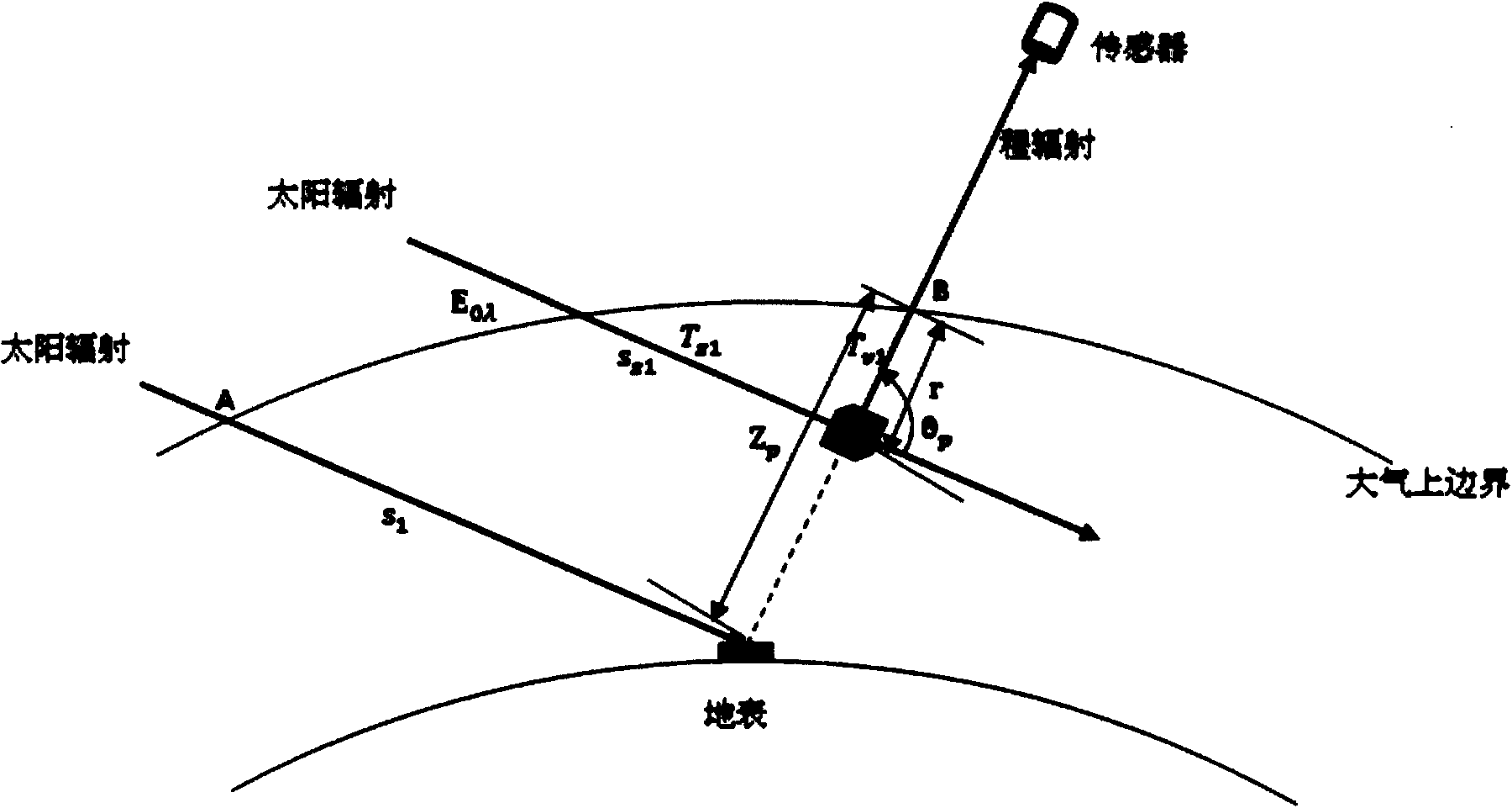
[0039] Atmospheric-path radiation is the combined result of Rayleigh scattering and aerosol Mie scattering, and the total atmospheric-pass radiation reaching the sensor can be regarded as the integral of atmospheric up-going radiation on the surface-sensor path ( figure 1 ), the theoretical calculation formula of the radiation is as follows:
[0040] L p = ∫ 0 Z p E 0 / d 2 T z 1 β sca ( θ p , λ ) T v 1 dr - - - ( 1 )
[0041] Amon...
PUM
 Abstract
Description
Claims
Application Information
 - R&D
- Intellectual Property
- Life Sciences
- Materials
- Tech Scout
- Unparalleled Data Quality
- Higher Quality Content
- 60% Fewer Hallucinations
Browse by: Latest US Patents, China's latest patents, Technical Efficacy Thesaurus, Application Domain, Technology Topic, Popular Technical Reports.
© 2025 PatSnap. All rights reserved.Legal|Privacy policy|Modern Slavery Act Transparency Statement|Sitemap|About US| Contact US: help@patsnap.com


