

Automatic submarine topography generating method
An automatic generation and terrain technology, applied in image data processing, 3D modeling, instruments, etc., can solve the problems of not considering continuous water depth data processing, unable to integrate data, and unable to truly reflect the characteristics of seabed topography
- Summary
- Abstract
- Description
- Claims
- Application Information
AI Technical Summary
Problems solved by technology
Method used
Image

Examples
Embodiment Construction
[0057] The present invention will be further described in detail below in conjunction with the accompanying drawings and embodiments.
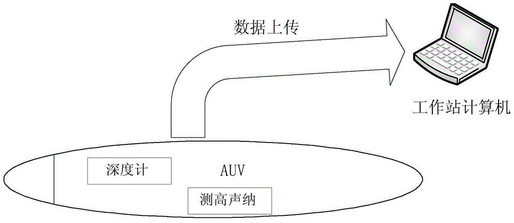
[0058] The present invention is made up of AUV (Autonomous underwater vechle, unmanned unmanned submersible) and graphics workstation computer, wherein AUV needs to be equipped with a depth gauge and an altimeter sonar to measure the depth value of seawater, such as figure 1 shown.
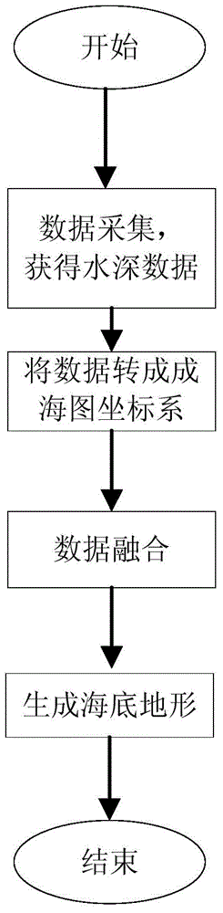
[0059] The method of seabed terrain generation is as follows: figure 2 As shown, after the AUV obtains the data according to the survey line trajectory, it uploads the data to the computer of the graphics workstation, uses the seabed terrain data generation method for processing, and calls Vega after processing to model the seabed terrain and generate the seabed terrain, as shown in figure 2 shown.
[0060] According to the method of the present invention, the water depth data is processed on the graphics workstation computer, and finally the seabed topography...
PUM
 Abstract
Description
Claims
Application Information