Remote sensing image pseudostereoscopy correction method

A remote sensing image and correction method technology, applied in image data processing, graphics and image conversion, instruments, etc.

Inactive Publication Date: 2015-06-10
BEIJING NORMAL UNIVERSITY
View PDF3 Cites 5 Cited by
  • Summary
  • Abstract
  • Description
  • Claims
  • Application Information

AI Technical Summary

Problems solved by technology

[0006] The present invention is aimed at some deficiencies of the existing terrain correction method to generate stere

Method used


Image

  • Remote sensing image pseudostereoscopy correction method
  • Remote sensing image pseudostereoscopy correction method
  • Remote sensing image pseudostereoscopy correction method

Examples


Embodiment Construction

[0058] The technical implementation of the present invention will be further described below in conjunction with the accompanying drawings.

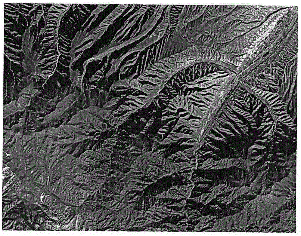
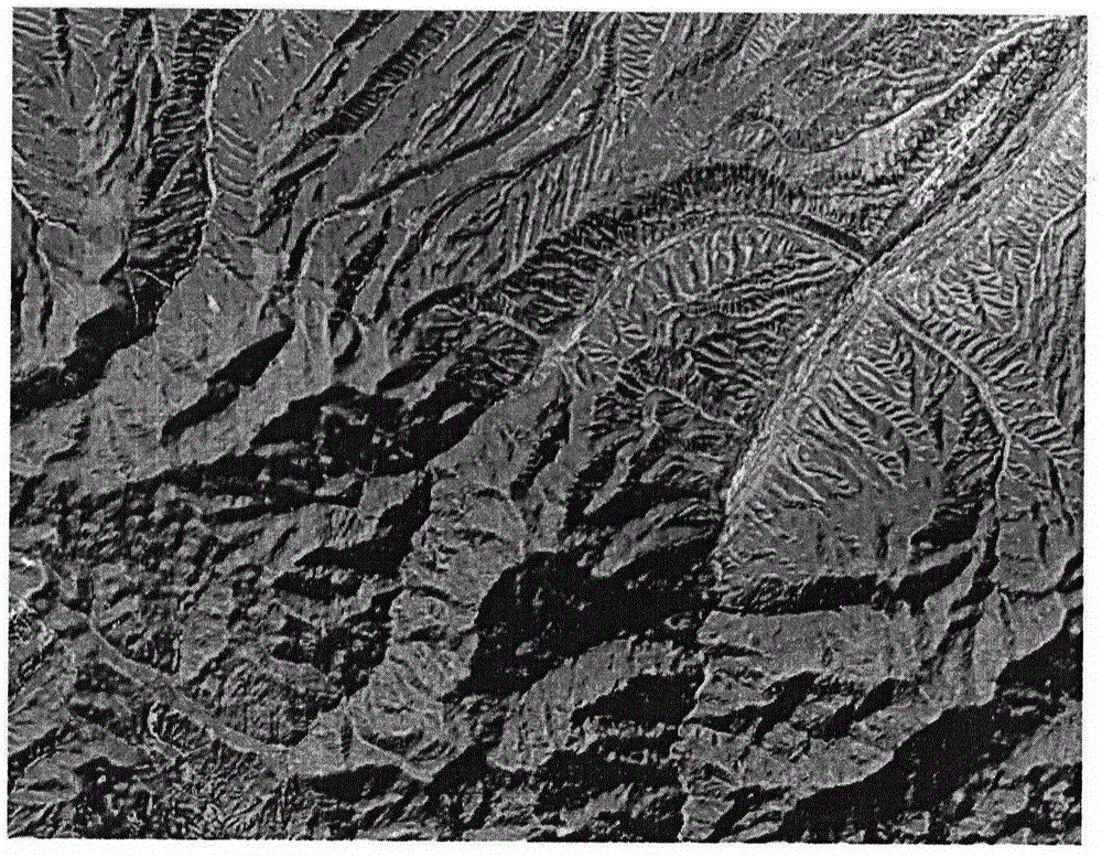
[0059] A. Geometric precision correction of remote sensing images and digital elevation model (DEM) data preprocessing

[0060] Select ground control points to perform geometric fine correction on the remote sensing image to obtain a new image with a certain map projection; at the same time, convert the DEM data into the same projection type and spatial resolution as the remote sensing image, and crop the DEM data so that It has the same ground coverage as remote sensing images.

[0061] In this case, the map projection used for remote sensing images is UTM (Universal Transverse Mercator Projection, Universal Transverse Mercator Projection), with a spatial resolution of 30 meters. DEM data also needs to be transformed into UTM projection with a spatial resolution of 30 meters and the same spatial coverage as remote sensing images.

[0...


PUM


Abstract

The invention discloses a remote sensing image pseudostereoscopy correction method. A current solar azimuth and a solar altitude are obtained by utilizing an original remote sensing image, data of a DEM and a remote sensing image, and an orthostereoscopy image according with practical topographic features is generated through image geometric precise correction, image intensification, calculation of gradient and exposure, calculation of an effective solar incident angle cosine value, topographical correction based on a gradient matching model and calculation of a gradient matching model inverse process. The remote sensing image pseudostereoscopy correction method has the advantages of being strong in mechanism, and widely suitable for pseudostereoscopy correction of remote sensing images of different regions and different sources. A generated orthostereoscopy image is high in third dimension, vivid in tone and balance in brightness, and the remote sensing image pseudostereoscopy correction method can be applied to the fields of map navigation, planning and designing, ecological zoning, resources monitoring such as land, agriculture and the forestry, geological disaster monitoring, geological prospecting, hydrological survey, military and the like.

Description

technical field [0001] The invention relates to fine geometric correction of remote sensing images, image enhancement, calculation of slope and aspect, calculation of cosine value of effective solar incident angle and terrain correction, and belongs to the field of remote sensing image processing and production. Background technique [0002] With the continuous development of remote sensing technology, remote sensing data is becoming more and more abundant. Remote sensing images have been widely used in digital cities, digital land, digital earth and other fields because of their rich information and intuitive and realistic expressions. The use of remote sensing images is no longer Restricted to professionals. However, the images taken by sun-synchronous satellites in the northern hemisphere in the morning often have anti-stereoscopic phenomena, which makes the river valleys on the remote sensing images look like ridges, and the ridges look like valleys, which is difficult f...

Claims


Application Information

Patent Timeline
IPC IPC(8): G06T3/00
Inventor 朱文泉郑周涛张东海江源
Owner BEIJING NORMAL UNIVERSITY
Why Eureka
Try Eureka