Spatial interpolation method for long-span bridge monitoring data
A technology of monitoring data and spatial interpolation, applied in electrical digital data processing, special data processing applications, instruments, etc., can solve problems such as low accuracy and incomplete information
- Summary
- Abstract
- Description
- Claims
- Application Information
AI Technical Summary
Problems solved by technology
Method used
Image
Examples
Embodiment Construction
[0059] The present invention will be further described below in conjunction with the accompanying drawings.
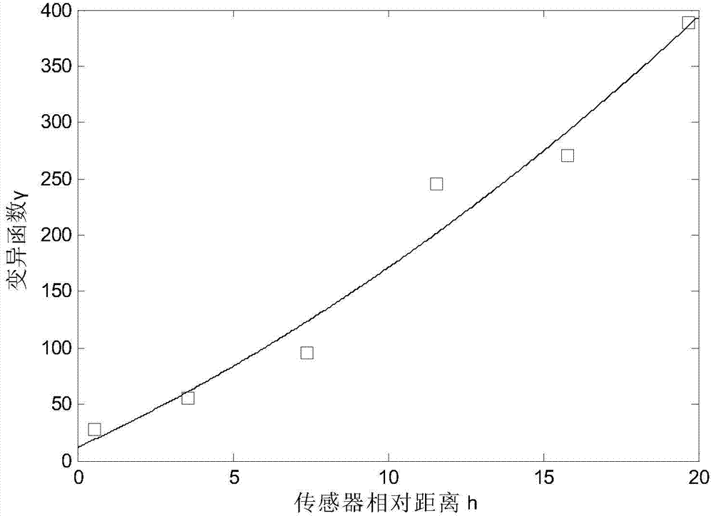
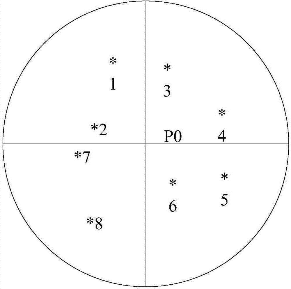
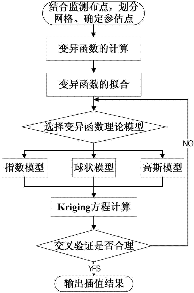
[0060] refer to Figure 1 ~ Figure 4 , a method for spatial interpolation of long-span bridge monitoring data, comprising the following steps:
[0061]1) According to the distribution of measuring points of a certain monitoring data on a long-span bridge, the spatial autocorrelation analysis of similar sensors is carried out, which is reflected by the spatial variation function. Under the one-dimensional condition, the variation function is defined as, when the spatial point x is in a When the dimension x-axis changes, half of the variance of the difference between the monitoring value Z(x) and Z(x+h) of bridge monitoring data Z(x) at spatial coordinate points x and x+h is the regionalized variable Z(x ) in the x-axis direction, denoted as γ(h), namely
[0062] γ ( h ...
PUM
 Abstract
Description
Claims
Application Information
 - R&D
- Intellectual Property
- Life Sciences
- Materials
- Tech Scout
- Unparalleled Data Quality
- Higher Quality Content
- 60% Fewer Hallucinations
Browse by: Latest US Patents, China's latest patents, Technical Efficacy Thesaurus, Application Domain, Technology Topic, Popular Technical Reports.
© 2025 PatSnap. All rights reserved.Legal|Privacy policy|Modern Slavery Act Transparency Statement|Sitemap|About US| Contact US: help@patsnap.com


