Remote sensing character optimization algorithm for improving mRMR (min-redundancy max-relevance) algorithm
An algorithm and remote sensing technology, applied in computing, computer parts, instruments, etc., can solve the problem of less discussion, achieve low data requirements, high computing efficiency, and simple principles
- Summary
- Abstract
- Description
- Claims
- Application Information
AI Technical Summary
Problems solved by technology
Method used
Image
Examples
Embodiment Construction
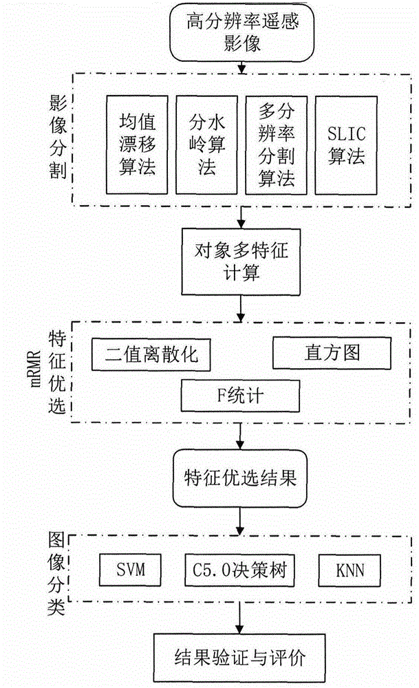
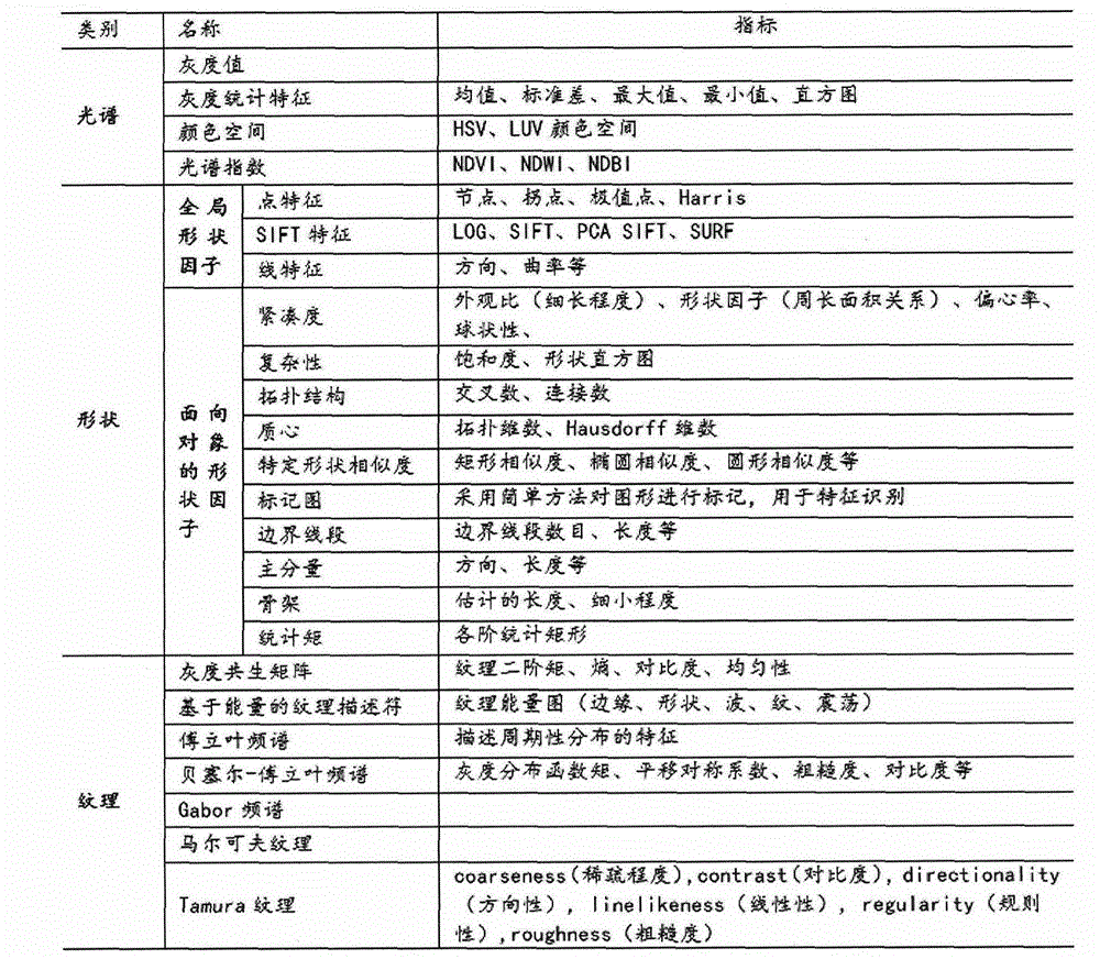
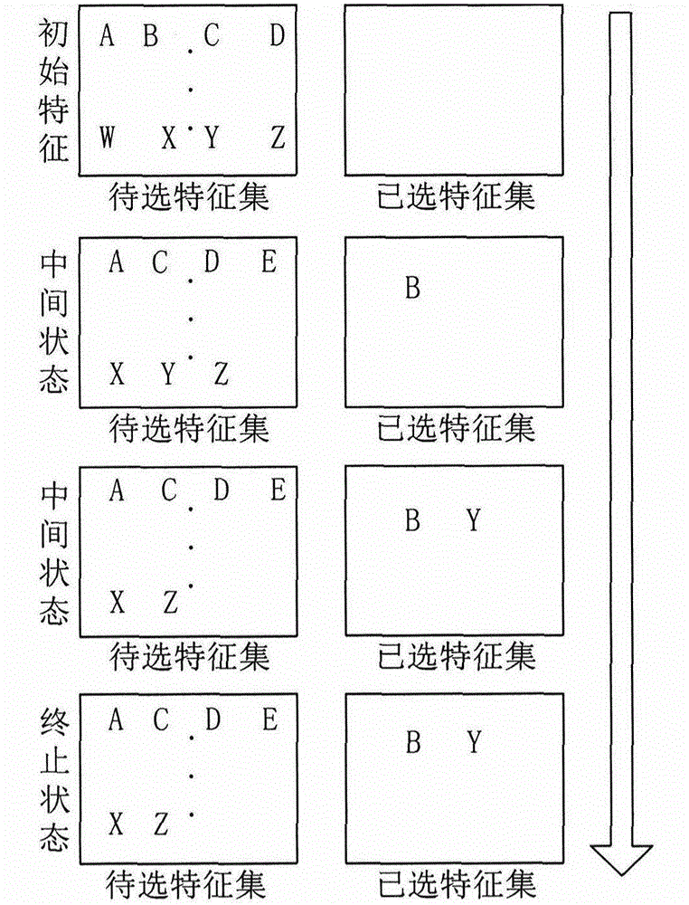
[0031] figure 1 The main realization idea of the present invention is illustrated. In the process of high-resolution remote sensing image processing and classification, it is necessary to use remote sensing multi-scale segmentation algorithms to achieve image segmentation (methods can choose mean shift, watershed, multi-resolution, SLIC, etc.), and further perform segmentation on the segmented primitive objects. Multi-feature calculation, and then according to the characteristics of different objects, the land category of the object is judged, and the classification process of the land parcel object is completed. Since there are many features that can be calculated on the plot, such as figure 2 In the list of commonly used feature calculations shown, generally in the calculation of primitive features, object spectral features, texture features, and shape features are mostly used, followed by spatial relationship features between multiple objects. Different features will p...
PUM
 Abstract
Description
Claims
Application Information
 - R&D
- Intellectual Property
- Life Sciences
- Materials
- Tech Scout
- Unparalleled Data Quality
- Higher Quality Content
- 60% Fewer Hallucinations
Browse by: Latest US Patents, China's latest patents, Technical Efficacy Thesaurus, Application Domain, Technology Topic, Popular Technical Reports.
© 2025 PatSnap. All rights reserved.Legal|Privacy policy|Modern Slavery Act Transparency Statement|Sitemap|About US| Contact US: help@patsnap.com


