

Power inspection tour flying robot air route planning method based on three-dimensional digital map
A flying robot, three-dimensional digital technology, applied in three-dimensional position/channel control and other directions, can solve problems such as less consideration of dynamic obstacles in harsh environments and no route planning method.
- Summary
- Abstract
- Description
- Claims
- Application Information
AI Technical Summary
Problems solved by technology
Method used
Image

Examples
Embodiment Construction
[0024] The method proposed by the present invention will be further described below in conjunction with the accompanying drawings and embodiments.
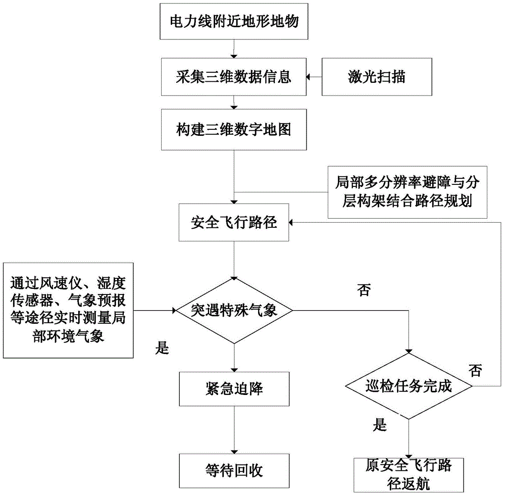
[0025] Such as figure 1 Shown is the flow chart of the route planning of the inspection flight robot based on the three-dimensional digital map of the present invention; the specific steps of the method are:
[0026] 1) Collect the three-dimensional data information of the terrain and features near the power line through laser scanning technology, and construct the corresponding three-dimensional digital map;
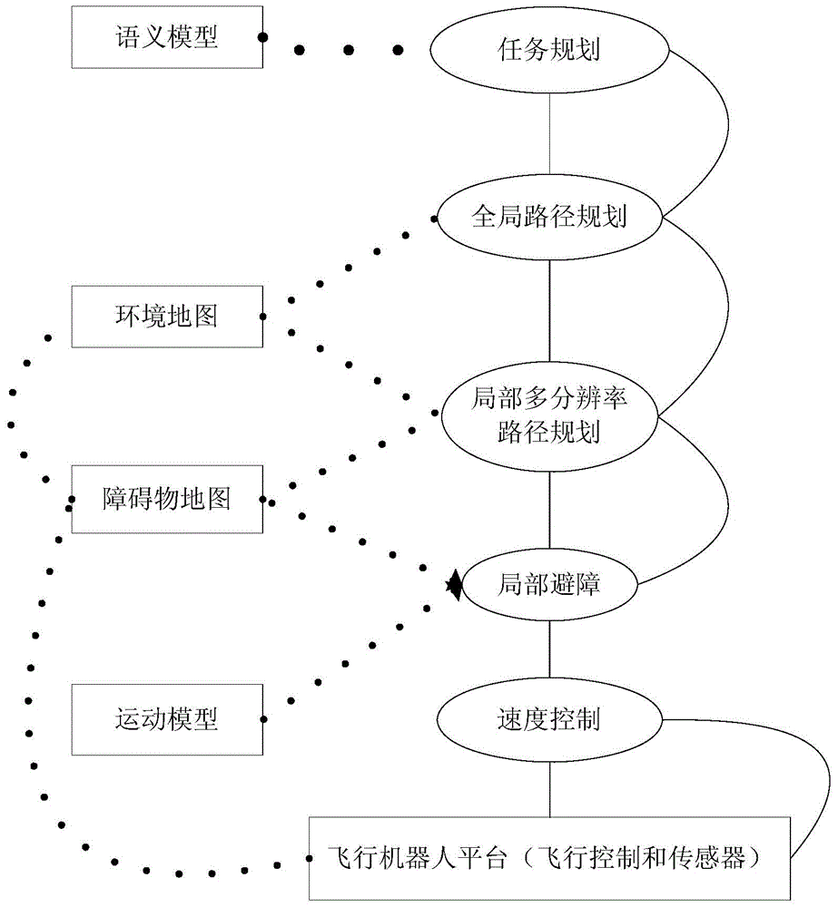
[0027] 2) Generate obstacle maps based on 3D digital maps, and use octree-based high-frequency probabilistic 3D mapping frameworks to generate global environment maps. In addition, through airborne omnidirectional sensors, a specific semantic model according to task requirements is automatically established, thereby utilizing local multiple A path planning method combining resolution obstacle avoidance and layered architec...
PUM
 Abstract
Description
Claims
Application Information