Underwater terrain matching navigation system based on acoustic Doppler log
A Doppler log and acoustic technology, applied in navigation, mapping and navigation, instruments, etc., can solve problems such as inaccuracy, only one working method, and few measuring points, and achieve the effect of ensuring accuracy
- Summary
- Abstract
- Description
- Claims
- Application Information
AI Technical Summary
Problems solved by technology
Method used
Image
Examples
Embodiment Construction
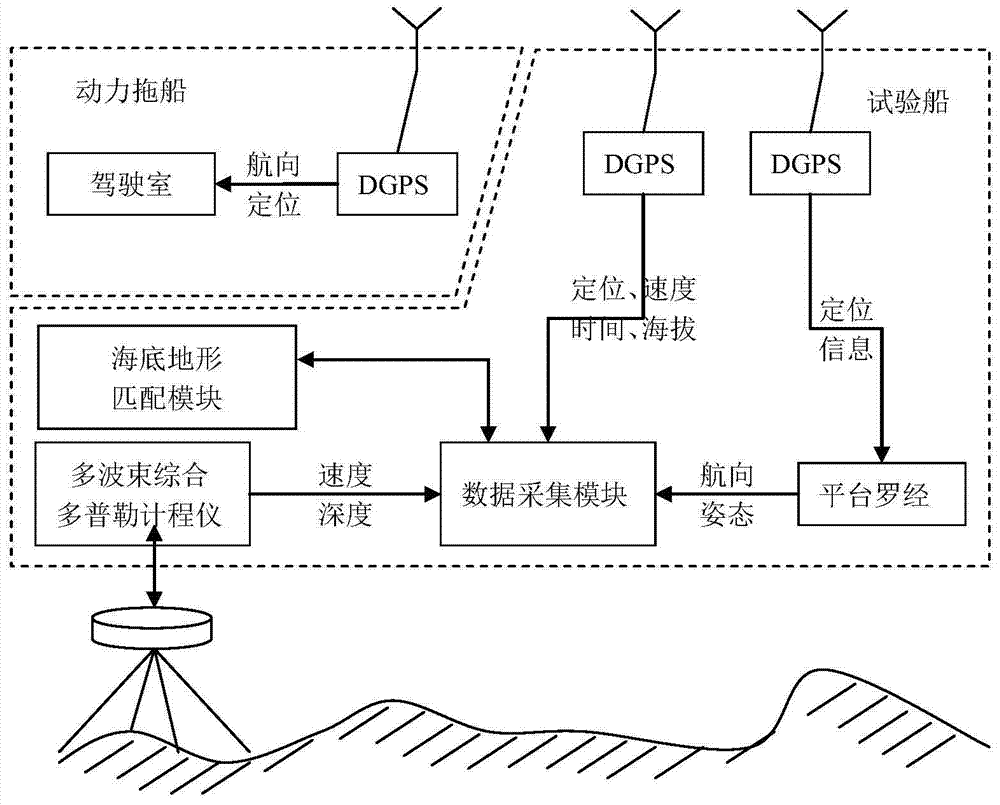
[0022] The present invention will be further described in detail below in conjunction with the accompanying drawings and specific embodiments.
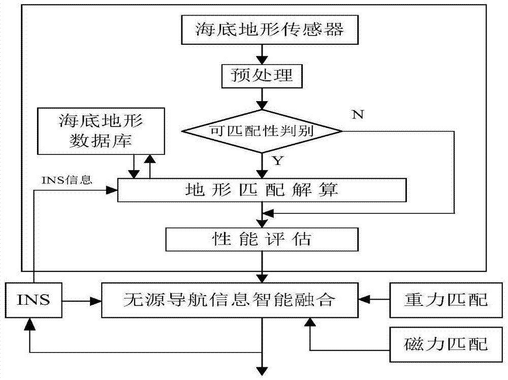
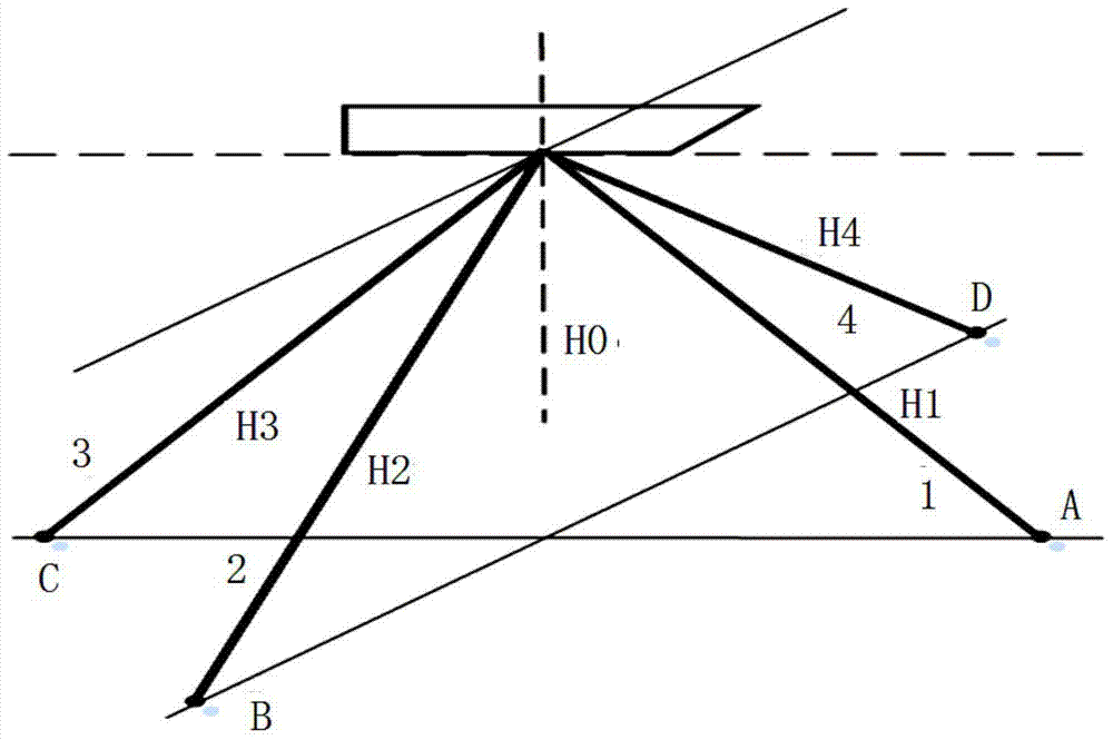
[0023] See figure 1 , The underwater terrain matching navigation system of the present invention mainly includes a multi-beam comprehensive Doppler log, a DGPS positioning system (differential global positioning system), a platform compass, a data acquisition module and a seabed terrain matching module. As the sensor of this system, the multi-beam integrated Doppler log is used to measure the water depth data of multiple measuring points and the longitudinal velocity and lateral velocity of the underwater vehicle. Time-sharing measurement of beam bathymetry and velocimetry. The DGPS positioning system is used to provide high-precision latitude and longitude information of underwater vehicles, and provide heading information of underwater vehicles for ship operation. The platform compass is used to provide the attitude information of...
PUM
 Abstract
Description
Claims
Application Information
 - R&D
- Intellectual Property
- Life Sciences
- Materials
- Tech Scout
- Unparalleled Data Quality
- Higher Quality Content
- 60% Fewer Hallucinations
Browse by: Latest US Patents, China's latest patents, Technical Efficacy Thesaurus, Application Domain, Technology Topic, Popular Technical Reports.
© 2025 PatSnap. All rights reserved.Legal|Privacy policy|Modern Slavery Act Transparency Statement|Sitemap|About US| Contact US: help@patsnap.com


