SAR image terrain classification method based on domain adaption

A technique of transfer learning and ground object classification, applied in the field of synthetic aperture radar image ground object classification, can solve the problem of limited spatial range and regional accessibility of field inspection methods, affecting the reliability and detail of category labels, SVM calculation amount and In order to reduce the number of redundant samples, optimize the classification results, and reduce the cost of acquisition, the problems of increased storage capacity and other issues can be achieved.

A technique of transfer learning and ground object classification, applied in the field of synthetic aperture radar image ground object classification, can solve the problem of limited spatial range and regional accessibility of field inspection methods, affecting the reliability and detail of category labels, SVM calculation amount and In order to reduce the number of redundant samples, optimize the classification results, and reduce the cost of acquisition, the problems of increased storage capacity and other issues can be achieved.

CN105224949AActive Publication Date: 2016-01-06UNIV OF ELECTRONICS SCI & TECH OF CHINA

Image

  • SAR image terrain classification method based on domain adaption

Examples


Embodiment Construction

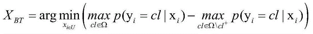
[0028] A SAR image classification method based on cross-domain transfer learning, comprising the following steps:

[0029] Step 1: Normalize the SAR images of the input source domain and target domain respectively, and perform feature extraction:

[0030] Correct the value of the outlier pixel points accounting for 0.3% of the original image to [P min ,P max ] in the size range. which is lower than P min The pixel value of is artificially revised as P min , higher than P max The value of is artificially revised as P max , and then mapped to the [0,255] pixel interval to obtain a clear image.

[0031] For example, correct the outlier pixel value of 0.3% of the original image in the source domain with a size of 500×250 pixels and the target domain to be in the range of [0,0.02]. Among them, values ​​higher than 0.02 were artificially revised to 0.02.

[0032] The 48-dimensional Gabor wavelet feature is extracted for each pixel of the normalized source domain and target d...


PUM


Abstract

The invention provides a SAR image terrain classification method based on domain adaption. By use of domain adaption algorithm, by means of prior SAR image data of a source domain, a classification model is established for adaptive application in classification of another similar yet different target domain SAR image, so that the cost of obtaining a target domain SAR image label is reduced. According to the invention, the mechanism of only reserving support vectors as the training set every time when a training set is optimized and updated can substantially reduce the redundant sample quantity of the training set and can effectively alleviate the problem that an SVM classifier is restricted by computational complexity and a storage capacity; through introduction of a recovery utilization mechanism of target domain samples unable to serve as the support vectors, the target area samples can be repeatedly and efficiently utilized so that a classification face can be continuously adjusted and corrected; and at the same time, through deletion of source domain samples unable to serve as the support vectors, the quantity of source domain training samples which do not match target domain distribution can be reduced, more accurate classification results can be obtained, and the convergence is better.

Description

technical field [0001] The invention relates to the technical field of image processing, in particular to a method for classifying ground objects in synthetic aperture radar (Synthetic Aperture Radar, SAR) images. Background technique [0002] Synthetic aperture radar image classification is an image processing technology that uses the gray scale, texture, shape, edge and direction of different ground object samples to determine their categories in SAR images, and divides different types of ground objects into regions. Due to the particularity of SAR imaging, SAR images are very different from optical images. For example, SAR images contain more redundant information, there is speckle noise, and SAR targets are very sensitive to azimuth angles. Therefore, how to accurately classify ground objects from SAR images has always been a difficult point in SAR image interpretation. [0003] With the continuous improvement of SAR image resolution, the target information has shown an...

Claims


Application Information

Patent Timeline
06 Jan 2016
Publication
CN105224949A
IPC
G06K9/62
CPC
G06F18/2411
Inventors
曹宗杰; 葛雨辰