

Path planning method based on terrain semantics
A path planning and semantic technology, applied in road network navigators, data processing applications, predictions, etc.
- Summary
- Abstract
- Description
- Claims
- Application Information
AI Technical Summary
Problems solved by technology
Method used
Image

Examples
Embodiment Construction
[0039] In order to facilitate those of ordinary skill in the art to understand and implement the present invention, the present invention will be described in further detail below in conjunction with the accompanying drawings and embodiments. It should be understood that the implementation examples described here are only used to illustrate and explain the present invention, and are not intended to limit this invention.
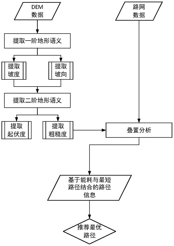
[0040] Digital elevation model (DEM) is a solid ground model that expresses the ground elevation in the form of a set of ordered numerical arrays. It is a branch of digital terrain model, and various other terrain characteristic values can be derived from it. It is an important terrain factor in digital terrain analysis, and it is widely used in geoscience analysis and engineering such as hydrological analysis, soil erosion simulation, and landform type division. It is generally believed that DTM is to describe the spatial distribution of various geomorphol...
PUM
 Abstract
Description
Claims
Application Information