Downscaling method of cmorph satellite rainfall products based on fuzzy-ols and multi-environmental factor variables

A downscaling and multi-environment technology, applied in special data processing applications, instruments, electrical digital data processing, etc., can solve the problem of low resolution and achieve the effect of improving spatial resolution

Active Publication Date: 2018-06-12
ZHEJIANG UNIV
View PDF2 Cites 0 Cited by
  • Summary
  • Abstract
  • Description
  • Claims
  • Application Information

AI Technical Summary

Problems solved by technology

However, the original resolution of the CMORPH satellite is relatively low (spatial resolution is 0.25°, about 25km), and it has certain limitations and deviations in predicting rainfall on a regional scale. Higher resolution rainfall measurements
But there is currently no method for more accurate rainfall forecasts for complex regions

Method used


Image

  • Downscaling method of cmorph satellite rainfall products based on fuzzy-ols and multi-environmental factor variables
  • Downscaling method of cmorph satellite rainfall products based on fuzzy-ols and multi-environmental factor variables
  • Downscaling method of cmorph satellite rainfall products based on fuzzy-ols and multi-environmental factor variables

Examples


Embodiment 1

[0029] In this embodiment, traditional multiple regression is used for downscaling prediction, and the specific steps are as follows:

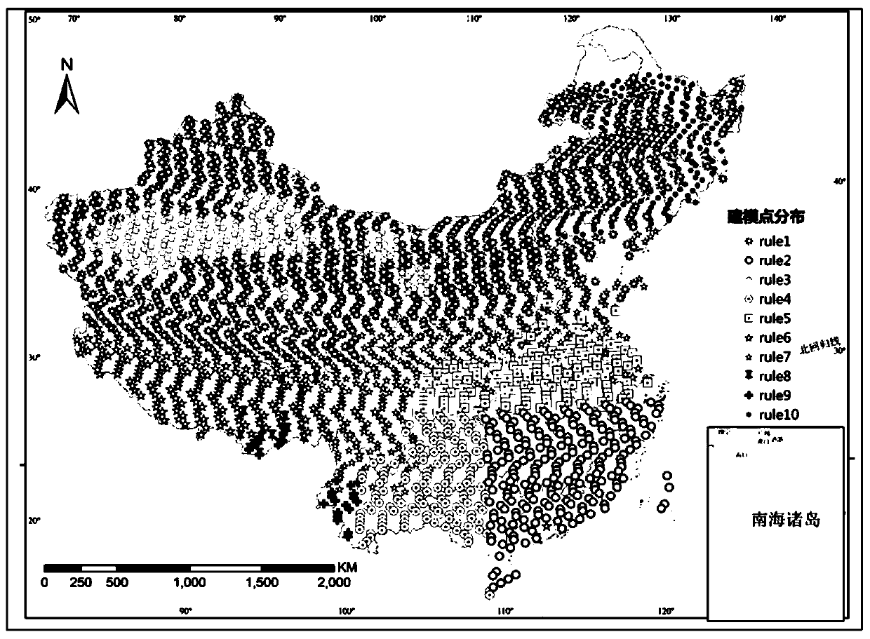
[0030] The whole country is selected as the research area, and the monthly rainfall in the wet season (May-October) of 2003-2009 is predicted and studied, and finally the monthly rainfall distribution map with a spatial resolution of 1km is obtained.

[0031] Step 1) Data acquisition: Obtain the CMORPH meteorological satellite remote sensing image data, MODIS satellite remote sensing image data and ASTER GDEM satellite remote sensing image data in the whole country, and collect the daily rainfall observation values ​​of the ground observation stations in the national area; the MODIS satellite remote sensing image The data includes MOD11A2 data product and MOD13A2 data product. Among them: the spatial resolution of the CMORPH meteorological satellite remote sensing image data is 0.25°×0.25°, and the time resolution is 3 hours; the spatial resol...

Embodiment 2

[0042] In this embodiment, the fuzzy-OLS method is used for regression modeling, and the specific steps are: In this embodiment, fuzzy clustering least squares regression is used for downscaling prediction, and the specific steps are as follows:

[0043] The whole country is selected as the research area, and the monthly rainfall in the wet season (May-October) of 2003-2009 is predicted and studied, and finally the monthly rainfall distribution map with a spatial resolution of 1km is obtained.

[0044] Step 1) Data acquisition: Obtain the CMORPH meteorological satellite remote sensing image data, MODIS satellite remote sensing image data and ASTER GDEM satellite remote sensing image data in the national area, and collect the daily rainfall observation values ​​of the ground observation stations in the national area; the MODIS satellite remote sensing image data Image data includes MOD11A2 data products and MOD13A2 data products. Among them: the spatial resolution of the CMORPH...


PUM


Abstract

The invention discloses a CMORPH satellite precipitation data downscaling method based on Fuzzy-OLS (Ordinary Least Squares) and a multi-environment factor variable. The method comprises the following steps: firstly, aggregation calculation is carried out on 1km environment factor variables, i.e., eight pieces of data including a vegetation index, a digital elevation model, daytime surface temperature, night surface temperature, a topographic wetness index, a gradient, a slope direction and a slope length gradient to 25km to serve as independent variables, and the CMORPH data of a corresponding 25km resolution is used as a dependent variable. On the basis of a fuzzy aggregation idea, the optimal aggregation number and aggregation center of the environment variable under the scale of 25km can be calculated so as to divide a whole sample set into subsample sets with most prominent difference, so that samples in each subsample set have a maximum similarity, and a least square regression model is independently established for each subsample set so as to predict the downscaling precipitation data of 1km. A downscaling result based on the Fuzzy-OLS model is obviously superior to the downscaling result of a conventional regression model.

Description

technical field [0001] The invention relates to a method for downscaling CMORPH rainfall data, in particular to a method for downscaling CMORPH satellite rainfall data based on Fuzzy-OLS. technical background [0002] Rainfall plays an important role in the fields of hydrology, meteorology, ecology, and agricultural research, especially an important part of the conservation of matter-energy exchange. Surface observation station is a widely used means of rainfall measurement, and has the characteristics of high precision and mature technology. However, the rainfall monitored by surface observation stations only represents the precipitation conditions at a certain distance from the surface observation stations and surrounding areas, so it is difficult to describe the characteristics of large-scale rainfall distribution, especially in plateau areas where the network density of surface observation stations is sparse. The satellite remote sensing technology can provide rainfall ...

Claims


Application Information

Patent Timeline
Patent Type & Authority Patents(China)
IPC IPC(8): G06F17/50
CPCG06F30/367
Inventor 史舟马自强刘用梁宗正
Owner ZHEJIANG UNIV
Why Eureka
Try Eureka