

Method for measuring spatial relationship of geology element and ore deposit on the basis of fractal method
A technology of spatial relationship and mineral deposits, applied in special data processing applications, instruments, electrical digital data processing, etc., can solve the problems of geological elements and spatial distribution of mineral deposits that have not been reported, and achieve the effect of objective calculation results and simple calculation process
- Summary
- Abstract
- Description
- Claims
- Application Information
AI Technical Summary
Problems solved by technology
Method used
Image

Examples
Embodiment Construction
[0019] In order to make the object, technical solution and advantages of the present invention more clear, the present invention will be further described in detail below in conjunction with the examples. It should be understood that the specific embodiments described here are only used to explain the present invention, not to limit the present invention.
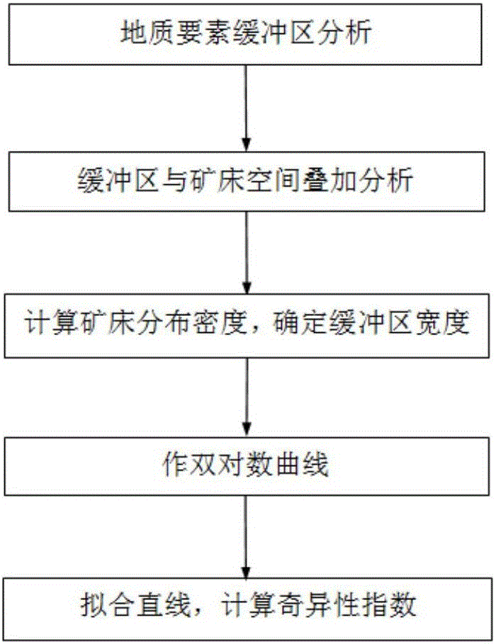
[0020] Such as figure 1 Shown, the specific implementation steps of the present invention are as follows:
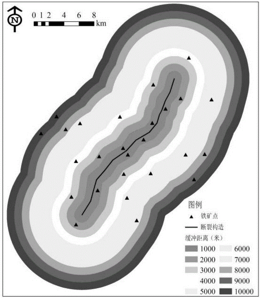
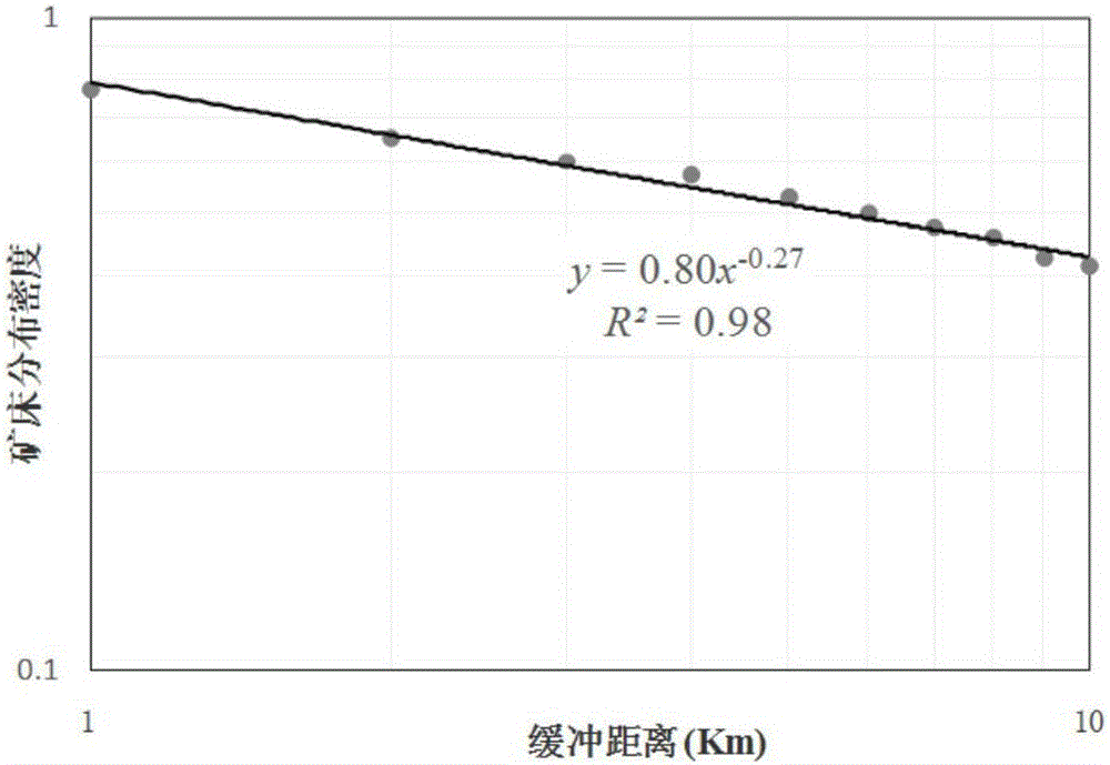
[0021] (1) Select geological elements and analyze the buffer zone under the GIS environment; according to the geological characteristics of the area where the deposit is located, determine the possible influence range of the geological elements, so as to determine the width and buffer distance of the buffer zone. Buffer analysis can be realized with the help of commercial GIS software such as ArcGIS, such as figure 2 Shown is a schematic diagram of the buffer zone of a fault structure, the buffer distance is 1km, ...
PUM
 Abstract
Description
Claims
Application Information