Method for accurately positioning traveling vehicle in intelligent traffic system
A vehicle and satellite positioning technology, which is applied in the field of precise positioning of driving vehicles for intelligent transportation, and can solve problems such as failure to meet safe driving performance requirements
- Summary
- Abstract
- Description
- Claims
- Application Information
AI Technical Summary
Problems solved by technology
Method used
Image
Examples
Embodiment Construction
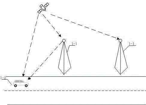
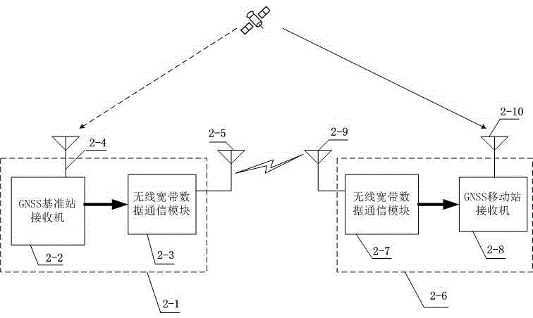
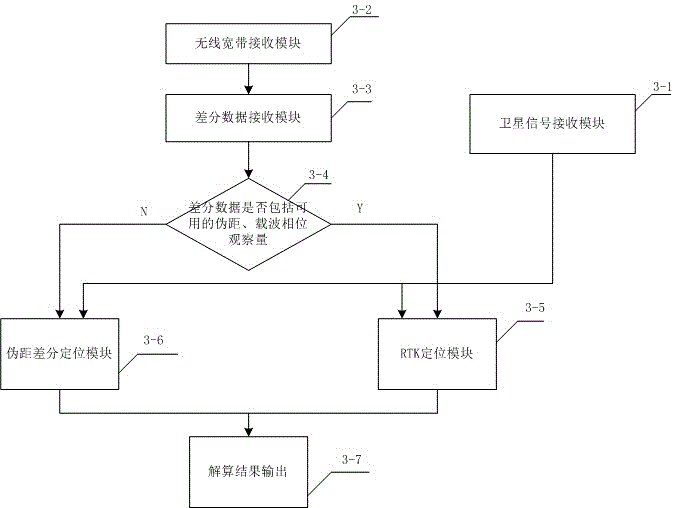
[0022] figure 1 In the system deployment diagram of this example, the base station 1-1 may be a traditional base station of the 3G / 4G wireless communication system, or a specific base station specially designed for this system. The base stations 1-1 are fixed and set up along the side of the road. The distance between the base stations 1-1 can range from a few hundred meters to several kilometers. In order to ensure the positioning accuracy, it generally does not exceed 10 kilometers. The base station 1-1 receives GNSS satellite signals, and is responsible for broadcasting differential data such as pseudorange differential corrections, pseudorange and carrier phase observations, etc. The mobile terminal 1-2 is installed on the vehicle, and the mobile terminal 1-2 receives the GNSS satellite signal and the differential data broadcast by the base station 1-1 at the same time, and then calculates the current accurate position, speed and time information of the mobile vehicle in r...
PUM
 Abstract
Description
Claims
Application Information
 - R&D
- Intellectual Property
- Life Sciences
- Materials
- Tech Scout
- Unparalleled Data Quality
- Higher Quality Content
- 60% Fewer Hallucinations
Browse by: Latest US Patents, China's latest patents, Technical Efficacy Thesaurus, Application Domain, Technology Topic, Popular Technical Reports.
© 2025 PatSnap. All rights reserved.Legal|Privacy policy|Modern Slavery Act Transparency Statement|Sitemap|About US| Contact US: help@patsnap.com


