Device and method for estimating soil structural evolution online in real time based on unmanned aerial vehicle

A technology for evaluating devices and unmanned aerial vehicles, which is used in measurement devices, instruments, scientific instruments, etc., can solve the problems of poor definition and resolution of macro video images, and achieve the effect of improving test accuracy.

Inactive Publication Date: 2016-10-26
WUHAN UNIV
View PDF8 Cites 3 Cited by
  • Summary
  • Abstract
  • Description
  • Claims
  • Application Information

AI Technical Summary

Problems solved by technology

[0004] However, when the existing image acquisition equipment shoots macro video images, it is easily affected by natural conditions (such as rain, snow...

Method used


Image

  • Device and method for estimating soil structural evolution online in real time based on unmanned aerial vehicle
  • Device and method for estimating soil structural evolution online in real time based on unmanned aerial vehicle
  • Device and method for estimating soil structural evolution online in real time based on unmanned aerial vehicle

Examples


Embodiment Construction

[0048] In order to facilitate those of ordinary skill in the art to understand and implement the present invention, the present invention will be described in further detail below in conjunction with the accompanying drawings and embodiments. It should be understood that the implementation examples described here are only used to illustrate and explain the present invention, and are not intended to limit this invention.

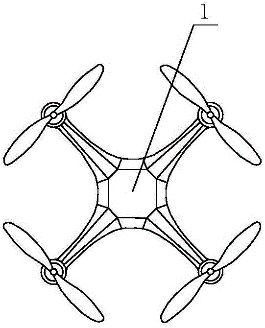
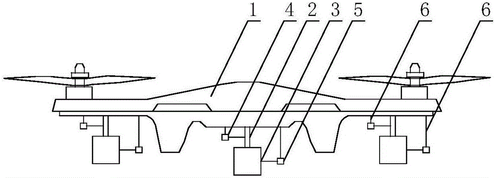
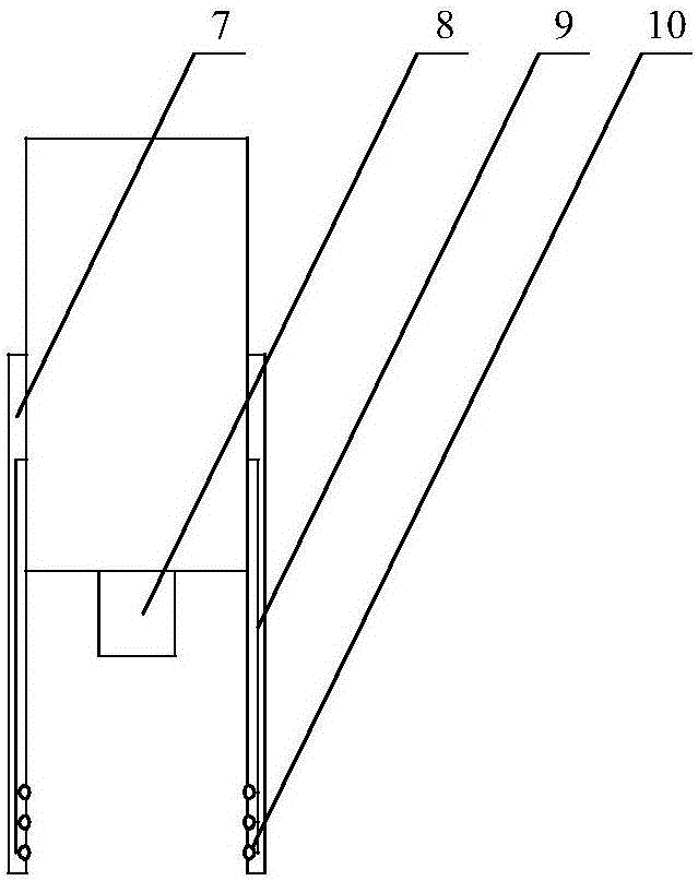
[0049] please see figure 1 , figure 2 , image 3 , Figure 4 and Figure 5 , a real-time online evaluation device for soil structure evolution based on unmanned aerial vehicle provided by the present invention, comprising an unmanned aerial vehicle 1, telescopic equipment 2, macro-distance video image acquisition equipment 3, a first signal receiver 4, a second signal receiver Device 5, bracket 6, high-strength metal sleeve 7 with blackened inner wall, camera lens 8, wire 9, LED white light 10 and remote control computer 11. The first signal receiver 4 ...


PUM


Abstract

The invention discloses a device and method for estimating soil structural evolution online in real time based on an unmanned aerial vehicle; the device comprises the unmanned aerial vehicle, a telescopic device, a micro-distance video and image acquisition device, a first signal receiver, a second signal receiver, and a remote control computer; the method comprises: first, establishing a micro-distance video gray image database; second, establishing in the database, a correspondence between substances and a gray value range; third, calculating in the micro-distance video gray image, a number of pixels representative of the substances in the gray value range, and establishing a relation with corresponding substance contents or forms; fourth, determining actual characteristic parameters of a soil body to be detected according to the above relation so as to determine development state of the soil body. Micro-distance video estimation is performed on a soil sample in situ, testing precision is high, and soil body composition and its evolution identification are more accurate; it is possible to perform large-range long-term continuous real-time online monitoring for a soil body where a human body and an axle-driven vehicle cannot reach easily, and evolution law of the soil body in the area is obtained.

Description

technical field [0001] The invention belongs to the technical field of soil evolution monitoring, and in particular relates to a method and device for real-time on-line evaluation of macroscopic video images carried by drones for soil structure evolution. Background technique [0002] At present, the monitoring of soil microstructure evolution mainly adopts the field test method mainly based on manual measurement, but this method has low efficiency, low precision, and large manual errors. Because this method needs to transport the soil sample from the field back to the laboratory for testing; on the one hand, after the soil sample is taken out from the ground, the stress acting on it will change; on the other hand, the soil sample During transportation, the properties of the soil will change; these reasons will lead to inaccurate final test results. Moreover, in many special scenes and areas (such as severe chemical pollution, high temperature, swamps, some slopes, etc.), i...

Claims


Application Information

Patent Timeline
IPC IPC(8): G01N21/84
CPCG01N21/84
Inventor 王若林朱道佩桑农
Owner WUHAN UNIV
Why Eureka
Try Eureka