Determination method of mine fault influence area

A technique for determining the scope of influence and determining the method, which is applied in the direction of special data processing applications, instruments, and electrical digital data processing, etc., which can solve the troublesome prediction and early warning of fault-structured coal and rock dynamic disasters, the monitoring of local dangerous areas, and the inability to determine the characteristics of monitoring information activities And other issues

A technique for determining the scope of influence and determining the method, which is applied in the direction of special data processing applications, instruments, and electrical digital data processing, etc., which can solve the troublesome prediction and early warning of fault-structured coal and rock dynamic disasters, the monitoring of local dangerous areas, and the inability to determine the characteristics of monitoring information activities And other issues

CN106485015AInactive Publication Date: 2017-03-08LIAONING TECHNICAL UNIVERSITY

Image

  • Determination method of mine fault influence area
  • Determination method of mine fault influence area
  • Determination method of mine fault influence area

Examples


Embodiment Construction

[0045] An embodiment of the present invention will be further described below in conjunction with the accompanying drawings.

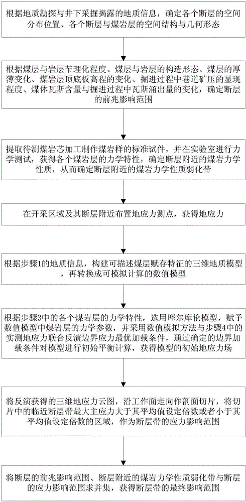
[0046] In the embodiment of the present invention, the method for determining the scope of influence of mine faults, the method flow chart is as follows figure 1 shown, including the following steps:

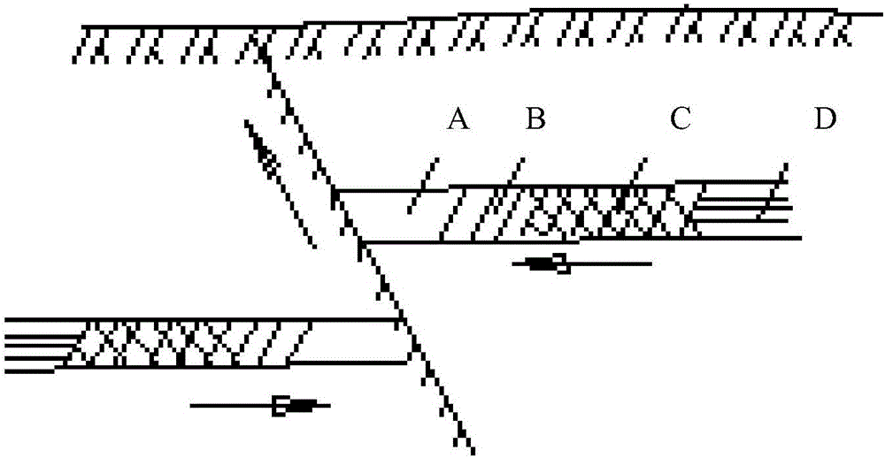
[0047] Step 1. According to the geological information revealed by geological exploration and underground mining, determine the spatial distribution position of each fault, the spatial structure and geometric form of each fault and coal rock layer (or called coal seam and rock layer or stratum);

[0048] In the embodiment of the present invention, the geological information includes: the lithology of each stratum, the thickness of each stratum, the roof elevation value of each stratum, the floor elevation value of each stratum, the trend of each fault, the tendency of each fault, the tendency of each fault The coordinates of the annihilation point, the co...


PUM


Abstract

The invention provides a determination method of a mine fault influence area, and belongs to the technical field of mine safe mining. By the adoption of the determination method, a precursor influence area of a fault zone is determined according to geological exploration and roadway tunneling and revealing conditions; weakened zones of an upper set and a lower set of the fault are determined according to mechanical experiments of a coal rock layer near the fault zone; distribution characteristics of ground stress is inverted according to a three-dimensional fine numerical value model, and a maximum principal stress influence area is calculated in theory; finally, by the union of the precursor influence area, the weakened zones and the maximum principal stress influence area, a space influence area of the fault zone is scientifically determined; in this way, a new determination method is provided for the fault influence area, and a new thought and method are provided for division of a dangerous area where a coal rock dynamic disaster is induced by a fault tectonic zone.

Description

technical field [0001] The invention relates to the technical field of mine safety mining, in particular to a method for determining the influence range of mine faults. Background technique [0002] Coal and rock dynamic disasters induced by faults have become one of the main dynamic disasters threatening the mining of deep coal resources in my country; according to the statistical analysis of a large number of mines in China, when mining operations are carried out near fault structures, rock bursts, coal and gas are more likely to occur. Coal-rock dynamic disasters such as outbursts occur suddenly and are highly destructive, causing a large number of casualties and posing a serious threat to the safe production of mines. In order to effectively prevent the coal-rock dynamic disasters induced by faults, it is necessary to predict the influence range of the layers first. But at present, there is no effective method to determine or predict the scope of fault influence. Only la...

Claims


Application Information

Patent Timeline
08 Mar 2017
Publication
CN106485015A
IPC
G06F17/50
CPC
G06F30/20
Inventors
吕进国; ζ›Ήεš