Onboard GNSS-assisted Beidou navigation satellite orbit determination method
A Beidou satellite and Beidou navigation technology, which is applied to satellite radio beacon positioning systems, measurement devices, instruments, etc., to reduce system errors, improve orbit determination accuracy, and improve the BDS precision orbit determination configuration.
- Summary
- Abstract
- Description
- Claims
- Application Information
AI Technical Summary
Problems solved by technology
Method used
Image
Examples
specific Embodiment
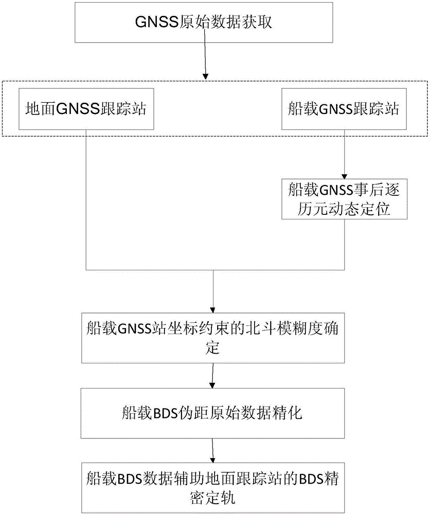
[0111] The shipborne GNSS assisted Beidou satellite determination method provided in the embodiment of the present invention is implemented according to the following steps:
[0112] Step 1: Obtain shipborne GNSS raw data and terrestrial GNSS raw data:
[0113] Shipborne and terrestrial GNSS raw data are at least compatible with BDS and GPS dual systems, which include GNSS satellite navigation ephemeris and satellite raw observation data; the satellite raw observation data include pseudorange observations and carrier phase observations of two frequencies;
[0114] Step 2, Kalman filter-based shipboard GNSS post-event dynamic positioning by epoch:
[0115] The kinematic models of large cargo ships, cruise ships and other ship-borne GNSS platforms are relatively obvious, and their routes are preset, and the platform movement is relatively slow and stable. Therefore, the Kalman filter method is used to perform high-precision ship-borne GNSS post-event dynamic positioning by epoc...
PUM
 Abstract
Description
Claims
Application Information
 - R&D
- Intellectual Property
- Life Sciences
- Materials
- Tech Scout
- Unparalleled Data Quality
- Higher Quality Content
- 60% Fewer Hallucinations
Browse by: Latest US Patents, China's latest patents, Technical Efficacy Thesaurus, Application Domain, Technology Topic, Popular Technical Reports.
© 2025 PatSnap. All rights reserved.Legal|Privacy policy|Modern Slavery Act Transparency Statement|Sitemap|About US| Contact US: help@patsnap.com


