Three-dimensional police geographic information platform and system structure
A geographic information and three-dimensional police technology, applied in the field of police information system construction, can solve problems such as the inability to truly simulate the objective world, limited urban virtual scenes, and difficulty in perfection and accuracy.
- Summary
- Abstract
- Description
- Claims
- Application Information
AI Technical Summary
Problems solved by technology
Method used
Image
Examples
Embodiment Construction
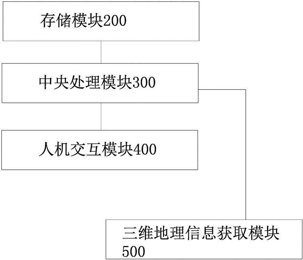
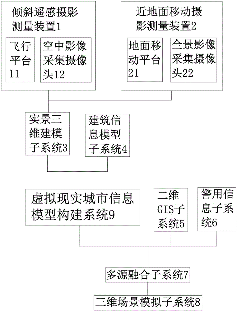
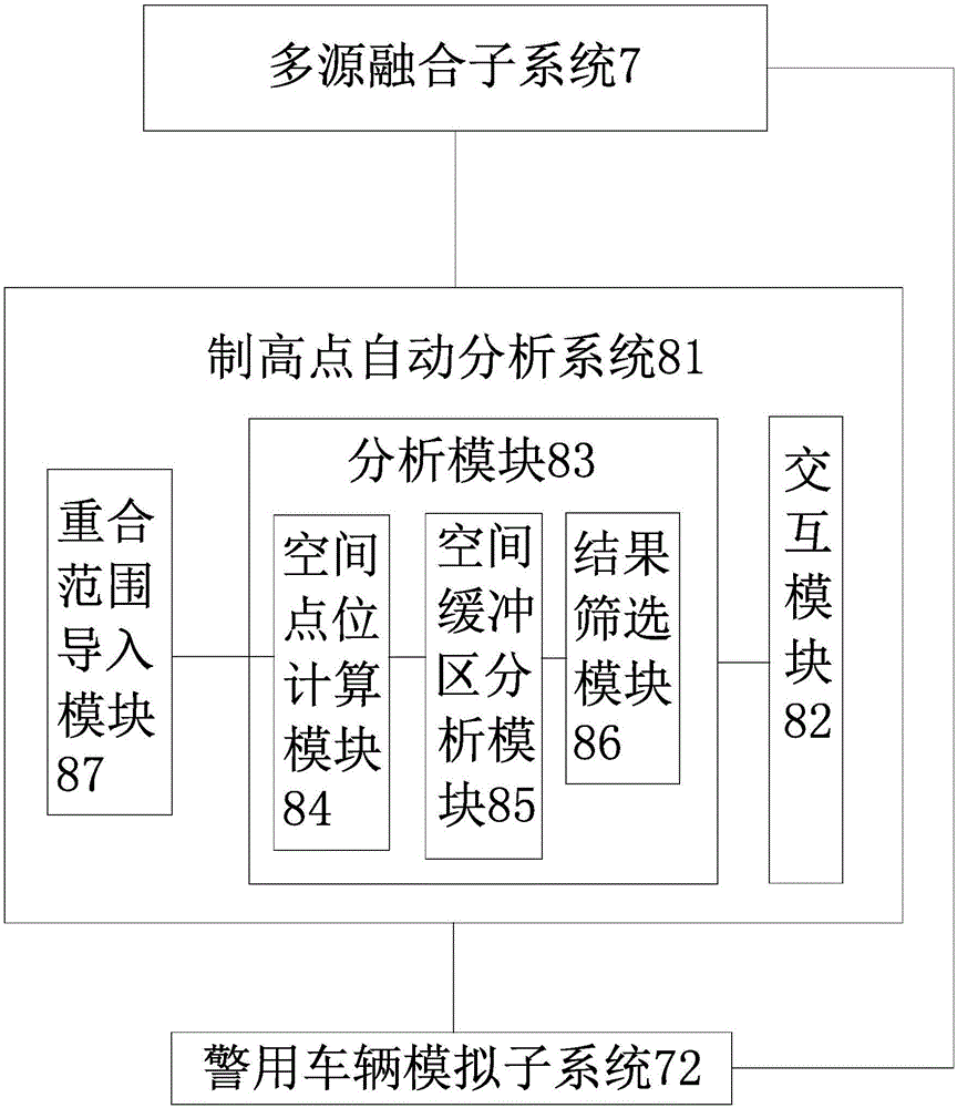
[0031] Such as figure 1 As shown, the three-dimensional police geographic information platform includes a storage module 200 with at least one memory or several interconnected memories, a central processing module 300 with at least one central processor or several interconnected central processors, and a human-computer interaction module 400 And the three-dimensional geographic information acquisition module 500, the storage module 200, the human-computer interaction module 400 and the three-dimensional geographic information acquisition module 500 are all connected to the central processing module 300, and the three-dimensional geographic information acquisition module 500 includes an oblique remote sensing photogrammetry device 1 and a near-ground mobile photogrammetry device 2, the tilt remote sensing photogrammetry device 1 and the near-ground mobile photogrammetry device 2 are respectively connected to the central processing module 300 through wireless communication. Such...
PUM
 Abstract
Description
Claims
Application Information
 - R&D
- Intellectual Property
- Life Sciences
- Materials
- Tech Scout
- Unparalleled Data Quality
- Higher Quality Content
- 60% Fewer Hallucinations
Browse by: Latest US Patents, China's latest patents, Technical Efficacy Thesaurus, Application Domain, Technology Topic, Popular Technical Reports.
© 2025 PatSnap. All rights reserved.Legal|Privacy policy|Modern Slavery Act Transparency Statement|Sitemap|About US| Contact US: help@patsnap.com


