Eureka AIR delivers breakthrough ideas for toughest innovation challenges, trusted by R&D personnel around the world.

Rapid segmentation method for remote sensing image port water surface target

A technology for water surface targets and remote sensing images, applied in the field of remote sensing image processing, can solve the problems of inability to meet real-time requirements, high computational complexity, poor robustness, etc., and achieve the effects of improving target recognition speed, simple calculation, and improved accuracy.

Inactive Publication Date: 2017-10-03
CHANGGUANG SATELLITE TECH CO LTD
View PDF4 Cites 6 Cited by
  • Summary
  • Abstract
  • Description
  • Claims
  • Application Information

AI Technical Summary

Problems solved by technology

[0004] In order to solve the problem that the existing image preprocessing method has high computational complexity and poor robustness, resulting in failure to meet real-time requirements, the present invention provides a rapid segmentation method for remote sensing image port water surface targets

Method used


Image

  • Rapid segmentation method for remote sensing image port water surface target
  • Rapid segmentation method for remote sensing image port water surface target
  • Rapid segmentation method for remote sensing image port water surface target

Examples


specific Embodiment approach 1

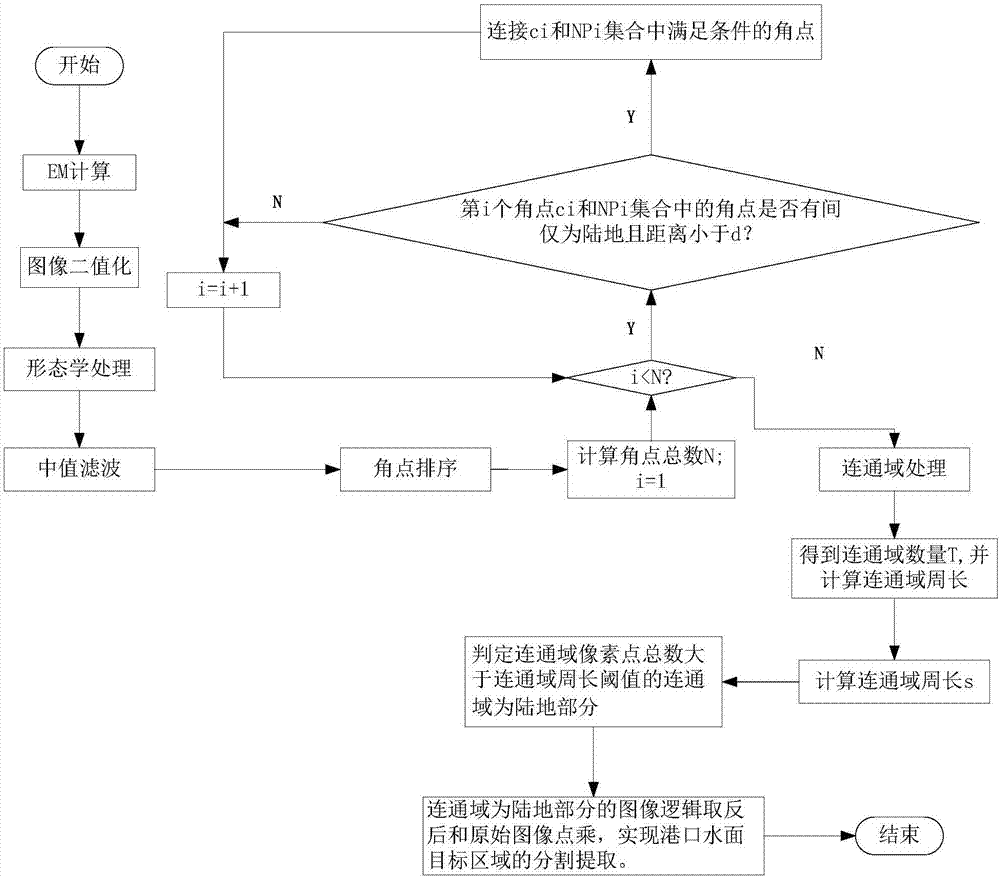
[0025] Specific implementation mode 1. Combination Figure 1 to Figure 7 Describe this embodiment, a kind of rapid segmentation method of remote sensing image port water surface target, this method is realized by the following steps:

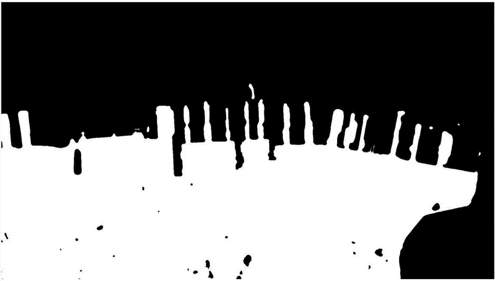
[0026] 1. Image preprocessing: Through thresholding, morphological operations and other steps, the original image is binarized, and the sea and land segmentation is initially realized.

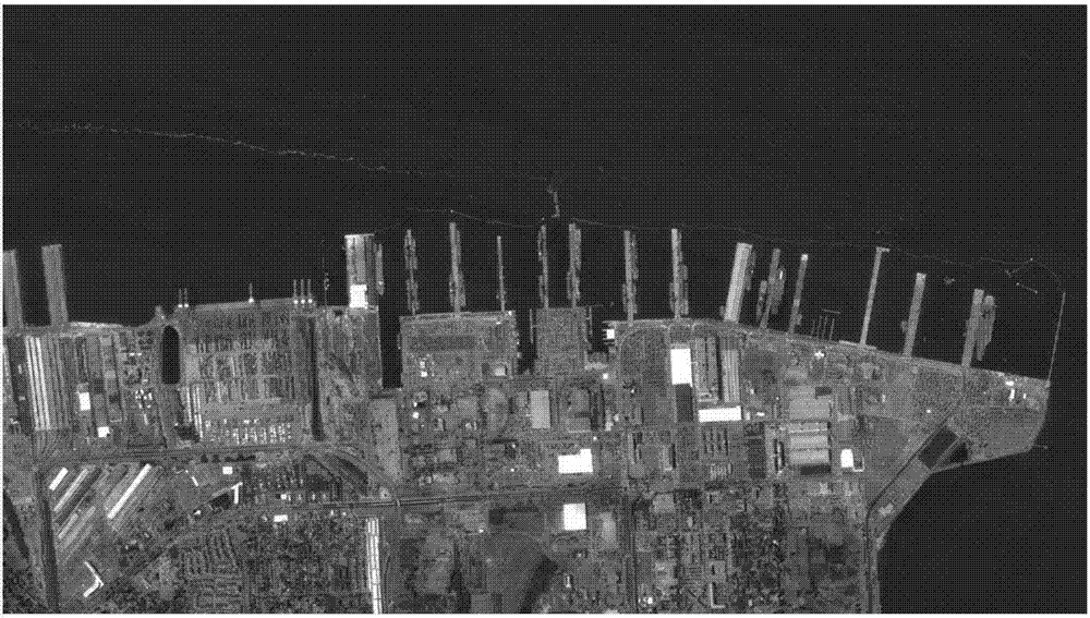
[0027] The histogram containing the port image can be considered as a mixed Gaussian distribution (MoG: Mixture of Gaussians), which consists of two Gaussian distributions. The gray value range of the ocean area can be estimated by the EM (Expectation Maximization Algorithm) iterative algorithm. In this embodiment, the picture size is 4329×7696 pixels, combined with figure 2 .

[0028] First, the image is down-sampled to improve the computing speed and reduce the amount of data processing; then the image is thresholded (threshold is calculated to be 50 in thi...


PUM


Abstract

The invention provides a rapid segmentation method for a remote sensing image port water surface target. The rapid segmentation method relates to the field of remote sensing image processing, and solves the problem that the requirement of real-time performance cannot be satisfied due to high computation complexity, poor robustness of the existing image preprocessing method. The rapid segmentation method comprises the steps of: preprocessing an image; performing binarization processing on the original image to realize sea-land segmentation; extracting angular points of the image after binarization processing, and acquiring an image after sea-land segmentation; performing connected domain processing on the image after sea-land segmentation, acquiring a total number of connected domains, calculating the circumference of the connected domains, and determining the connected domains with a total number of connected domain pixel points greater than a connected domain circumference threshold value to be a land portion; and extracting a port target. The rapid segmentation method realizes sea-land segmentation, can extract the coastal target quickly and precisely, can reduce the calculation amount of subsequent target identification, accelerates the target identification speed, and can improve the target identification precision since the vast majority of land image interference is eliminated.

Description

technical field [0001] The invention relates to the field of remote sensing image processing, in particular to a rapid segmentation method for remote sensing image port water surface targets. Background technique [0002] With the continuous development of the field of satellite remote sensing, more and more attention has been paid to satellite data processing methods, among which how to quickly and intelligently identify water surface targets has become the focus of attention. However, the background of remote sensing images is complex. If the target of interest is directly extracted from a remote sensing image of a port, it will take a long time to calculate and the accuracy rate is low. Therefore, before extracting information on water surface targets, if the land and sea are accurately segmented, and the target area to be identified is accurately reserved, it is an important prerequisite for rapid and accurate identification of water surface targets in ports. [0003] M...

Claims


Application Information

Patent Timeline
Patent Type & Authority Applications(China)
IPC IPC(8): G06T7/11G06T7/12G06T7/13G06T7/136G06T7/181G06T7/187
CPCG06T7/11G06T7/12G06T7/13G06T7/136G06T7/181G06T7/187G06T2207/10032G06T2207/20032
Inventor 于树海贺小军于野钟兴于渊博
Owner CHANGGUANG SATELLITE TECH CO LTD
Why Eureka
Eureka Blog
Learn More