

Satellite-borne radar imaging parameter online estimating method based on Kalman filtering
A technology of Kalman filtering and spaceborne radar, which is applied in the direction of radio wave reflection/re-radiation, radio wave measurement system, and utilization of re-radiation, etc., which can solve the problem of increased mismatch error, increase the amount of calculation, and increase real-time on-board Signal processing load and other issues, to achieve the effect of reducing the amount of calculation
- Summary
- Abstract
- Description
- Claims
- Application Information
AI Technical Summary
Problems solved by technology
Method used
Image

Examples
Embodiment Construction
[0022] The following will clearly and completely describe the technical solutions in the embodiments of the present invention with reference to the accompanying drawings in the embodiments of the present invention. Obviously, the described embodiments are only some, not all, embodiments of the present invention. Based on the embodiments of the present invention, all other embodiments obtained by persons of ordinary skill in the art without making creative efforts belong to the protection scope of the present invention.
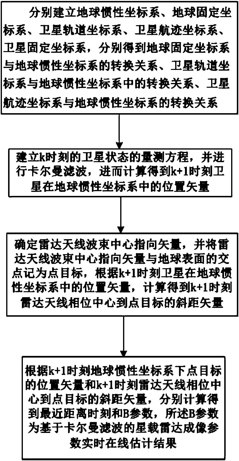
[0023] refer to figure 1 , is a flow chart of a real-time online estimation method for spaceborne radar imaging parameters based on Kalman filtering in the present invention; wherein the real-time online estimation method for spaceborne radar imaging parameters based on Kalman filtering comprises the following steps:
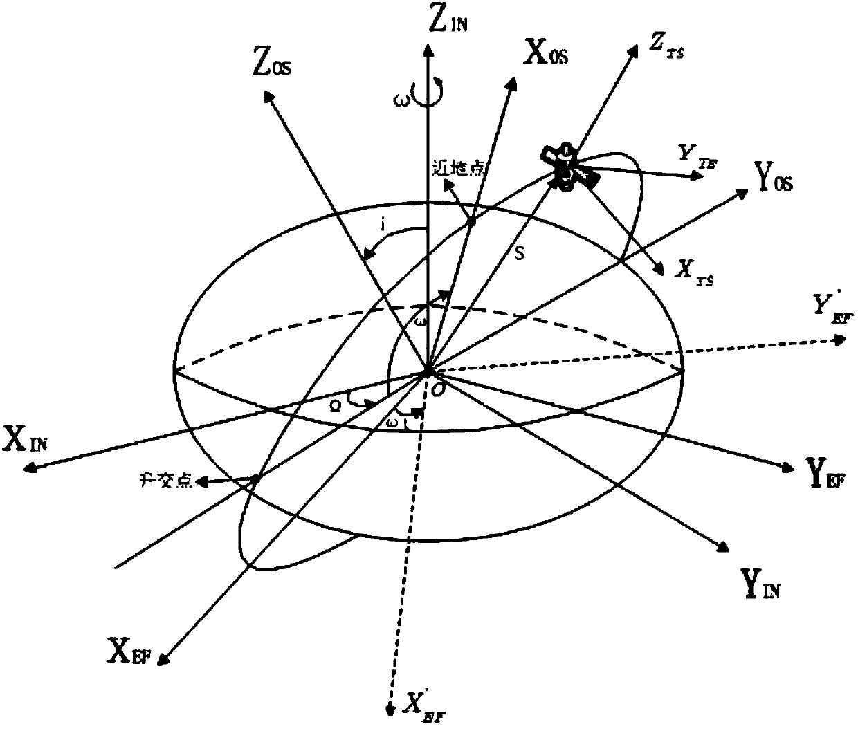
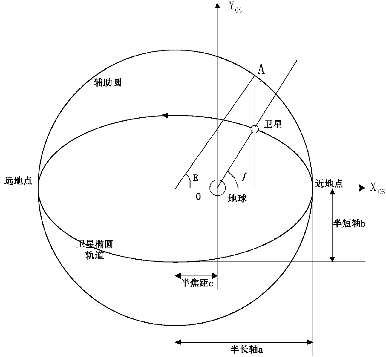
[0024] Step 1, respectively establish the earth inertial coordinate system, the earth fixed coordinate system, the satellite orbit coordinate s...
PUM
 Abstract
Description
Claims
Application Information