Generation method of recommended tourist route diagram on basis of network travel notes
A technology of circuit diagrams and travel notes, applied in special data processing applications, instruments, electrical digital data processing, etc.
- Summary
- Abstract
- Description
- Claims
- Application Information
AI Technical Summary
Problems solved by technology
Method used
Image
Examples
Embodiment 1
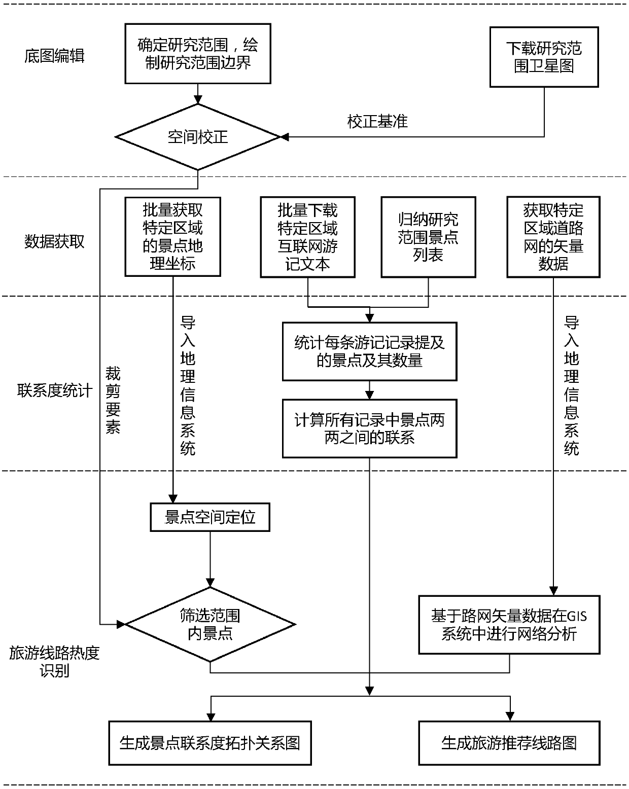
[0086] Such as figure 1 As shown, this embodiment provides a method for generating a travel recommendation route map based on online travel notes, the method includes the following steps:
[0087] 1) Basemap editing
[0088] First determine the scope of the tourist route identification, take the identified scope as the research scope, draw the boundary of the scope in AutoCAD, download the satellite image and coordinate information of the research scope through the all-round electronic map downloader, and import the boundary and satellite image of the research scope into ArcGIS software In , the spatial correction is performed on the boundary of the research range to prepare for the subsequent analysis.
[0089] 1.1) Boundary drawing of the research area
[0090] Open the AutoCAD software, draw the boundary of the research area with the polyline command according to the selected research area, draw it as a closed polyline, and save it as a dwg format file.
[0091] 1.2) Sat...
Embodiment 2
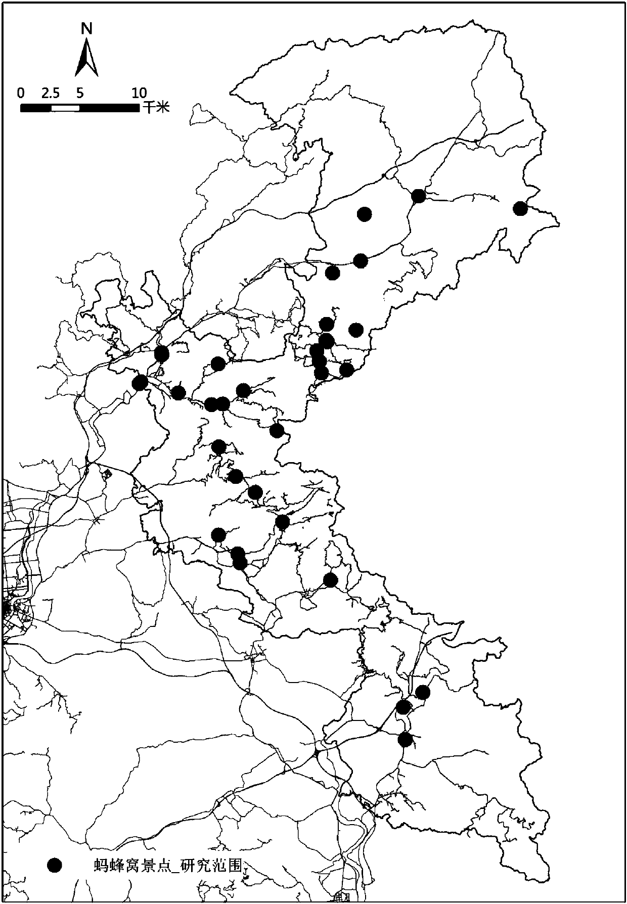
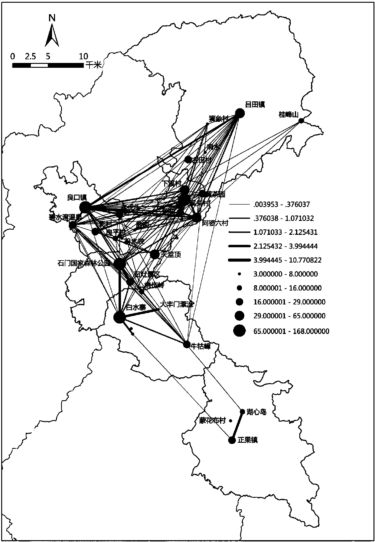
[0207] This embodiment is an application example. Taking Zengcheng District, Guangzhou City, and about 1,000 square kilometers in the north of Conghua District as the research scope, a total of 678 travel notes about Zengcheng and Conghua were selected from the Mafengwo Travel Notes website, and the roads in this area were downloaded from the OpenStreetMap open source map website. Network data for travel route identification, the specific implementation steps of the whole process include:
[0208] 1) Analysis network establishment
[0209] 1.1) Boundary drawing of the research area
[0210] Open the AutoCAD software, draw the boundary of the research area with the polyline command according to the selected research area of 1000 square kilometers in the north of Conghua, Zengcheng, draw it as a closed polyline, and save it as a dwg format file.
[0211] 1.2) Satellite image download of research scope
[0212] Open the all-round electronic map downloader software, download t...
PUM
 Abstract
Description
Claims
Application Information
 - R&D
- Intellectual Property
- Life Sciences
- Materials
- Tech Scout
- Unparalleled Data Quality
- Higher Quality Content
- 60% Fewer Hallucinations
Browse by: Latest US Patents, China's latest patents, Technical Efficacy Thesaurus, Application Domain, Technology Topic, Popular Technical Reports.
© 2025 PatSnap. All rights reserved.Legal|Privacy policy|Modern Slavery Act Transparency Statement|Sitemap|About US| Contact US: help@patsnap.com


