Surveying and mapping method

A technology of measurement control and measurement data, applied in the field of surveying and mapping, can solve the problems of low operation efficiency, inability to realize surveying and mapping, multi-manpower, etc., and achieve the effect of improving operation efficiency, saving surveying and mapping time and manpower, and fast coordinate measurement

Inactive Publication Date: 2018-03-20
AERIAL PHOTOGRAMMETRY & REMOTE SENSING CO LTD
View PDF3 Cites 7 Cited by
  • Summary
  • Abstract
  • Description
  • Claims
  • Application Information

AI Technical Summary

Problems solved by technology

The existing surveying and mapping methods have low operating efficiency, require a lot of manpower, and cannot achieve rapid surveying and mapping

Method used


Image

  • Surveying and mapping method
  • Surveying and mapping method
  • Surveying and mapping method

Examples


Embodiment Construction

[0037] The following will clearly and completely describe the technical solutions in the embodiments of the present invention with reference to the accompanying drawings in the embodiments of the present invention. Obviously, the described embodiments are only some, not all, embodiments of the present invention. The components of the embodiments of the invention generally described and illustrated in the figures herein may be arranged and designed in a variety of different configurations. Accordingly, the following detailed description of the embodiments of the invention provided in the accompanying drawings is not intended to limit the scope of the claimed invention, but merely represents selected embodiments of the invention. Based on the embodiments of the present invention, all other embodiments obtained by those skilled in the art without making creative efforts belong to the protection scope of the present invention.

[0038] It should be noted that like numerals and let...


PUM


Abstract

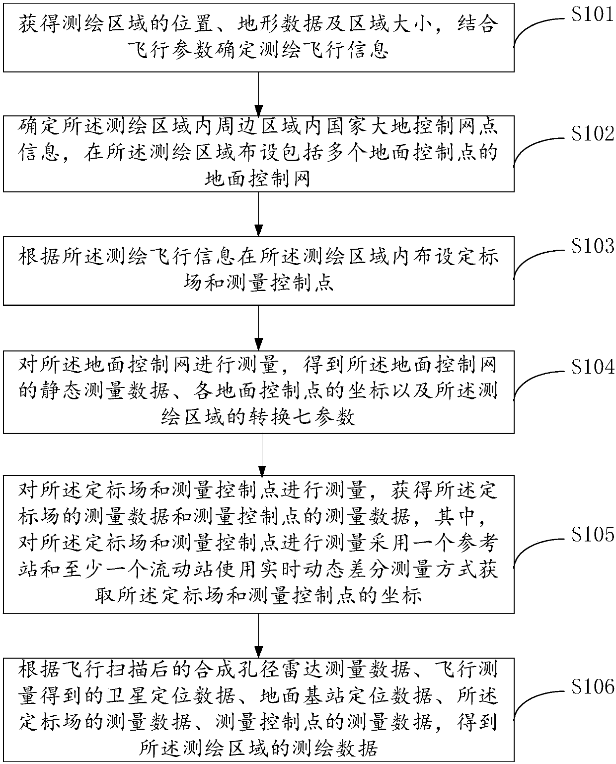
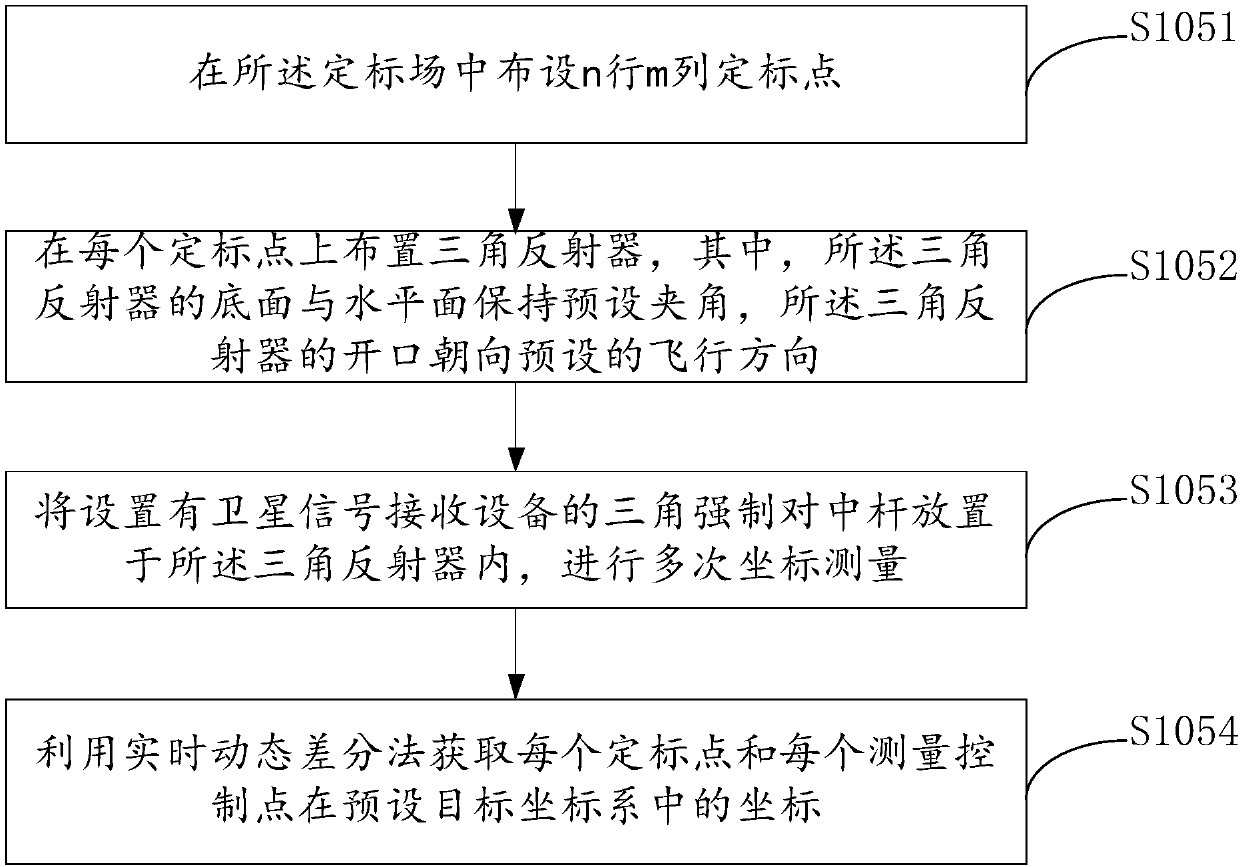
The invention provides a surveying and mapping method, and relates to the technical field of surveying and mapping. The surveying and mapping method comprises the steps of surveying, mapping and planning a surveying and mapping area, arranging a ground control net, a calibration field and measurement control points in the surveying and mapping area, surveying and mapping the surveying and mappingarea in combination with microwave data and satellite positioning data obtained through flight scanning. During the coordinate measurement process of the calibration field and the measurement controlpoints, coordinates can be measured more quickly by adopting the GPS-based real-time dynamic differential method. The work efficiency of ground measurement is improved. Meanwhile, the coordinates of calibration points and measurement control points on the ground can be quickly acquired. The time and the manpower during the surveying and mapping process are saved. Moreover, the method is not influenced by the weather and the surveying and mapping area, so that the adaptability of the surveying and mapping operation to the environment sudden change can be improved.

Description

technical field [0001] The present invention relates to the technical field of surveying and mapping, in particular to a surveying and mapping method. Background technique [0002] Synthetic Aperture Radar (SAR) is an active microwave imaging sensor developed by the U.S. military in the 1950s. It is widely used in aerial remote sensing, aerial survey, aerospace reconnaissance and other fields. Synthetic Aperture Radar Interferometry (InSAR) technology is based on SAR technology, and two SAR images of the same observation area are interferometrically processed to obtain interferometric images, and further obtain high-precision surface elevation information. The current main working mode is to install two radar antennas at a certain distance on the aircraft platform. During work, one antenna transmits radar pulse signals, and the two antennas simultaneously receive the returned pulse waves and image them independently to obtain two coherent images. Good photogram. At the sa...

Claims


Application Information

Patent Timeline
Patent Type & Authority Applications(China)
IPC IPC(8): G01S13/86G01S13/90G01S19/14G01S19/45
CPCG01S13/86G01S13/90G01S19/14G01S19/45G01S13/9023
Inventor 李建林李兆辉崔帅马高峰张昆张增场
Owner AERIAL PHOTOGRAMMETRY & REMOTE SENSING CO LTD
Why Eureka
Try Eureka