

Multi-sensor fusion mapping system and method thereof
A multi-sensor fusion and sensor technology, applied in the field of navigation, can solve problems such as dependence and large error of lidar, and achieve the effect of improving efficiency, improving accuracy and reducing time
- Summary
- Abstract
- Description
- Claims
- Application Information
AI Technical Summary
Problems solved by technology
Method used
Image

Examples
Embodiment Construction
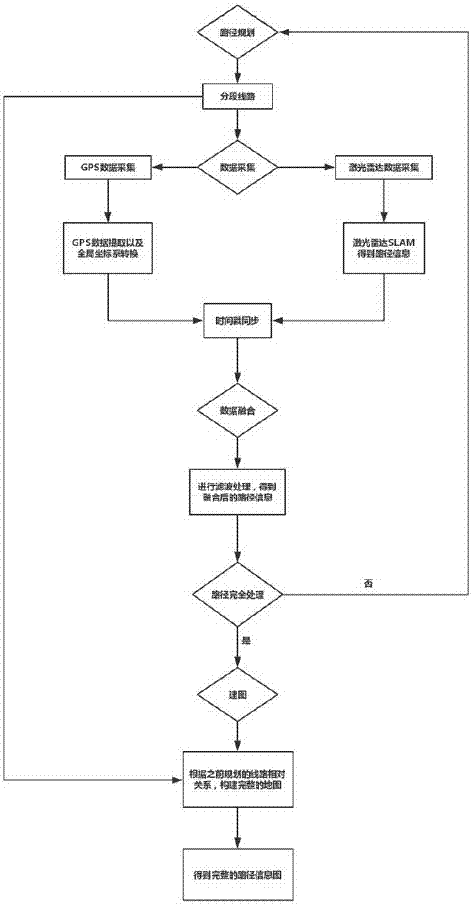
[0029] The accompanying drawings are for illustrative purposes only, and should not be construed as limitations on this patent; in order to better illustrate this embodiment, certain components in the accompanying drawings will be omitted, enlarged or reduced, and do not represent the size of the actual product; for those skilled in the art It is understandable that some well-known structures and descriptions thereof may be omitted in the drawings. The positional relationship described in the drawings is for illustrative purposes only, and should not be construed as a limitation on this patent.
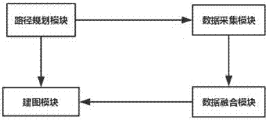
[0030] Such as figure 1 , 2 As shown, a multi-sensor fusion mapping method includes a path planning module, a data acquisition module, a data fusion module, and a mapping module; the path planning module: before collecting data, plan the route information to be collected, and divide the entire map into Section collection, confirm the order of collection, set the label, each section ...
PUM
 Abstract
Description
Claims
Application Information