Flying device surveying and mapping work route planning method and device as well as terminal
A flying device and air route technology, applied in the field of unmanned aerial vehicles, can solve problems such as easy to produce errors, cannot be changed, and complicated processing process, so as to improve the convenience of adjustment and ensure the effect of identity
- Summary
- Abstract
- Description
- Claims
- Application Information
AI Technical Summary
Problems solved by technology
Method used
Image

Examples
Embodiment 1
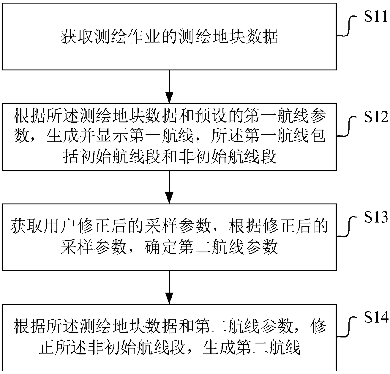
[0096] combine figure 1 , this embodiment provides a flight device surveying and mapping operation route planning method, the subject of which is executed as a terminal, including the following steps:
[0097] S11 acquires the surveying and mapping plot data of the surveying and mapping operation;
[0098] Specifically, a single surveying and mapping operation includes at least one surveying and mapping plot, that is, the same surveying and mapping plot may have only one surveying and mapping plot, or may correspondingly include multiple surveying and mapping plots. In the embodiment of the present invention, the route planning for one of the surveying and mapping plots in the surveying and mapping operation is taken as an example for description. Before performing route surveying and mapping, the user selects an existing or newly created surveying and mapping operation through the terminal, and performs route planning for it. If the currently selected surveying and mapping o...
Embodiment 2
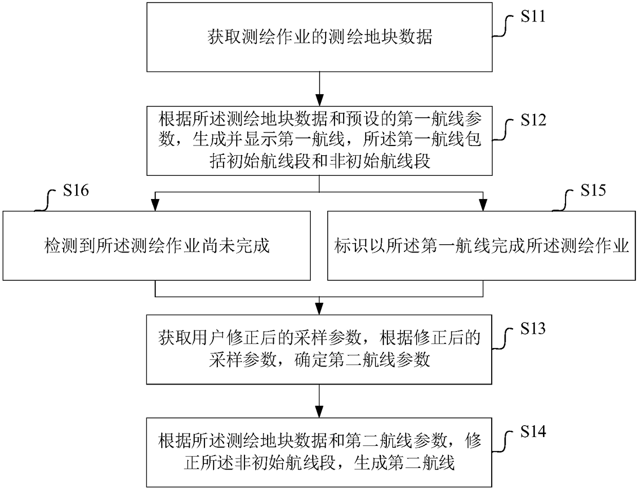
[0152] combine Figure 8 , different from Embodiment 1, this embodiment also includes the steps after planning the first route according to the surveying and mapping plot data and the first route parameters:
[0153] S21 Determine to determine a flight route segment on the first route according to the endurance capability of the flight device;
[0154] S22 Display the flight route segment and the non-initial route segment of the route of the first route in a light and dark manner on the display interface.
[0155] In this embodiment, its application scenario is adapted to when the user finds or the system prompts that the endurance of the flight device is not enough to complete the flight of all route segments of the first route when the actual surveying and mapping operation is performed after the first route is generated. Part of the route segment in the first route can be selected as the flight route segment when the flying device actually performs the surveying and mappin...
Embodiment 3
[0163] combine Figure 9 , the present embodiment provides a flight device surveying and mapping operation route planning device, including the following modules:
[0164] The first obtaining module 31 is used to obtain the surveying and mapping plot data of the surveying and mapping operation;
[0165] The first generating module 32 is configured to generate and display a first route according to the surveying plot data and preset first route parameters, the first route including an initial route segment and a non-initial route segment;
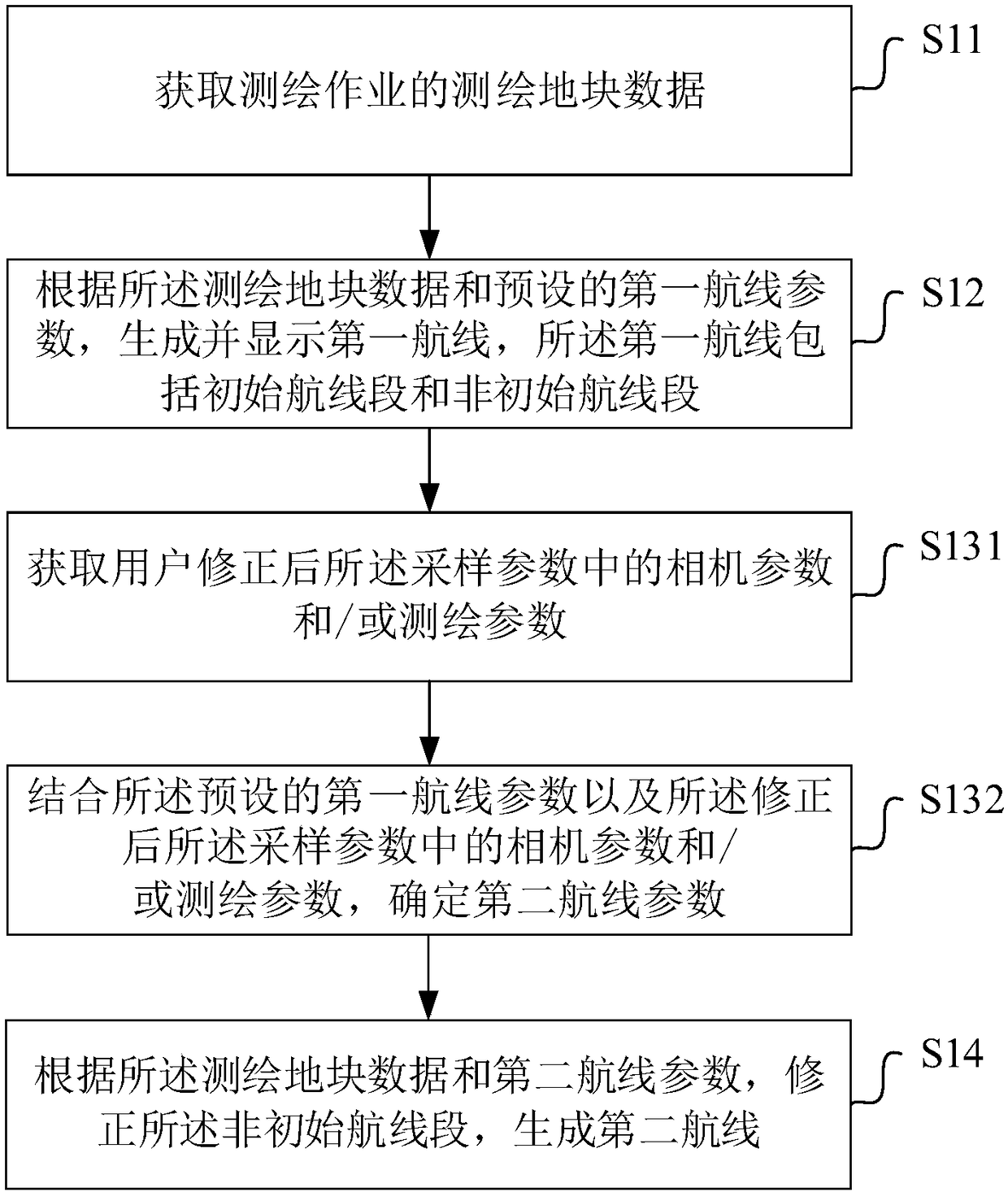
[0166] The second obtaining module 33 is used to obtain the sampling parameters corrected by the user, and determine the second route parameters according to the corrected sampling parameters;
[0167] The second generation module 34 is configured to correct the non-initial route segment and generate a second route according to the surveyed plot data and the second route parameters.
[0168] Further, combine Figure 10 ,Also includes:
...
PUM
 Abstract
Description
Claims
Application Information
 - R&D
- Intellectual Property
- Life Sciences
- Materials
- Tech Scout
- Unparalleled Data Quality
- Higher Quality Content
- 60% Fewer Hallucinations
Browse by: Latest US Patents, China's latest patents, Technical Efficacy Thesaurus, Application Domain, Technology Topic, Popular Technical Reports.
© 2025 PatSnap. All rights reserved.Legal|Privacy policy|Modern Slavery Act Transparency Statement|Sitemap|About US| Contact US: help@patsnap.com