
GNSS satellite abnormity state fast monitoring technology

An abnormal state and satellite technology, applied in the field of satellite navigation, can solve problems such as imperfection, timeliness, inconsistent standards, and failure to consider iGMAS system alarms, etc., to ensure integrity, improve reliability, and simplify secondary development interfaces Effect

Inactive Publication Date: 2018-07-03
SPACE STAR TECH CO LTD
View PDF3 Cites 10 Cited by
  • Summary
  • Abstract
  • Description
  • Claims
  • Application Information

AI Technical Summary

Problems solved by technology

[0005] The technical problem solved by the present invention is: based on the existing business of the monitoring and evaluation center, the present invention proposes a set of abnormal state rapid monitoring technology applicable to multiple GNSS satellites, which solves the timeliness and standardization of multiple satellite alarms in the traditional mode. Not unified, the content of the alarm is not comprehensive, and the problems of incomplete alarms in the construction phase of the iGMAS system are not considered, and the independence and timeliness of business alarms are realized.

Method used


Image

  • GNSS satellite abnormity state fast monitoring technology
  • GNSS satellite abnormity state fast monitoring technology
  • GNSS satellite abnormity state fast monitoring technology

Examples


Embodiment Construction

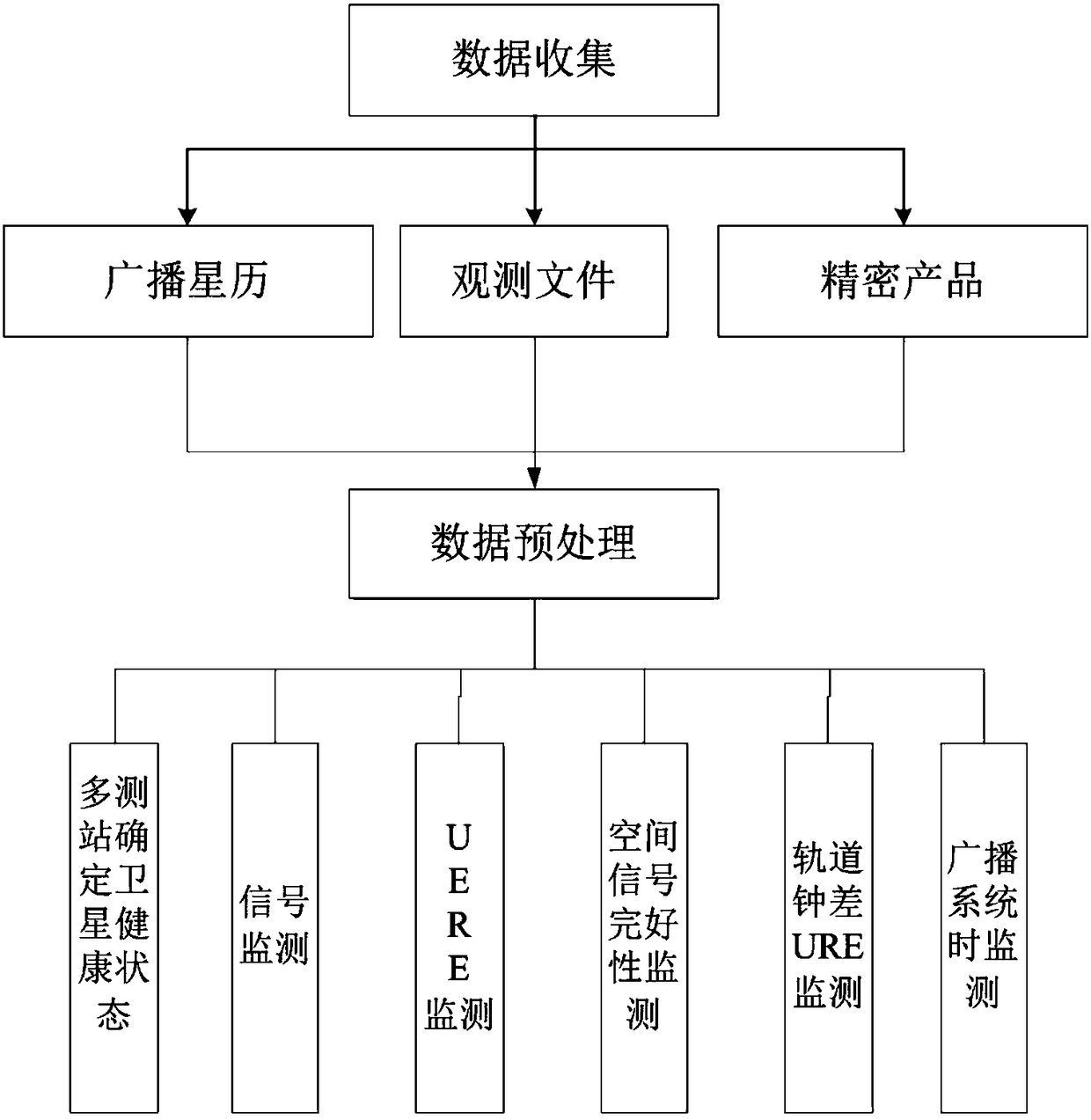
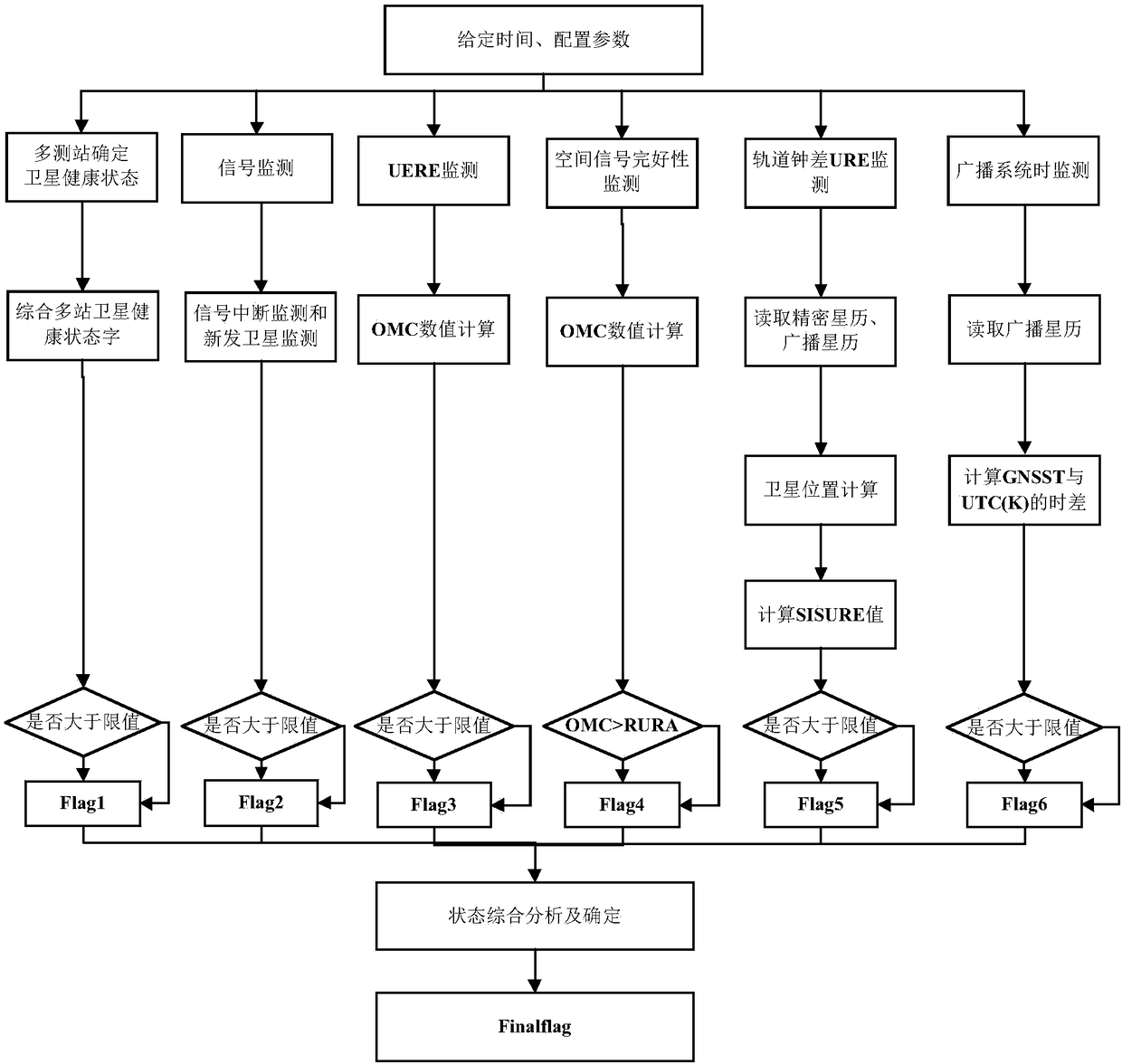
[0037] The technical solution adopted by the present invention to solve its technical problems mainly comprises the following steps:

[0038] Step 1: Use the receiver to receive the navigation satellite downlink signal;

[0039] Step 2: Monitoring of individual elements;

[0040] Step 3: Comprehensive analysis of information.

[0041] The present invention mainly involves the following aspects, wherein the main content of step 2 is key point 1 to key point 6, and the main content of step 3 is key point 7.

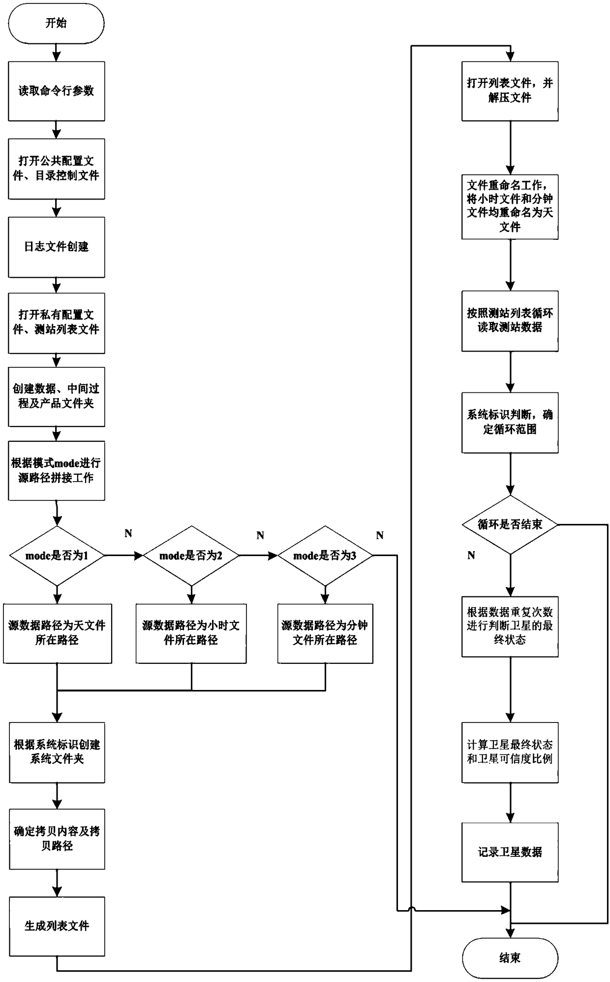
[0042] Key point 1: Multi-station determination of satellite health status, using satellite ephemeris data from multiple iGMAS monitoring stations to comprehensively obtain satellite health status. Select the data source according to the mode identification, and generate a station list; read the station data according to the station list, judge the final state of the satellite according to the number of repetitions of the satellite, calculate the final state of the satell...


PUM


Abstract

The invention discloses a fast monitoring technology suitable for multi-GNSS satellites; the technology analyzes from the data source, uses multi-station to determine satellite health states, and employs signal monitoring alarm, UERE alarm, space signal completeness alarm, broadcast track clock error URE alarm and broadcast system time alarm to make determinations; the method uses corresponding methods under different conditions, and finally integrates processing results of 6 means, thus obtaining the true work states of the satellite.

Description

technical field [0001] The invention belongs to the field of satellite navigation and relates to a technology for quickly monitoring abnormal states of GNSS satellites, which is suitable for quickly determining the working states of satellites and giving timely alarms. Background technique [0002] At present, there are four major satellite navigation systems in the world, namely BDS in China, GPS in the United States, GLONASS in Russia, and GALILEO in the European Union. Today's satellite navigation system can be described as a starry sky, and the available signal resources for satellite navigation users are extremely rich [1]. Available GNSS constellations are the basis of applied research. Under multi-system conditions, the status and performance of space constellations are very critical information for users. They need to be monitored and given results, so that users can choose some constellations for navigation Positioning, so as to get high-quality service. [0003] ...

Claims


Application Information

Patent Timeline
Patent Type & Authority Applications(China)
IPC IPC(8): G01S19/20
CPCG01S19/20
Inventor 范顺西范毅郭美军张明明李亚萍郑洁李双钦翟伟
Owner SPACE STAR TECH CO LTD
Learn More