Method and device for region division

A region division method and region division technology, applied in the direction of instruments, maps/plans/charts, special data processing applications, etc., can solve problems such as unreasonable division, and achieve the effect of solving unreasonable and reasonable division of regions

Inactive Publication Date: 2018-07-03
ZTE CORP +1
View PDF0 Cites 28 Cited by
  • Summary
  • Abstract
  • Description
  • Claims
  • Application Information

AI Technical Summary

Problems solved by technology

[0004] Embodiments of the present invention provide a region division method and device to ...

Method used


Image

  • Method and device for region division
  • Method and device for region division
  • Method and device for region division

Examples


no. 1 example

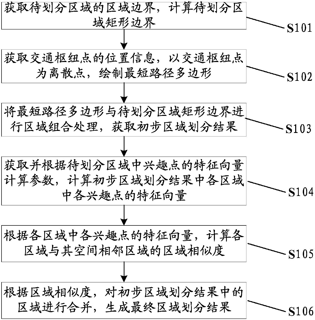
[0031] figure 1 It is a flow chart of the area division method provided by the first embodiment of the present invention, consisting of figure 1 It can be seen that the area division method provided in this embodiment includes:

[0032] S101: Obtain the area boundary of the area to be divided, and calculate the rectangular boundary of the area to be divided;

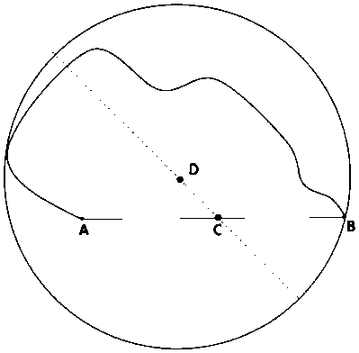
[0033] S102: Obtain the location information of the traffic hub in the area to be divided, and draw the shortest path polygon with the traffic hub as a discrete point;

[0034] S103: Combine the shortest path polygon and the rectangular boundary of the area to be divided into areas to obtain a preliminary area division result, and the preliminary area division result includes multiple areas;

[0035] S104: Obtain and calculate parameters according to the eigenvector calculation parameters of the points of interest in the region to be divided, and calculate the eigenvectors of each point of interest in each region in th...

no. 2 example

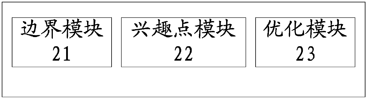
[0065] figure 2 It is a schematic structural diagram of the area division device provided by the second embodiment of the present invention, which is represented by figure 2 It can be seen that the region division device provided in this embodiment includes: a boundary module 21, a point of interest module 22 and an optimization module 23, wherein,

[0066] The boundary module 21 is used to obtain the boundary of the area to be divided, calculate the rectangular boundary of the area to be divided; obtain the position information of the traffic hub in the area to be divided, and use the traffic hub as a discrete point to draw the shortest path polygon; combine the shortest path polygon with the area to be divided Area combination processing is carried out on the rectangular boundary of the area, and the preliminary area division result is obtained, and the preliminary area division result includes multiple areas;

[0067] Point of interest module 22 is used to obtain and cal...

no. 3 example

[0077] In this embodiment, the region to be divided is explained as an example of a city. In practical applications, the region to be divided can be any national, provincial, municipal, or village-level map. Now, the present invention will be further explained in combination with specific application scenarios.

[0078] Regional POI (Point of Interest, point of interest) is a very important division index. Regional POI refers to points of interest in the region, such as restaurants, shopping malls, gymnasiums, schools, companies, and so on. Each POI contains at least four aspects of information: name, category, longitude, and latitude. POI information reflects the location semantics of the region, which is the meta-feature of the region, and the flow of people is attracted by POIs. Therefore, it is very important to understand the distribution of POIs in the region to calculate the flow of people in the region. Thiessen polygon (Voronoi polygon) is a method proposed by Dutch ...


PUM


Abstract

The embodiment of the invention provides a method and device for region division. The method comprises: a regional boundary of a to-be-divided region is obtained and a rectangular boundary of the to-be-divided region is calculated; location information of a transportation junction point in the to-be-divided region is obtained and a shortest-path polygon is drawn by using the transportation junction point as a discrete point; regional combination processing is carried out on the shortest-path polygon and the rectangular boundary of the to-be-divided region to obtain a preliminary regional division result; feature vector calculation parameters of interest points in the to-be-divided region are obtained and feature vectors of all interest points in all regions in the preliminary regional division result are calculated based on the feature vector calculation parameters; on the basis of the feature vectors of all interest points in all regions, regional similarity degrees between all regions and spatial adjacent regions are calculated; and according to the regional similarity degrees, regions in the preliminary regional division result are combined to generate a final regional divisionresult. According to the invention, with full consideration of characteristics of a road network and regional interest points, regional division becomes reasonable.

Description

technical field [0001] The present invention relates to the field of urban planning, in particular to an area division method and device. Background technique [0002] In recent years, with the rapid development of LBS (Location Based Service, location-based service) and GIS (Geographic Information System, geographic information system), urban area research has become more and more important in many fields, such as route planning, traffic Flow analysis, regional passenger flow analysis, regional population assessment, regional attributes, crowd movement, inter-regional relations, etc. Before performing these analyses, it is first necessary to divide the city into regions. [0003] In order to simplify the region division, the most commonly used method is the grid-based map segmentation method. This method divides the map into squares of fixed size, and analyzes the squares as regions directly. Although it is simple and convenient to implement, it is also difficult. There ar...

Claims


Application Information

Patent Timeline
IPC IPC(8): G09B29/00
CPCG06F16/00G09B29/00G09B29/007
Inventor 赵娟娟罗圣美范小朋刘丽霞文韬吉锋
Owner ZTE CORP
Why Eureka
Try Eureka