Spatial attribute prediction method based on local weighting linear regression

A technology of spatial attributes and prediction methods, applied in the field of statistical learning and geographic information systems, can solve severe and underfitting problems, achieve simple calculation results, low computational complexity, and facilitate program processing

Inactive Publication Date: 2018-07-17
四川易利数字城市科技有限公司
View PDF9 Cites 4 Cited by
  • Summary
  • Abstract
  • Description
  • Claims
  • Application Information

AI Technical Summary

Problems solved by technology

[0004] The purpose of the present invention is to solve the serious under-fitting problem when using the existing linear regression analysis method for...

Method used


Image

  • Spatial attribute prediction method based on local weighting linear regression
  • Spatial attribute prediction method based on local weighting linear regression
  • Spatial attribute prediction method based on local weighting linear regression

Examples


Embodiment Construction

[0042] Exemplary embodiments of the present invention will now be described in detail with reference to the accompanying drawings. It should be understood that the implementations shown and described in the drawings are only exemplary, intended to explain the principle and spirit of the present invention, rather than limit the scope of the present invention.

[0043] A spatial attribute prediction method based on locally weighted linear regression, such as figure 1 As shown, including the following steps S1-S8:

[0044] S1. Select a research area specified by the user in the geographic information system as the analysis area.

[0045] In the embodiment of the present invention, a research area designated by the user may be a regional economic planning plate, an administrative area, an economic development area, and the like.

[0046] S2. Extracting business attributes and latitude and longitude coordinates of the analysis area through spatial query.

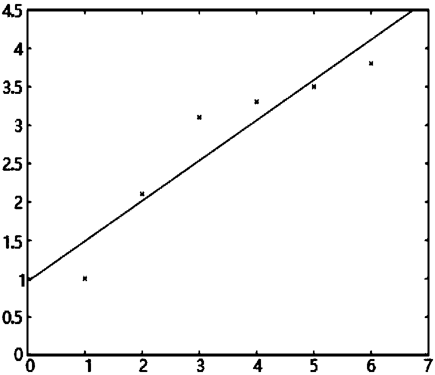
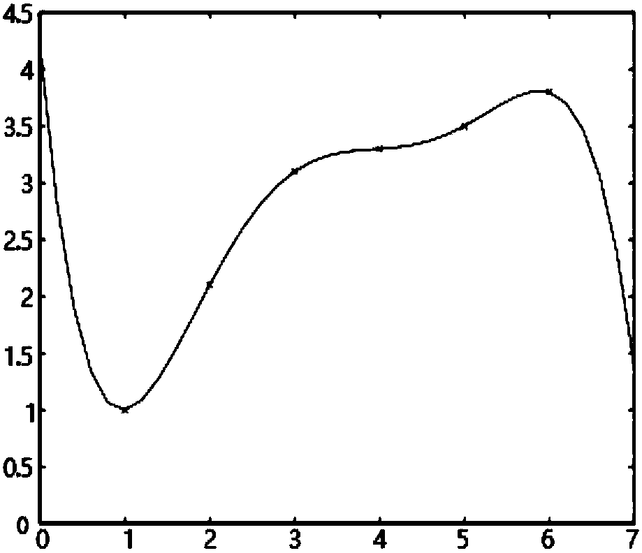
[0047] In the embodime...


PUM


Abstract

The invention discloses a spatial attribute prediction method based on local weighting linear regression. The method comprises the steps that a multivariate linear regression method is adopted for conducting mathematical modeling on an influence relation of spatial attributes, a spatial distance factor is introduced to a fitting assessment expression of linear regression analysis to solve the problem, and the spatial distance and the influence degree on an analysis target is in an inverse correlation, wherein data of low spatial distance has large influence on the analysis target, and data ofhigh spatial distance has less influence on the analysis target. The spatial attribute prediction method is low in computation complexity, unique and simple in calculation result and beneficial to program processing, the linear combination relation of various spatial attributes can be processed, and the problem of less fitting during combination analysis of multi-dimensional spatial attributes byadopting an existing linear regression analysis method is effectively solved.

Description

technical field [0001] The invention belongs to the technical field of statistical learning and geographic information systems, and in particular relates to the design of a spatial attribute prediction method based on locally weighted linear regression. Background technique [0002] Geographic Information System (GIS), also known as "geographic information system", is a specific and very important spatial information system. It is a technical system that collects, stores, manages, calculates, analyzes, displays and describes the relevant geographical distribution data in the entire or part of the earth's surface (including the atmosphere) space with the support of computer hardware and software systems. [0003] In geographic information systems, usually there are correlations between multiple spatial business attributes in geographic regions, for example: traffic coverage attributes, vegetation coverage attributes, and commercial density attributes will all affect house pri...

Claims


Application Information

Patent Timeline
IPC IPC(8): G06F17/30
CPCG06F16/29
Inventor 杨斌彭真曹晔徐锴袁建华
Owner 四川易利数字城市科技有限公司
Why Eureka
Try Eureka