Multi-source information fusion method based on factor graph

A technology of multi-source information fusion and factor graph, applied in the field of multi-source information fusion and all-source navigation based on factor graph, can solve the problems of time asynchrony, signal delay, unavailability, etc., achieve less processing and improve navigation accuracy Effect

A technology of multi-source information fusion and factor graph, applied in the field of multi-source information fusion and all-source navigation based on factor graph, can solve the problems of time asynchrony, signal delay, unavailability, etc., achieve less processing and improve navigation accuracy Effect

CN108364014APending Publication Date: 2018-08-03SOUTHEAST UNIV

Image

  • Multi-source information fusion method based on factor graph
  • Multi-source information fusion method based on factor graph
  • Multi-source information fusion method based on factor graph

Examples


Embodiment 1

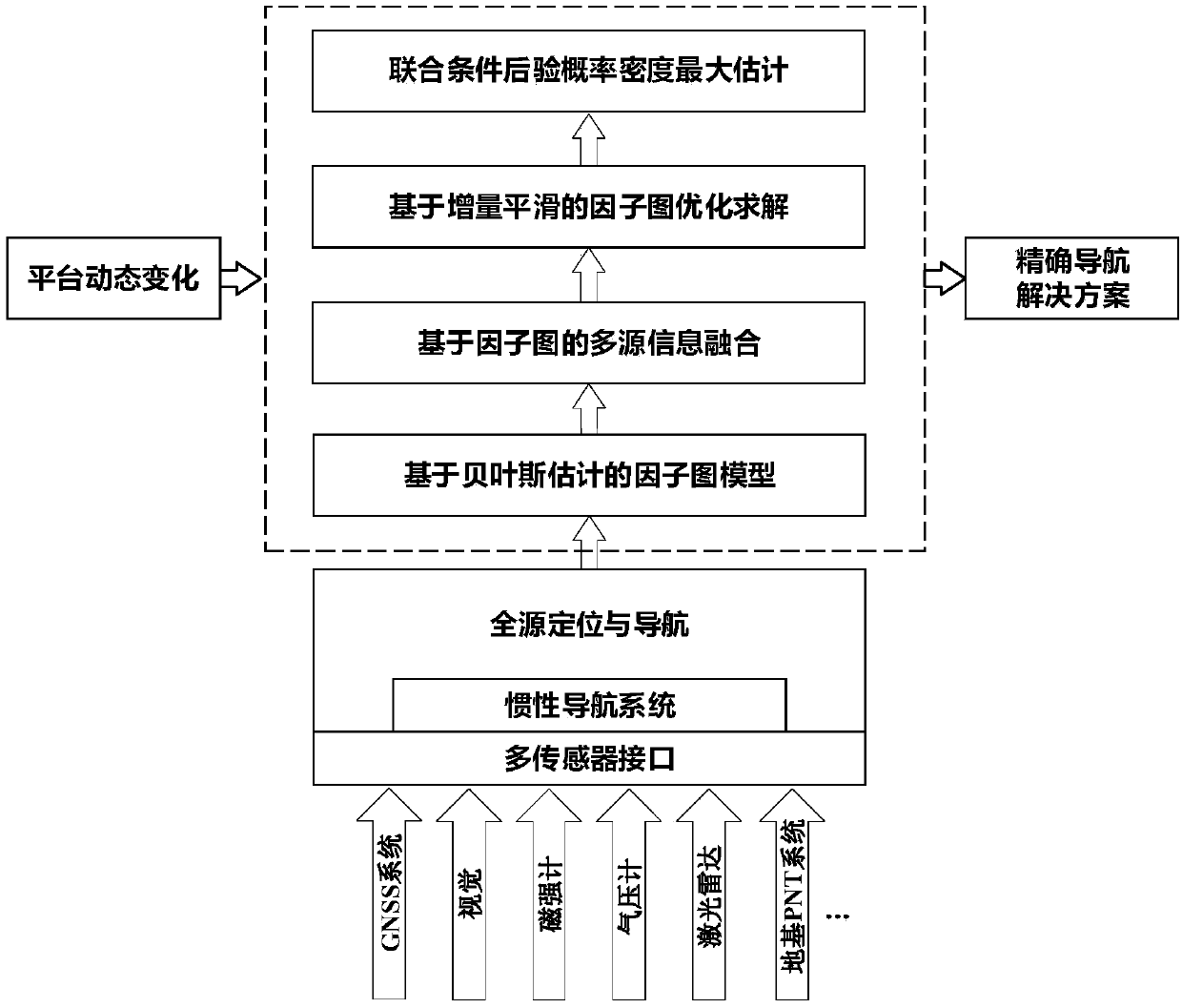
[0042] Embodiment 1: as figure 1 As shown, a multi-source information fusion method based on factor graph, this program uses the factor graph method to solve the problem of multi-source information fusion in complex environments, with IMU as the core and other sensors as auxiliary navigation. It involves seven types of sensors, including IMU, GNSS, vision, magnetometer, lidar, ground-based PNT, and barometer, to simulate the existence of multiple sensors with different frequencies, asynchronous or time delays, and use available sensors anytime and anywhere to make the carrier meet Complicated environmental changes and different tasks require that multi-sensor plug-and-play is realized; the specific implementation steps are as follows:

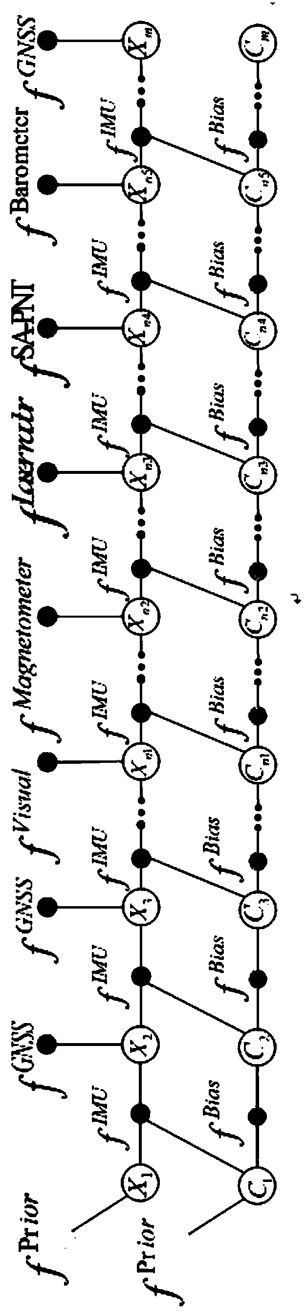
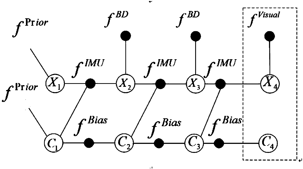
[0043] (1) Establish a factor graph model based on Bayesian estimation,

[0044] In the factor diagram, the state equations of the IMU and its calibration parameters are defined as:

[0045]

[0046] C k+1 =g(C k )(2); where X k Indicat...


PUM


Abstract

The invention relates to a multi-source information fusion method based on a factor graph. The multi-source information fusion method aims to realize full-source positioning and navigation without relying on satellite navigation in a complex environment, takes an inertial navigation system as the core, utilizes all available navigation information sources, and performs rapid fusion, optimal configuration and self-adaptive switching on asynchronous heterogeneous sensor information. A factor graph model is constructed by means of recursive Bayesian estimation, the factor graph is broadened by means of a variable node and a factor node of the system after measurement information of different sensors are acquired, state recursion and updating are completed based on a set cost function, and thefactor graph optimization problem is solved through sparse QR decomposition by adopting an increment smoothing method. The multi-source information fusion method effectively solves the time-varying state space problem generated between carrier motion and measurement availability, can calculate a solution of precise navigation according to dynamic changes of a carrying platform, realizes plug-and-play of multiple sensors, and meets the requirements of carriers changing in complex environment and different tasks.

Description

technical field [0001] The invention relates to a fusion method, in particular to a multi-source information fusion method based on a factor graph, which is suitable for all-source navigation under complex environments, different requirements and tasks. Background technique [0002] Satellite navigation has vulnerabilities such as weak signal, poor penetrating ability, susceptibility to occlusion, interference and spoofing, which will lead to limited navigation, positioning and timing services of carriers in complex environments. In order to solve the constraints of the inherent vulnerability of satellite navigation systems, the Advanced Military Technology Research Institute led by the US Defense Advanced Research Projects Agency (DARPA) launched the All Source Positioning and Navigation (ASPN) project in 2010. The all-source navigation system takes the timing and inertial measurement unit integrated with inertial navigation and precise clock as the core, and can be flexibl...

Claims


Application Information

Patent Timeline
03 Aug 2018
Publication
CN108364014A
IPC
G06K9/62
CPC
G06F18/25
Inventors
张涛; 王健