

Virtual land coordinate mapping method and management method based on plane coordinate system
A plane coordinate system and coordinate mapping technology, which is applied in the direction of extracting from basic elements, sports accessories, indoor games, etc., can solve problems such as inapplicability of non-navigation software applications, large hardware resources, poor experience, etc., to improve query efficiency and The effect of managing efficiency, reducing operating pressure, and reducing search scope
- Summary
- Abstract
- Description
- Claims
- Application Information
AI Technical Summary
Problems solved by technology
Method used
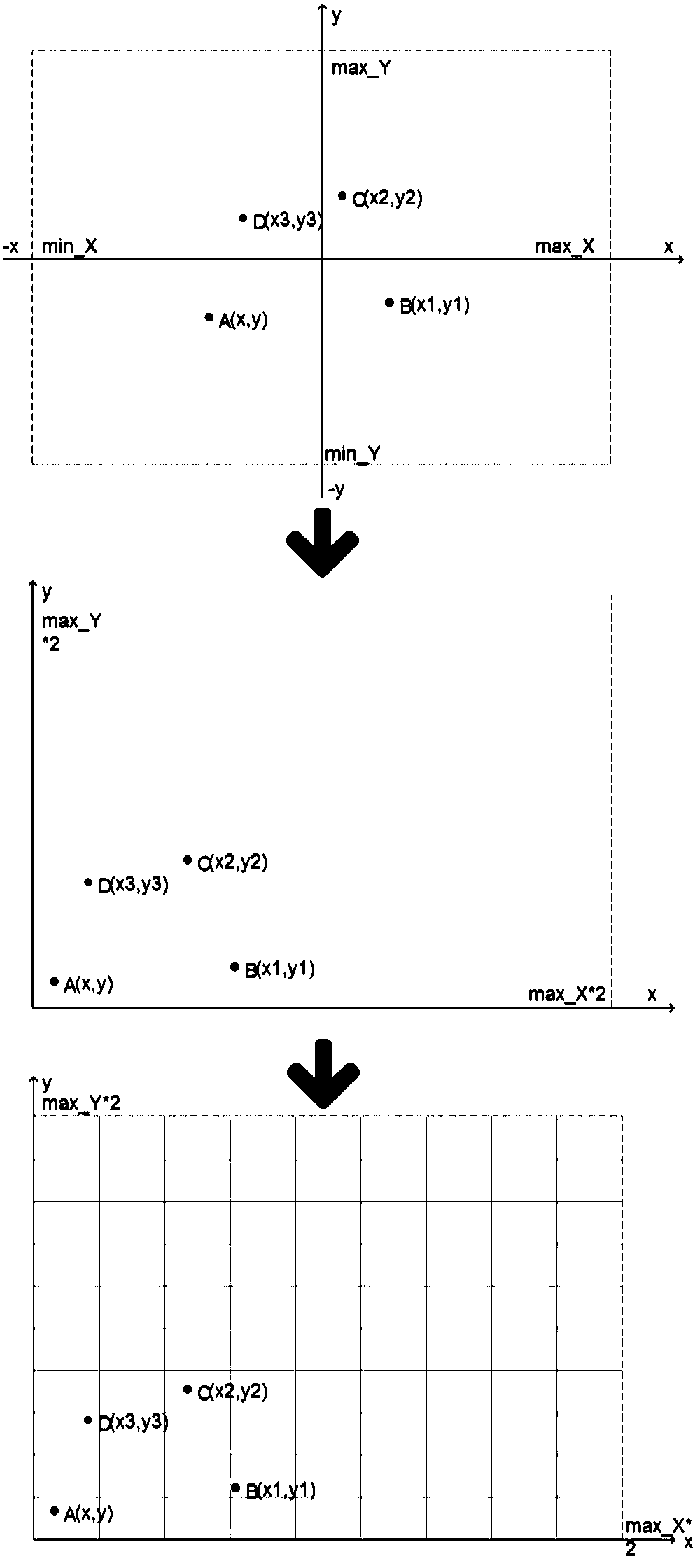
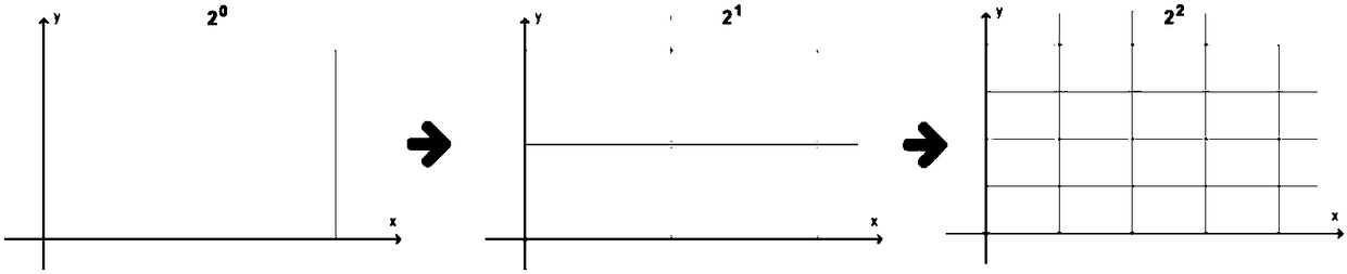
Image

Examples
example 1
[0055] Example 1: Square large virtual plot:
[0056] Custom assumption: max_X=max_Y=180; assumption level: Level=17;
[0057] Take the coordinate A (x, y) in the large virtual plot as (106.508084, 29.536231); obtain (tileX, tileY) through the formula as (104314, 76289); customize the number according to the result: YC001
[0058] Take the coordinates B(x, y) that are relatively close to the straight line distance as (106.508382, 29.535712), and get (tileX, tileY) as (104314, 76289) through the formula; according to the results, it can be concluded that the (tileX, tileY) of the two points ) are the same, so it is determined that points A and B are mapped to the same small virtual plot.
[0059] Take the coordinate C(x, y) with a relatively far distance from the straight line as (106.511142, 29.53815), and use the formula to get (tileX, tileY) as (104315, 76290)
[0060] According to the results, it is determined that points A and C are mapped to different small virtual plots,...
example 2
[0061] Example 2: Large rectangular virtual plot:
[0062] Custom assumptions: max_X=180; max_Y=100;
[0063] Suppose the division level: level=17.
[0064] Take the coordinate D(x,y) in the large virtual plot as (106.508084, 29.536231);
[0065] We get (tileX, tileY) as (104314, 84892) through the formula; according to the result, we customize the number: YC002
[0066] Take the coordinates F(x, y) that are relatively close to the straight line distance as (106.508382, 29.535712), and get (tileX, tileY) as (104314, 84892) through the formula; according to the results, it is determined that points D and F are mapped to the same small virtual ground piece.
[0067] Take the coordinates G(x, y) with a relatively far distance from the straight line as (106.511142, 29.53815), and use the formula to get (tileX, tileY) as (104315, 84894); according to the results, it is determined that points D and G are mapped to different small virtual grounds block, such as Figure 4 shown. ...
example 3
[0084] Example 3: Small square virtual plot:
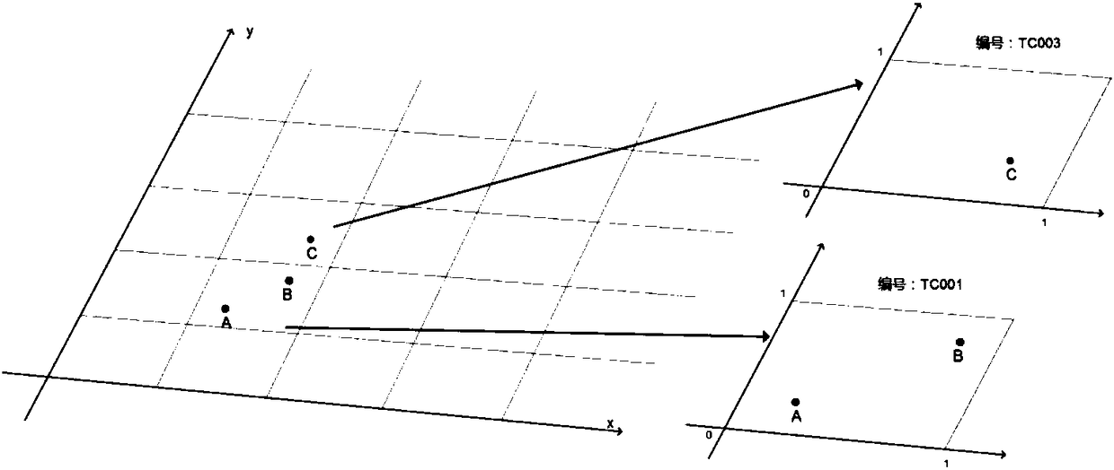
[0085] It is known from Example 1 that max_X=max_Y=180; the number of the small virtual plot obtained by obtaining the mapping of point C is TC003, and its coordinate set (tileX, tileY) is (104315, 76290); two points are randomly selected on this plot coordinate
[0086] g(0.345355,0.834564),h(0.521234,0.782123)
[0087] Known level=17
[0088] Push back the coordinate system through the formula to g1(106.51065313568114,
[0089] 29.539035362548844), h1 (106.51113620178222,
[0090] 29.538891329040524), both approach the coordinates of point C on the large virtual plot
[0091] (106.511142, 29.53815), if there is a plane displacement between g and h coordinate points, there will also be a mapping displacement between g1 and h1, and vice versa, as Figure 5 shown.
PUM
 Abstract
Description
Claims
Application Information