
Method for improving fixed correct rate of network RTK double-difference wide lane ambiguity

A wide-lane ambiguity and accuracy technology, which is applied in the field of satellite positioning system and positioning measurement, can solve the problems of restricting the use of the three-frequency ultra-wide-lane combination method, and achieve the goal of improving positioning accuracy and stability, reducing influence and improving accuracy. Effect

Active Publication Date: 2018-08-17
QIANXUN SPATIAL INTELLIGENCE INC
View PDF14 Cites 31 Cited by
  • Summary
  • Abstract
  • Description
  • Claims
  • Application Information

AI Technical Summary

Problems solved by technology

The three-frequency ultra-wide-lane ambiguity method requires three-frequency observations, but except for all satellites of the Beidou satellite system that contain three-frequency observation data, only some satellites of the GPS satellite system have three-frequency observation data, and GLONASS satellites only have dual-frequency observation data
These objective conditions limit the use of the three-frequency ultra-wide lane combination method

Method used


Image

  • Method for improving fixed correct rate of network RTK double-difference wide lane ambiguity
  • Method for improving fixed correct rate of network RTK double-difference wide lane ambiguity
  • Method for improving fixed correct rate of network RTK double-difference wide lane ambiguity

Examples


Embodiment Construction

[0032] The present invention proposes a method for improving the fixed accuracy rate of network RTK double-difference wide-lane ambiguity, which is improved based on the phase linear combination method, and the phase linear combination formula is:

[0033]

[0034] in, is the inter-station double-difference operator, φ 1 , φ 2 Respectively represent the phase observation values ​​of the two frequencies in cycles, ρ is the geometric distance between the satellite and the reference station, I 1 , I 2 respectively represent the ionospheric delay values ​​of two frequencies on the satellite signal propagation path, T is the tropospheric delay value, ε 1 , ε 2 denote the unmodeled error and the noise error at two frequencies, respectively, λ 1 ,λ 2 represent the wavelengths of the two frequencies respectively, N 1 , N 2 represent the ambiguities of the two frequencies, respectively, That is, the double-differenced wide-lane ambiguity value, That is, the double-diffe...


PUM


Abstract

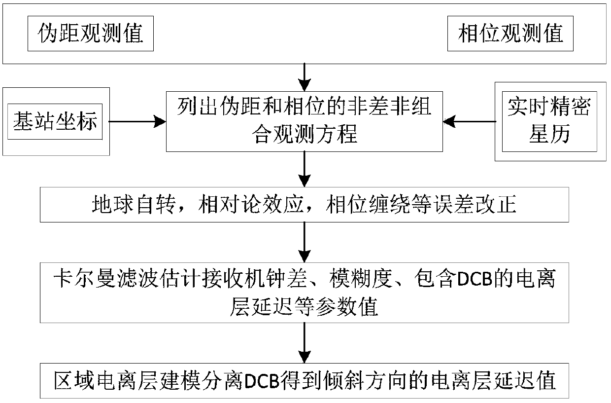
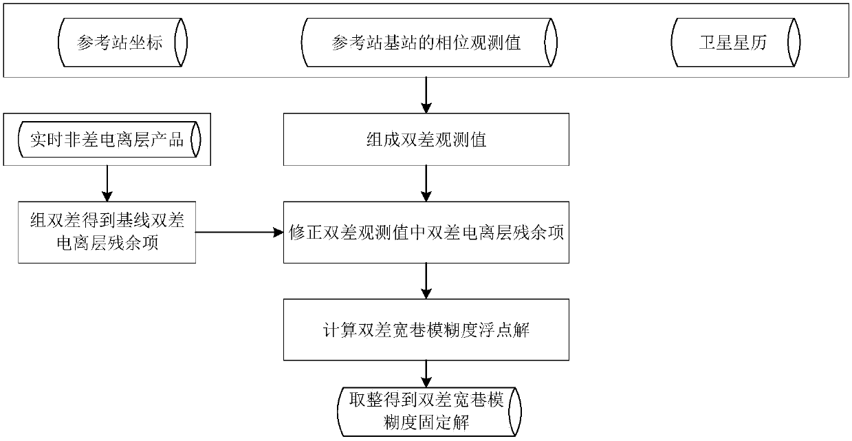
The invention provides a method for improving fixed correct rate of network RTK double-difference wide lane ambiguity. The method comprises the following steps of 1, data preparation, namely receivingreal-time observing data, satellite ephemeris and coordinate information of a GNSS reference station; 2, performing real-time ionosphere product calculation, namely performing non-difference precisesingle-point positioning according to coordinate information and satellite coordinate of the reference station, and calculating a non-difference real-time ionosphere delay value of a satellite signalpropagation path; and 3, performing baseline double-difference wide lane ambiguity calculation, wherein the step 3 comprises a procedure 3.1, forming a double-difference observing value by the observing data of two reference stations, and correcting a double-difference ionosphere residual item by means of the non-difference real-time ionosphere delay value calculated by the step 2; procedure 3.2,calculating a floating point solution of the double-difference wide lane ambiguity; and procedure 3.3, performing rounding on the floating point solution of the double-difference wide lane ambiguity for obtaining a double-difference wide lane ambiguity. The method improves correct rate in understanding the baseline double-difference wide lane ambiguity, thereby improving precision and stability ofthe network RTK.

Description

technical field [0001] The invention relates to the technical field of satellite positioning system and positioning measurement, in particular to a method for improving the accuracy rate of network RTK double-difference wide-lane ambiguity fixation. Background technique [0002] The VRS (Virtual Reference Station, virtual reference station) mode is the most commonly used positioning mode for network RTK (Real-Time Kinematic, real-time dynamic) positioning. Establish multiple (3 or more) GNSS (Global Navigation Satellite System, Global Navigation Satellite System) satellite continuous tracking reference stations (or base stations, reference stations) in a certain area to form a mesh coverage of the area , to provide real-time high-precision error correction information for positioning users in this area, and improve the positioning accuracy of users. This technology is called network RTK technology. Using these reference stations with known coordinates to generate a virtual ...

Claims


Application Information

Patent Timeline
Patent Type & Authority Applications(China)
IPC IPC(8): G01S19/44
CPCG01S19/44
Inventor 赖允斌汪登辉
Owner QIANXUN SPATIAL INTELLIGENCE INC
Learn More