Method of using high-resolution terrain and meteorology factors for multi-source precipitation fusion

A meteorological factor, high-resolution technology

Inactive Publication Date: 2018-10-12
HOHAI UNIV
View PDF4 Cites 19 Cited by
  • Summary
  • Abstract
  • Description
  • Claims
  • Application Information

AI Technical Summary

Problems solved by technology

Satellite quantitative precipitation estimation has the advantages of wide coverage and relatively continuous observation time. However, due to the limitations of remote sensing detection instruments and inversion algorithms, satellite precipitation products have low spatial resolution and relatively low accuracy, and the inversion ability for solid precipitation is very poor....

Method used


Image

  • Method of using high-resolution terrain and meteorology factors for multi-source precipitation fusion
  • Method of using high-resolution terrain and meteorology factors for multi-source precipitation fusion
  • Method of using high-resolution terrain and meteorology factors for multi-source precipitation fusion

Examples


Embodiment Construction

[0068] The present invention will be further described below in conjunction with the accompanying drawings and specific embodiments.

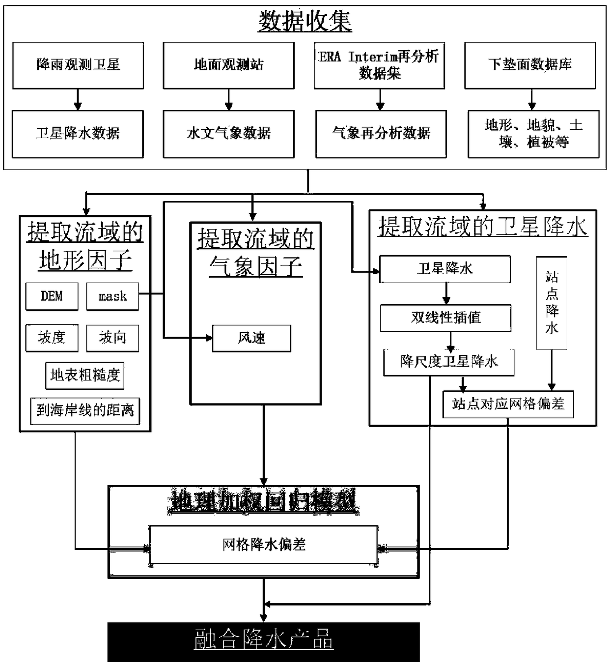
[0069] Such as figure 1 As shown, a kind of utilization high-resolution terrain and weather factor provided by the present invention carries out multi-source precipitation fusion method, comprises the following steps:

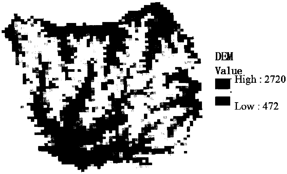
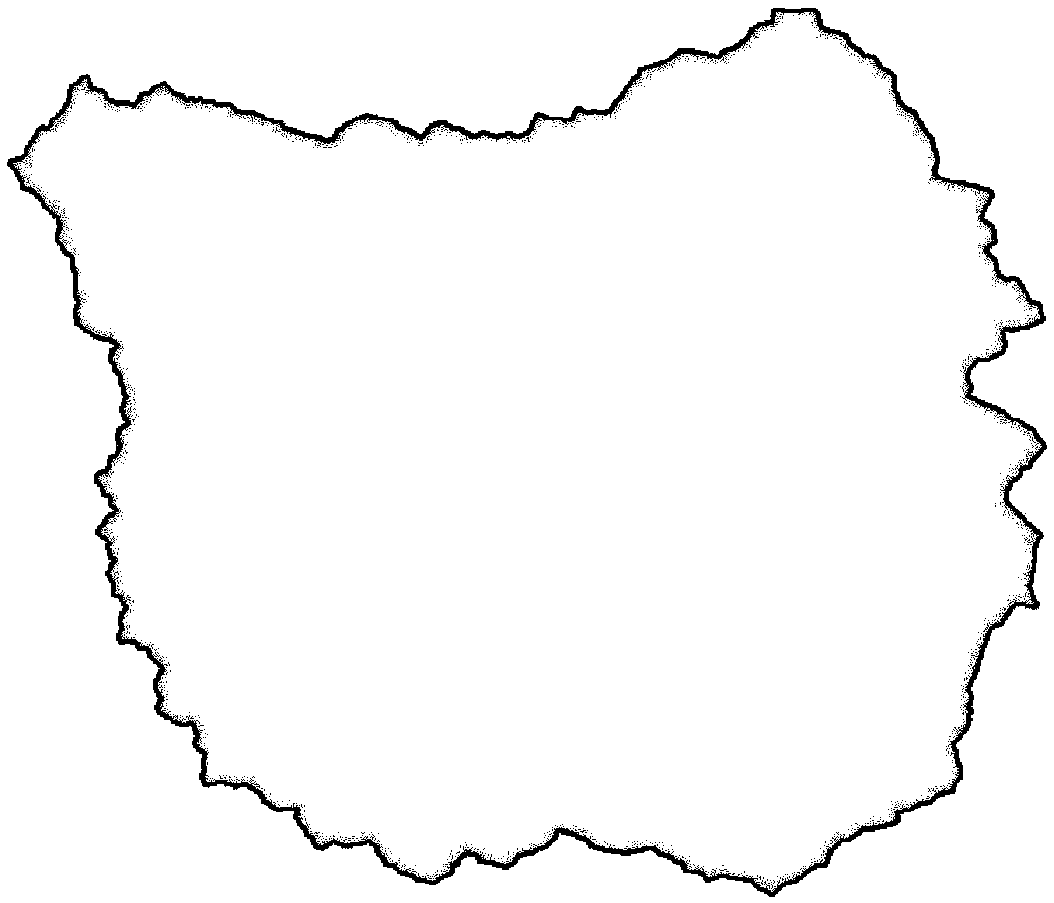
[0070] Step 1, extract the DEM raster data and mask file of the target watershed, specifically:

[0071] Step 11, filling the pit;

[0072] Step 12, calculate the flow direction;

[0073] Step 13, calculating the confluence flow;

[0074] Step 14, determine the outlet site of the watershed;

[0075] Step 15, extracting the target watershed;

[0076] Step 2, use the watershed DEM raster data to calculate the watershed slope, aspect, surface roughness, and distance to the coastline, specifically:

[0077] Step 21, calculate the watershed slope of Rkm by the DEM data of the target watershed;

[0078] Step 22, calculating the...


PUM


Abstract

The invention discloses a method of using high-resolution terrain and meteorology factors for multi-source precipitation fusion. The method comprises the steps of: extracting DEM grid data of a targetwatershed, and obtaining a mask file of the watershed; calculating a slope, an aspect, surface roughness and a to-shoreline distance of the target watershed by the DEM grid data of the target watershed; extracting wind speed data of the watershed according to the mask file; using the mask file to extract satellite precipitation data of the watershed; carrying out downscaling on original satelliteprecipitation to obtain satellite precipitation of Rkm; calculating deviation of satellite precipitation after downscaling and actually measured site precipitation; using a geographically weighted regression model to calculate precipitation deviation of Rkm grids; and obtaining an Rkm fusion precipitation product. According to the method, site data and the satellite precipitation product are fused, downscaling is carried out on the satellite precipitation, the high-time/space-resolution precipitation product is obtained, conversion of precipitation data from points to a surface can be realized, and data support is provided for an input of a refined hydrological model.

Description

technical field [0001] The invention belongs to the technical field of hydrology and meteorology, and in particular relates to a multi-source precipitation fusion method using high-resolution terrain and meteorological factors. Background technique [0002] China is a country with frequent flood disasters, and hydrological model is an important means to solve flood disasters. Precipitation is the most critical input source of hydrological models, and the accuracy and timeliness of precipitation directly affect the accuracy and reliability of simulation results. [0003] At present, the methods of obtaining precipitation data mainly include ground observation, satellite and radar quantitative precipitation estimation, and model quantitative precipitation forecasting. For a long time, the routine observation of precipitation has mainly relied on the observation stations deployed on the surface, and the limited observation results represent the real precipitation within tens o...

Claims


Application Information

Patent Timeline
IPC IPC(8): G06K9/62
CPCG06F18/25
Inventor 张珂晁丽君
Owner HOHAI UNIV
Why Eureka
Try Eureka