POI (Point of interest) and remote-sensing image integrated urban function zone division method

A technology of urban functions and remote sensing images, applied in character and pattern recognition, instruments, computer components, etc., can solve problems such as strong subjectivity, lack of quantitative calculation and analysis, and inability to accurately obtain the division of urban functional areas. The effect of quick division

Active Publication Date: 2018-11-06
BEIJING NORMAL UNIVERSITY
View PDF6 Cites 22 Cited by
  • Summary
  • Abstract
  • Description
  • Claims
  • Application Information

AI Technical Summary

Problems solved by technology

[0004] The purpose of the present invention is to solve the technical problem that the current division of urban functional areas is mainly based on statistical investigation or expert scoring and evaluation, which is highly subjective, lacks quantitative calculation and analysis, and cannot meet the needs of rapid and accurate acquisition of urban functional area divisions under the rapid urban development.

Method used


Image

  • POI (Point of interest) and remote-sensing image integrated urban function zone division method
  • POI (Point of interest) and remote-sensing image integrated urban function zone division method
  • POI (Point of interest) and remote-sensing image integrated urban function zone division method

Examples


Embodiment Construction

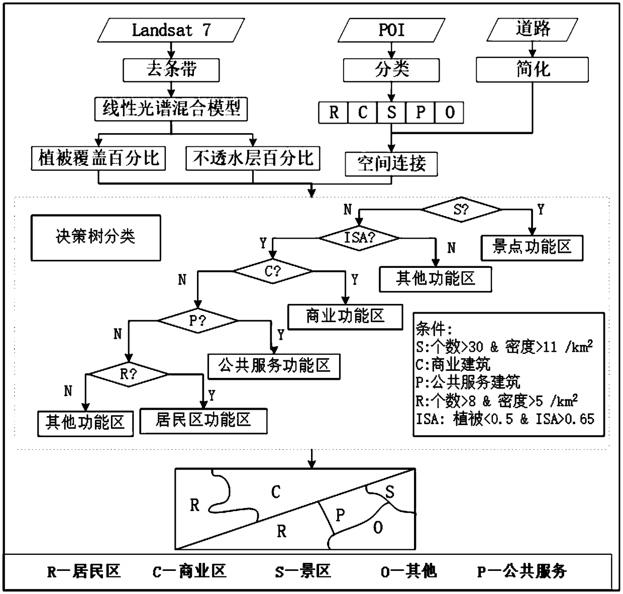
[0043] The present invention has adopted following research data:

[0044] 1. POI data

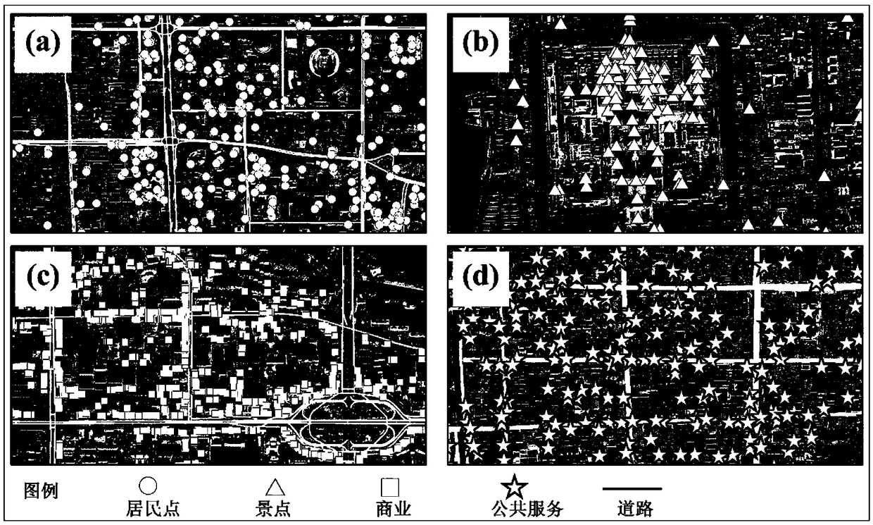
[0045] Point of interest (POI) data is a landmark provided by the electronic map location service, which is used to mark government departments, commercial institutions, historical sites, transportation facilities, and residential areas represented by the place. The data used is the 2014 POI data of Gaode map. Each POI data contains the location information (longitude, latitude and address) of the point and semantic information, that is, category attributes. It mainly includes 12 categories: catering services, public facilities, shopping services, commercial residences, life services, sports and leisure services, place name and address information, scenic spots, financial insurance services, science, education and cultural services, medical insurance services, government agencies and social groups etc.

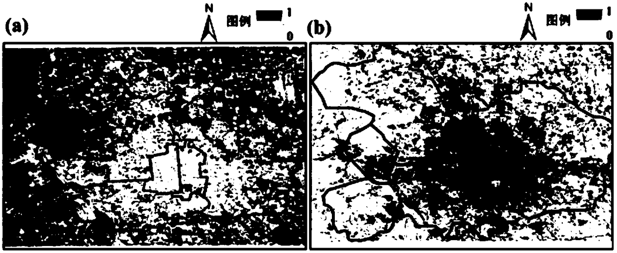
[0046] 2. Landsat 7 remote sensing images

[0047]After the US Landsat 7 (Landsat 7...


PUM


Abstract

The invention discloses a POI (Point of interest) and remote-sensing image integrated urban function zone division method. The method comprises the following steps of (1), obtaining POI data, remote-sensing images and space geographic entity data of a region; (2), selecting classes sensitive to urban function zone division from class attributes of the POI data, thereby forming evaluation classes,forming function POI data based on the POI data corresponding to the evaluation classes, matching the function POI data with the space geographic entity data, thereby obtaining an initial distributionstructure of each class of POI data in each geographic entity; (3), extracting land cover data from the remote-sensing images of the region; (4), making a decision tree classification rule based on the initial distribution structure of each class of POI data in the (2) and the land cover data in the (3); and (5), dividing urban function zones of the region according to the decision tree classification rule. According to the method, on the basis of a decision tree classification algorithm, the POI data and Landsat remote-sensing data are combined, so the urban function zones are rapidly divided.

Description

technical field [0001] The invention relates to a method for dividing urban functional areas by combining POI and remote sensing images. Background technique [0002] Urban functional areas reflect the characteristics of high concentration of various social and economic factors in a city, obvious radiation effects and significant social and economic benefits, and are important carriers for cities to realize their various social and economic functions. In the process of urban development, the aggregation effect of different functional areas has gradually formed: commercial areas, residential areas, scenic spots and mixed functional areas. Objective, accurate, fast and accurate acquisition of urban functional zoning plays an important guiding role in promoting sustainable development of urban functions, scientific and reasonable urban planning, promoting urban economic development, enhancing regional competitiveness and solving urban environmental problems. [0003] The tradi...

Claims


Application Information

Patent Timeline
Patent Type & Authority Applications(China)
IPC IPC(8): G06K9/00G06K9/32G06K9/62
CPCG06V20/176G06V10/25G06F18/241
Inventor 陈云浩李康宁李京
Owner BEIJING NORMAL UNIVERSITY
Why Eureka
Try Eureka