A dem-based coding method for grid calculus order of grid hydrological model
A hydrological model and coding method technology, applied in 3D modeling, computing, instruments, etc., can solve problems that only occur between adjacent layers, cannot distinguish between channel grids and non-channel grids, and cannot be searched
- Summary
- Abstract
- Description
- Claims
- Application Information
AI Technical Summary
Problems solved by technology
Method used
Image
Examples
Embodiment Construction
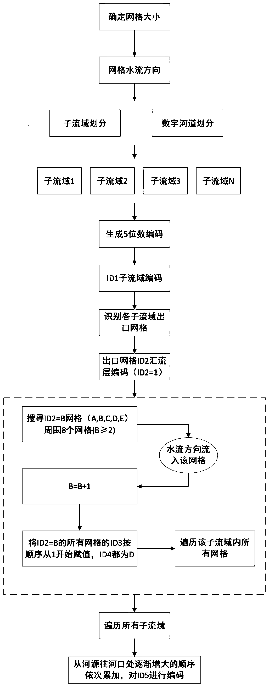
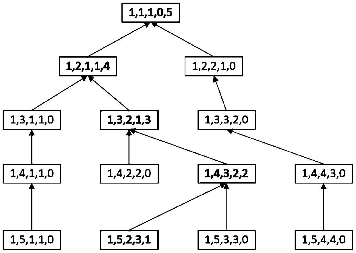
[0026] Combine below figure 1 and figure 2 , the present invention is further described:
[0027] Such as figure 1 As shown, this embodiment is a DEM-based grid-type hydrological model grid calculus sequence coding method, the process is as follows figure 1 shown. The steps of the method described in this embodiment are as follows:
[0028] Step 1: Determine the grid size of the established grid-type hydrological model according to the scope of the research area and research needs, such as 1km×1km, 3km×3km or 9km×9km, and the size of each grid should be consistent during a modeling process .
[0029] Step 2: With the help of the hydrological analysis tools in Arcgis 10.2, the water flow direction of each grid is obtained by the uniflow method.
[0030] Step 3: According to the flow direction information of each grid obtained in step 2, with the help of the hydrological analysis tool in Arcgis 10.2, set the catchment area threshold, and obtain the digital information of ...
PUM
 Abstract
Description
Claims
Application Information
 - R&D
- Intellectual Property
- Life Sciences
- Materials
- Tech Scout
- Unparalleled Data Quality
- Higher Quality Content
- 60% Fewer Hallucinations
Browse by: Latest US Patents, China's latest patents, Technical Efficacy Thesaurus, Application Domain, Technology Topic, Popular Technical Reports.
© 2025 PatSnap. All rights reserved.Legal|Privacy policy|Modern Slavery Act Transparency Statement|Sitemap|About US| Contact US: help@patsnap.com


