
Cultivated land change detection method based on depth learning

A deep learning and change detection technology, which is applied in the field of intelligent object monitoring of remote sensing images, can solve the problems of limited object classification accuracy, low classification accuracy, and large task load, so as to compensate for multi-pixel debris, improve accuracy, High real-time effects

Inactive Publication Date: 2019-02-22
NO 54 INST OF CHINA ELECTRONICS SCI & TECH GRP
View PDF5 Cites 12 Cited by
  • Summary
  • Abstract
  • Description
  • Claims
  • Application Information

AI Technical Summary

Problems solved by technology

[0004] (1) Most of the traditional methods mainly use the method of manual visual calibration. This method has the characteristics of a large amount of tasks, and the accuracy gradually decreases with the amount of tasks. Moreover, as the amount of remote sensing image data increases, this method can no longer meet the current tasks. need
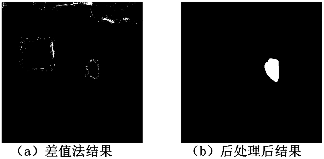
[0005] (2) The more commonly used automatic change detection method is mainly the pixel difference method, in which the pixel difference method mainly directly differentiates the pixel values ​​of the two images to obtain the result of pixel-by-pixel comparison, and then passes through low pixel value filtering and other processing methods This method is suitable for the situation where the difference between the acquisition conditions of the two images is small, but with the increasing number of sources of remote sensing images, this method is less suitable for shooting images under different loads and lighting conditions
The effect of this method is limited by the accuracy of ground object classification. The previous object comparison method is mostly based on the traditional object classification results, and the low classification accuracy leads to poor performance.

Method used


Image

  • Cultivated land change detection method based on depth learning
  • Cultivated land change detection method based on depth learning
  • Cultivated land change detection method based on depth learning

Examples


Embodiment Construction

[0026] Specific embodiments of the present invention will be described below in conjunction with the accompanying drawings, so that those skilled in the art can better understand the present invention. It should be noted that in the following description, when detailed descriptions of known functions and designs may dilute the main content of the present invention, these descriptions will be omitted here.

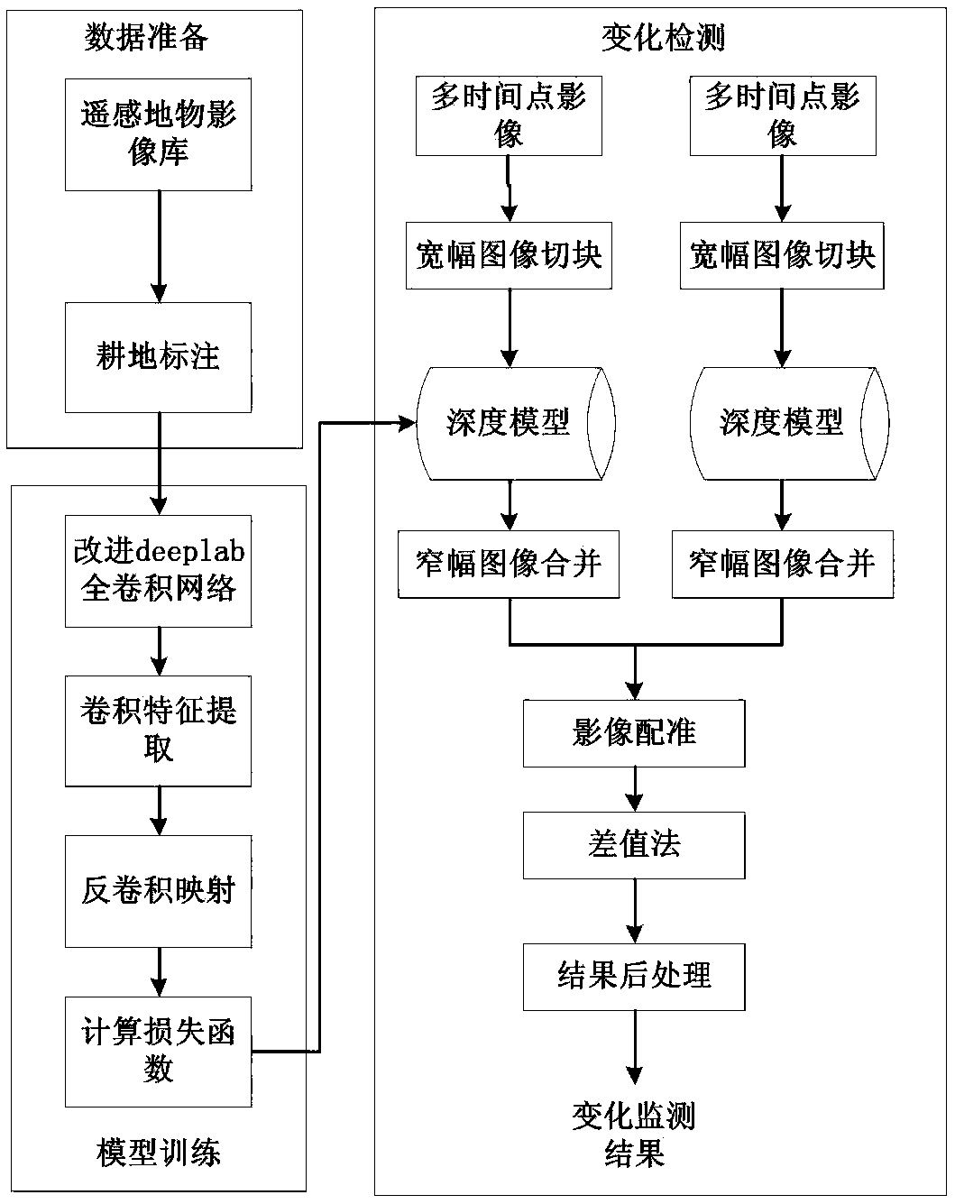
[0027] figure 1 It is a principle block diagram of a specific implementation of the deep learning-based cultivated land change detection method of the present invention.

[0028] In this example, if figure 1 The shown deep learning-based cultivated land change detection method includes the following steps:

[0029] 1. Data collection and labeling

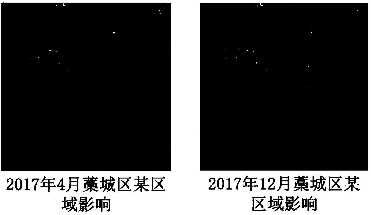
[0030] Collect high-resolution visible light remote sensing images of the same area at different times, such as figure 2 As shown, the cultivated land area in each image is then labeled pixel by pixel, and the labeled data f...


PUM


Abstract

The invention discloses a cultivated land change detection method based on depth learning, which is applied to cultivated land census task and has higher convenience and efficiency than manual on-the-spot investigation, at the same time, the remote sensing detection result has higher authenticity compared with the results reported by various levels of departments. Traditional remote sensing interpretation is mainly in the form of artificial visual, is high in human resources cost, but also cannot meet the growing amount of remote sensing data interpretation needs. The invention firstly accurately matches the remote sensing images of the same area taken at different times, then extracts the cultivated land area by adopting the full convolution network, then directly obtains the preliminarycultivated land change result by using the difference method, and finally obtains the final change detection result by adopting the morphological methods such as corrosion and expansion. The inventionalso discloses a method for extracting the cultivated land area from the remote sensing images. The invention adopts the method of depth learning semantic segmentation network to realize automatic extraction and change detection of cultivated land resources, which has higher detection accuracy than the method of the invention in the prior art.

Description

technical field [0001] The invention belongs to the technical field of remote sensing image intelligent ground object monitoring, and more specifically, relates to a cultivated land change detection technology based on a deep learning method under the demand of ground object monitoring. The method realizes the large-scale remote monitoring of cultivated land by remote sensing. Background technique [0002] Cultivated land is the foundation of agriculture. With the advent of the information age, the rapid acquisition and detection of cultivated land information by using spatial information technology has become an inevitable development of the times. Especially in recent years, with the deepening of my country's reform and opening up, accurately grasping the distribution and changes of cultivated land in the region is not only the need of technological development, but also the necessity of macro-management of agricultural development. At present, the extraction of farmland ...

Claims


Application Information

Patent Timeline
Patent Type & Authority Applications(China)
IPC IPC(8): G06T7/00G06N3/04G06T7/11
CPCG06T7/001G06T7/11G06T2207/10032G06N3/045
Inventor 楚博策高峰帅通王士成陈金勇
Owner NO 54 INST OF CHINA ELECTRONICS SCI & TECH GRP
Learn More