A method and system for survey and calculation of construction area

A technology of area and area to be measured, applied in computing, image data processing, special data processing applications, etc., can solve problems such as low measurement efficiency, impact on the strength and depth of the overall planning of project land, large manpower, material resources, etc.

Active Publication Date: 2019-03-15
CHINA TIESIJU CIVIL ENG GRP CO LTD
View PDF3 Cites 4 Cited by
  • Summary
  • Abstract
  • Description
  • Claims
  • Application Information

AI Technical Summary

Problems solved by technology

Uncertainty in the preliminary design of highway and railway projects and the unpredictability of some projects in the construction process have affected the strength and depth of the overall planning of project land use, resulting in the need for multiple surveys and plans for demolition areas and tight survey schedules
If the traditional method of relying on surveyors for survey planning is adopted, it will consume a lot of manpower and material resources, and the survey efficiency is low, which cannot meet the variability requirements of the construction area, and it is difficult to complete the survey within the specified construction period

Method used


Image

  • A method and system for survey and calculation of construction area
  • A method and system for survey and calculation of construction area

Examples


Embodiment Construction

[0047] In order to further illustrate the features of the present invention, please refer to the following detailed description and accompanying drawings of the present invention. The accompanying drawings are for reference and description only, and are not intended to limit the protection scope of the present invention.

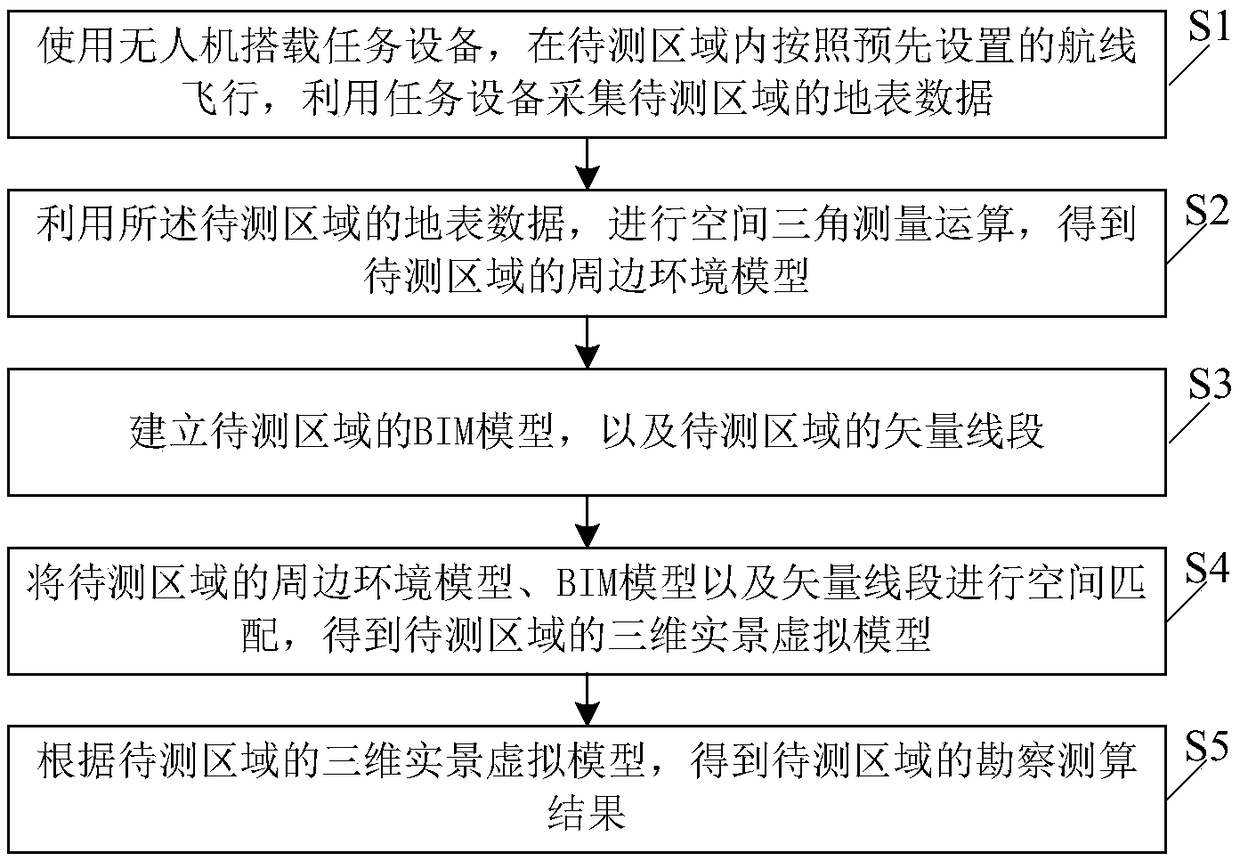
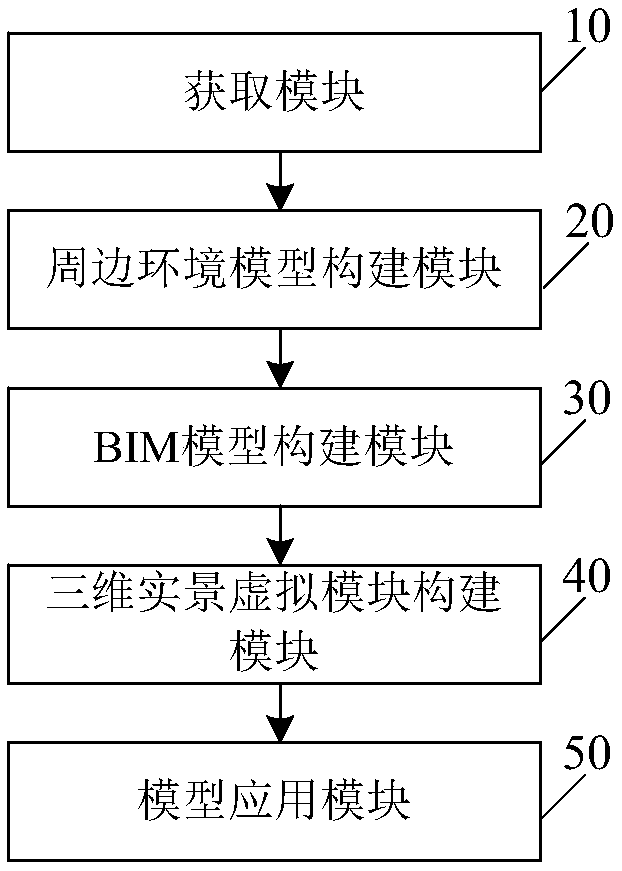
[0048] Such as figure 1 As shown, this embodiment discloses a construction area survey and calculation method, including the following steps S1 to S5:

[0049] S1. Use the drone to carry the mission equipment, fly in the area to be tested according to the preset route, and use the mission equipment to collect the surface data of the area to be tested;

[0050] The planning process of the pre-set route in this embodiment is: considering the geographical location of the area to be measured, the direction of the route, accuracy requirements, take-off and landing points and other factors, using route planning software (such as DJI GISpro, altizure) to calculate...


PUM


Abstract

The invention discloses a construction area survey and calculation method and a system, belonging to the technical field of building construction, which comprises the following steps of: using an unmanned aerial vehicle to investigate the early construction of a highway and a railway, investigating the early demolition area, and obtaining the surrounding environment of the area to be constructed and the building conditions to be demolished. Using BIM software to establish the BIM model of the area to be constructed, the BIM model and the surrounding environment model of the area to be constructed are matched in space, and the virtual reality scenes that can be experienced are obtained, and the removal evaluation and preliminary construction investigation are carried out on the basis of thevirtual scene. The invention can quickly and accurately carry out multiple surveys and calculations on the construction area to be constructed during the surveying period, and meets the requirementsof large outdoor construction area, changeable construction environment and complex surveying planning for multiple times.

Description

technical field [0001] The invention relates to the technical field of building construction, in particular to a construction area survey and calculation method and system. Background technique [0002] In the infrastructure construction, due to the large outdoor area and the changeable and complex environment in the early stage of highway and railway construction, it is necessary to plan the surrounding environment in the early stage of construction and calculate the specifications of the buildings that need to be demolished. [0003] The traditional method is that the surveyor releases the centerline of the pipeline and the well position according to the design drawings, and releases the sideline of the foundation pit according to the centerline of the pipe and the excavation requirements of the foundation pit. Surveyors need to calculate the height difference between the existing elevation and the design elevation, remove the elevation difference, mark on the designed pil...

Claims


Application Information

Patent Timeline
Patent Type & Authority Applications(China)
IPC IPC(8): G06F17/50G06T17/00
CPCG06T17/00G06F30/13G06F30/20Y02A90/10
Inventor 梁昊杜伸云杨铭耿天宝伍军汪清河胡伟王步云施萌肖丽娜吴艳
Owner CHINA TIESIJU CIVIL ENG GRP CO LTD
Why Eureka
Try Eureka